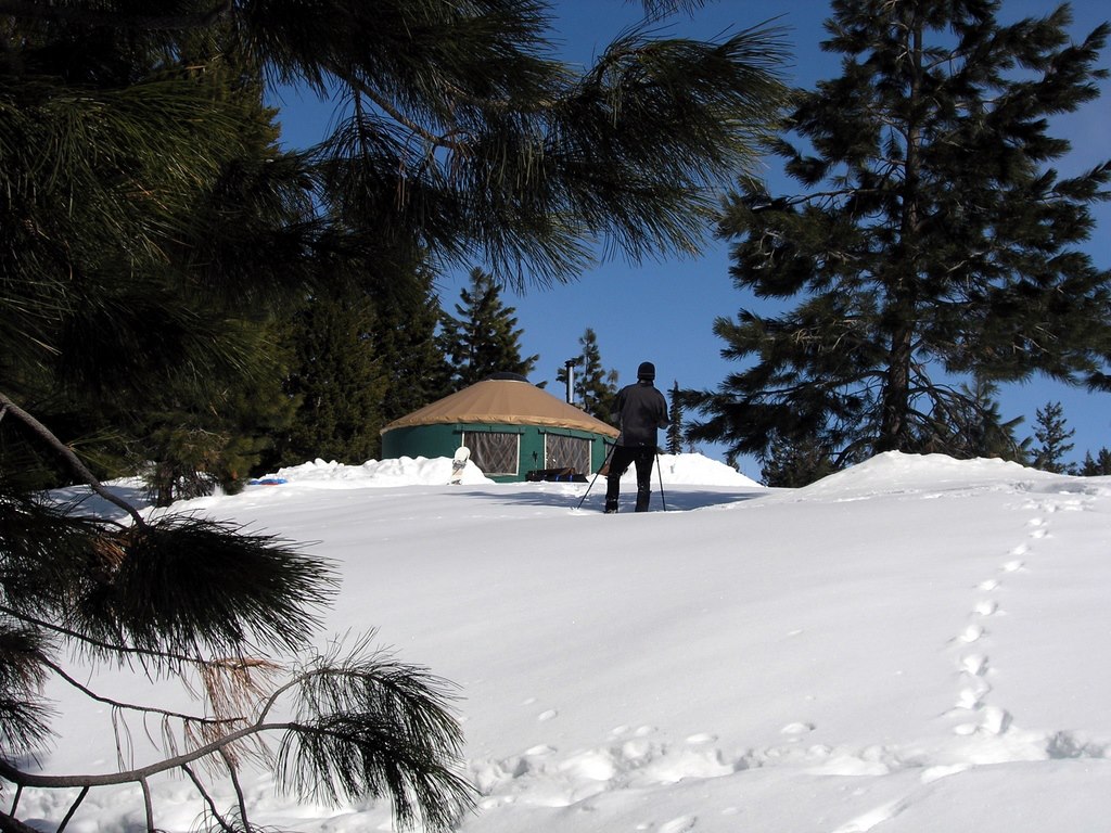
Strap on the skis or snowshoes and enjoy the snow at any of 14 Park N’ Ski areas across Idaho. Over 180 miles of groomed and ungroomed trails are marked in some of the most scenic areas in Idaho.
Revenues from the sale of permits go toward plowing parking lots and improving Nordic ski and snowshoe opportunities. Upon purchasing, skiers and snowshoers can designate which area they would like to have receive their fee. This designation process gives permit purchasers an opportunity to help make improvements to an area of their choice. In multiple-use parking lots, snowmobilers, when snowmobiling, are not required to purchase a Park N’ Ski pass.
The Park N’ Ski program is managed primarily by Idaho Department of Parks and Recreation, with cooperation and support from U.S. Forest Service, the Idaho Department of Lands, the Idaho Department of Transportation, and many local recreation user groups who provide volunteer trail-enhancement work to make it all possible.
Park N’ Ski Locations
There are 14 Park N’ Ski locations throughout Idaho. Park N’ Ski permits are required November 15 – April 30.
- Hanna Flats – 33 miles North of Priest River off State Highway 57
- Priest Lake Golf Course – 28 miles North of Priest River, west side Priest Lake off Highway 57
- Priest Lake State Park’s Park N Ski Unit: 11 miles North of Coolin, east side of Priest Lake
- Chipmunk Rapids: 22 miles North of Priest River, off Highway 57
- 4th of July Pass: From Coeur d’Alene, travel east on Highway I-90, approx. 23 miles take exit 28
- Fish Creek Meadows: From Grangeville, travel South of Forest Service Road 221, approx. 8 miles
- Palouse Divide: From Moscow, travel North on Highway 95, approx. 16 miles, then travel East on Highway 6, approx. 23 miles
- Brimstone/Buffalo River: From Ashton, travel North on Highway 20, approx. 26 miles
- Bear Gulch/Mesa Falls: From Ashton, travel East on Mesa Falls Forest Highway 47, approx. 12 miles
- Fall River Ridge: From Ashton, travel East on Mesa Falls Forest Highway 47 about 6 miles, then right onto Cave Falls Road about 6 miles
- Mink Creek: From Highway 15 at Pocatello, take Exit 63, travel South on Portneuf Road about 2 miles then South on Bannock Highway, approx. 10 miles
- Beaver Creek Summit: 25 miles North of Idaho city, off Highway 21
- Banner Ridge: 23 miles North of Idaho City, off Highway 21
- Gold Fork: 20 miles North of Idaho City, off Highway 21
- Whoop-Em-Up: 18 miles North of Idaho City, off Highway 21
Fees
How to Purchase a Permit