Official Government Website
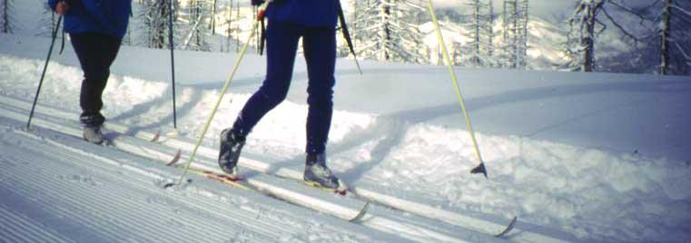
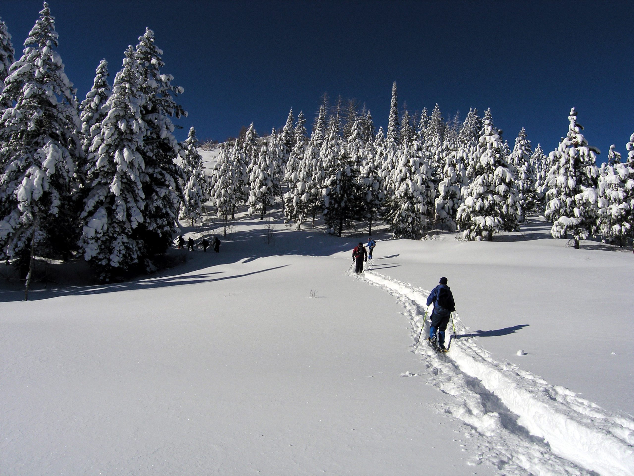
Idaho has a long snow season and high elevations, which translate into hundreds of miles of Nordic activities including: skate skiing, traditional skiing, and snowshoeing opportunities. In addition to 300 miles of groomed ski trails you will find a few hundred more miles of marked trails that provide solitude and untouched powder. The following parks offer overnight accommodations during the winter months:
- Castle Rocks State Park
- Farragut State Park
- Harriman State Park (premium)
- Lake Cascade State Park
- Ponderosa State Park (premium)
- Priest Lake State Park
- Winchester State Park
Winter Updates
Avalanche Warnings, Road Conditions, & Weather Reports
- Avalanche Warnings
- Snow Conditions
- Road Conditions
- 10 Day Forecast
- For more information, visit our programs tab for Winter Safety information.
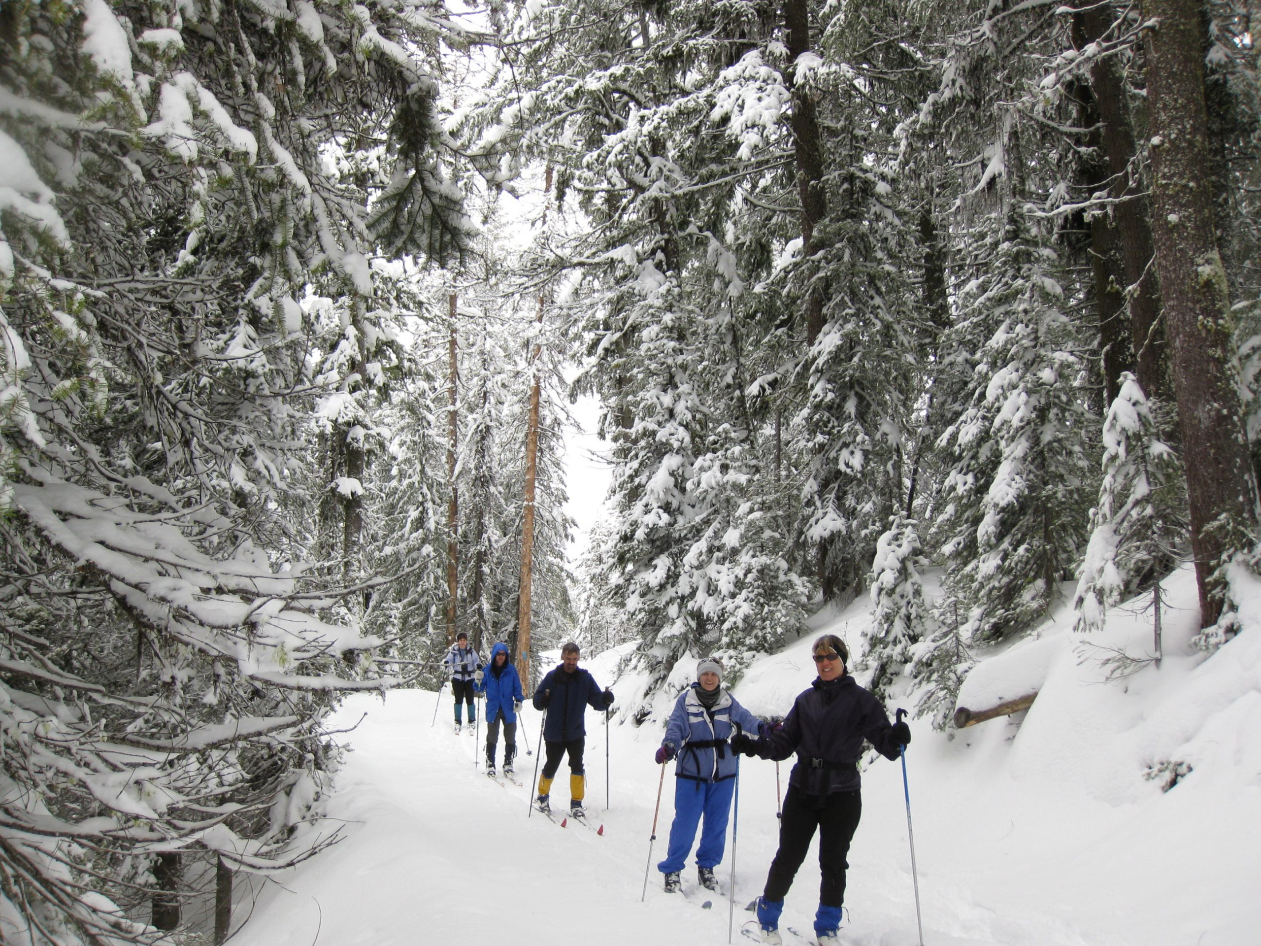
Strap on the skis or snowshoes and enjoy the snow at any of 14 Park N’ Ski areas across Idaho. Over 180 miles of groomed and ungroomed trails are marked in some of the most scenic areas in Idaho.
Revenues from the sale of permits go toward plowing parking lots and improving Nordic ski and snowshoe opportunities. Upon purchasing, skiers and snowshoers can designate which area they would like to have receive their fee. This designation process gives permit purchasers an opportunity to help make improvements to an area of their choice. In multiple-use parking lots, snowmobilers, when snowmobiling, are not required to purchase a Park N’ Ski pass.
The Park N’ Ski program is managed primarily by Idaho Department of Parks and Recreation, with cooperation and support from U.S. Forest Service, the Idaho Department of Lands, the Idaho Department of Transportation, and many local recreation user groups who provide volunteer trail-enhancement work to make it all possible.
Park N’ Ski Locations
There are 14 Park N’ Ski locations throughout Idaho. Park N’ Ski permits are required November 15 – April 30.
- Hanna Flats – 33 miles North of Priest River off State Highway 57
- Priest Lake Golf Course – 28 miles North of Priest River, west side Priest Lake off Highway 57
- Priest Lake State Park’s Park N Ski Unit: 11 miles North of Coolin, east side of Priest Lake
- Chipmunk Rapids: 22 miles North of Priest River, off Highway 57
- 4th of July Pass: From Coeur d’Alene, travel east on Highway I-90, approx. 23 miles take exit 28
- Fish Creek Meadows: From Grangeville, travel South of Forest Service Road 221, approx. 8 miles
- Palouse Divide: From Moscow, travel North on Highway 95, approx. 16 miles, then travel East on Highway 6, approx. 23 miles
- Brimstone/Buffalo River: From Ashton, travel North on Highway 20, approx. 26 miles
- Bear Gulch/Mesa Falls: From Ashton, travel East on Mesa Falls Forest Highway 47, approx. 12 miles
- Fall River Ridge: From Ashton, travel East on Mesa Falls Forest Highway 47 about 6 miles, then right onto Cave Falls Road about 6 miles
- Mink Creek: From Highway 15 at Pocatello, take Exit 63, travel South on Portneuf Road about 2 miles then South on Bannock Highway, approx. 10 miles
- Beaver Creek Summit: 25 miles North of Idaho city, off Highway 21
- Banner Ridge: 23 miles North of Idaho City, off Highway 21
- Gold Fork: 20 miles North of Idaho City, off Highway 21
- Whoop-Em-Up: 18 miles North of Idaho City, off Highway 21
View a full-screen interactive map.
 Fees
Fees
How to Purchase a Permit
| Details | Hanna Flats Park N’ Ski |
|---|---|
| Location | 33 miles north of Priest River off State Highway 57 |
| Difficulty | Beginner – intermediate |
| Distance | 5 m/10 km of ski trails; 2.2 m/3.5 km snowshoe trails |
| Grooming | Yes – traditional kick and glide and snowshoe |
| Snowshoeing | Yes |
| Yurt | No |
| Backcountry ski potential | Yes |
| Restroom | Yes |
| Dogs | Yes |
| About | Nordic ski trails and snowshoe trails at Hanna Flats are relatively gentle in a meadow and forest setting on the west side of Priest Lake. The trail system is well-suited for snowshoers and track skiers. The adjoining airstrip is a great workout for skate skiing. Two short loops are available for skiers and several interlacing loops for snowshoers. The Hanna Grove Nature Trail, located a little more than a mile from the trailhead, is worth checking out to see some old growth cedar trees and read about an old wildfire. Backcountry skiers could climb adjacent mountains above the flats to crank out a few turns. |
| More Information | Priest Lake Nordic Club Facebook Page Priest Lake Ranger District- (208) 443-2512 |
| Maps | Hanna Flats Hanna Flats Location Map |
| Details | Priest Lake Golf Course Park N’ Ski |
|---|---|
| Location | 28 m N of Priest River on west side of Priest Lake off Hwy 57 |
| Difficulty | Beginner – intermediate |
| Distance | 9.1 m/14.6 km ski trails; 2.8 m/4.5 km snowshoe trails |
| Grooming | Yes – set track for traditional kick and glide |
| Snowshoeing | Yes |
| Yurt | No |
| Backcountry ski potential | Yes |
| Restroom | Yes |
| Dogs | Allowed |
| About | The Priest Lake Golf Course has the most extensive groomed Nordic trail system in the vicinity of Priest Lake. During the winter season, the area is blanketed with generous amounts of snow and the golf course is transformed into the Priest Lake Nordic Center. Hill’s Resort serves as the hub for the Golf Course Nordic system and also offers rental equipment. The trail system provides routes along the lakeside and also connects to the Hanna Flats trails to the north. The total of nearly 50 kilometers of groomed trails from beginning to intermediate level provide an ideal setting for family Nordic activities. Trails are groomed on a regular basis, conditions permitting, for traditional kick and glide skiers and skate skiers. The Nordic Park N’ Ski Trail area is open daily. |
| More Information | Hill’s Resort (208) 443-2551 Priest Lake Nordic Club Facebook Page |
| Maps | Priest Lake Golf Course Priest Lake Golf Course Location Map |
| Details | Priest Lake State Park |
|---|---|
| Location | 11 m N of Coolin, ID on east side of Priest Lake |
| Difficulty | Beginner – intermediate |
| Distance | 5.4 m/8.7 km ski trails; 1.5 m/2.4 km snowshoe trails |
| Grooming | Yes |
| Snowshoeing | Yes |
| Yurt | No but winter one- and two-room cabins are available for $45 per night |
| Backcountry ski potential | No |
| Restroom | Yes |
| Dogs | Yes on ungroomed trails only |
| About | Priest Lake State Park’s Indian Creek Unit provides a change of scenery immediately adjacent to the lake. A compact trail loop system circles the park’s visitor center area, and if that’s not enough of a workout, another loop system to the north provides more mileage and more challenging trails. There is a new viewpoint trail that affords nice views of the lake and surrounding mountains on a sunny day. The park’s visitor center and store are open on weekends for fresh coffee or hot chocolate. Snowshoes can also be rented at the vistor’s center. |
| More Information | Priest Lake State Park (208) 443-2200 |
| Maps | Priest Lake State Park Priest Lake State Park Location Map |
| Details | Chipmunk Rapids |
|---|---|
| Location | 22 miles north of Priest River, off State Hwy 57 |
| Difficulty | Beginner to more difficult |
| Distance | 10.4 miles |
| Grooming | Occasional, track set for traditional kick and glide skiers |
| Snowshoeing | Yes |
| Yurt | No |
| Backcountry ski potential | Yes |
| Restroom | Yes |
| Dogs | Yes |
| About | Chipmunk Rapids ski trails are a two-loop system of interconnecting roads. The trail head is near the Priest Lake Visitors Information Center at Dickensheet Junction. The groomed trails are called the Kaniksu Marsh Loop and the River View Loop. There are other ungroomed trails in the area which are sometimes skier track set. These trails are mainly flat and used by novice to advanced cross-country skiers. The trails offer spectacular views of Kaniksu Marsh, Priest River, and the Selkirk Mountains. This area is also frequently used by big game as a winter range area, so try to minimize your disturbance to the winterizing wildlife. |
| More Information | Priest Lake Nordic Club Facebook Page Priest Lake Ranger District- (208) 443-2512 |
| Maps | Chipmunk Rapids Area Map |
| Details | 4th of July Pass |
|---|---|
| Location | From Coeur d’Alene, travel East on Hwy I-90, approximately 23 miles, take exit 28 |
| Difficulty | Beginner – intermediate with a few expert pitches |
| Distance | 7.8 miles |
| Grooming | Yes, 10-foot skating lane with track set for traditional kick and glide |
| Snowshoeing | Yes |
| Yurt | No, but there is a warming hut |
| Backcountry ski potential | Yes |
| Restroom | Yes |
| Dogs | No |
| About | 4th of July Pass is a great place to ski or snowshoe because it starts from a high point afforded by the 4th of July Summit. Three loop trails wind through stately cedar, fir, and pine forests. The snowshoeing trails are almost as extensive as the groomed ski trails. Backcountry skiers can climb nearby mountains to carve turns. |
| More Information | Panhandle Nordic Club Facebook Page Couer d’Alene River Ranger District (208) 664-2318 |
| Maps | 4th of July Trail Map |
| Details | Fish Creek Meadows Park N’ Ski |
|---|---|
| Location | From Grangeville, ID travel S on Forest Service Rd. 221 approximately 8 miles |
| Difficulty | Beginner – intermediate |
| Distance | 12 m/19.3 km |
| Grooming | Yes |
| Snowshoeing | No on groomed trails | Yes off-trail |
| Yurt | No but there is a warming hut |
| Backcountry ski potential | Yes |
| Restroom | Restrooms available at Trailhead |
| Dogs | Yes on ungroomed trails only |
| About | The Fish Creek Park N’ Ski area is a premium place to go Nordic skiing or snowshoeing. The terrain is moderate and well-suited for beginners and intermediate skiers. On a clear day, you can see Seven Devils and Gospel Hump Wilderness areas from the Fish Creek Meadows. For the adventurous, some nearby backcountry Nordic touring is possible. |
| More Information | (208) 839-2211- Salmon River Ranger District |
| Maps | Fish Creek Meadows Trails Fish Creek Location |
| Details | Palouse Divide Park N’ Ski |
|---|---|
| Location | From Moscow travel N on Hwy 95 approximately 16 miles, then travel E on Hwy 6 approximately 23 miles |
| Difficulty | Beginner – intermediate |
| Distance | 18 m/29 km ski trails |
| Grooming | Yes – set track for traditional kick and glide |
| Snowshoeing | Yes |
| Yurt | No |
| Backcountry ski potential | Yes |
| Restroom | No |
| Dogs | Yes on ungroomed trails only |
| About | Palouse Divide has something for everyone — Nordic trails for skate skiers and traditional cross-country skiers; a snowshoeing area on the west side of Idaho Hwy 6; and several opportunities for backcountry skiers to carve turns on either side of the highway. About 12 of the 18 miles of trail are groomed periodically. The ski trails hug the mountainside and contour through a forested setting, making them suitable for most abilities. There are several steep pitches to navigate. Backcountry skiers can seek out turns on Bald Mountain Lookout or Dennis Mountain. |
| More Information | (208) 875-1131 – Palouse Ranger Disctrict |
| Maps | Palouse Divide Trails Palouse Divide Location |
| Details | Brimstone/Buffalo River Park N’ Ski |
|---|---|
| Location | From Ashton travel N on Hwy 20 approximately 26 miles |
| Difficulty | Beginner – Intermediate – Expert |
| Distance | 17.9 m/28.8 km |
| Grooming | Yes – set track for traditional kick and glide |
| Snowshoeing | No on groomed trails, yes off-trail |
| Yurt | No |
| Backcountry ski potential | No |
| Restroom | No |
| Dogs | Not allowed |
| About | The Brimstone/Buffalo River Park N’ Ski area has many great opportunities for Nordic skiing in a beautiful setting next to Island Park Reservoir, the Buffalo River, Henrys Fork and Box Canyon. A 2.1 mile interpretive trail with information about nature in winter is a great loop for kids and families. The 2.8-mile Moose Loop is a little longer and connects to three other loops; Thurmon Ridge, Boggy Springs and Antelope Park. The Brimstone Trail, a 10.8-mile one-way trail, connects from Ponds Lodge to Harriman State Park. |
| More Information | For grooming report call Ashton Ranger Station: (208)652-7442 |
| Maps | Brimstone/Buffalo River trails Harriman State Park trails guide Brimstone/Buffalo Location Map |
| Details | Bear Gulch/Mesa Falls Park N’ Ski |
|---|---|
| Location | From Ashton travel E. on Mesa Falls Forest Hwy 47 approximately 12 miles |
| Difficulty | Intermediate – Advanced |
| Distance | 9.1 m/14.7 km |
| Grooming | Yes – set track for traditional kick and glide |
| Snowshoeing | No on groomed trails, yes off-trail |
| Yurt | No |
| Backcountry ski potential | No |
| Restroom | Yes at trailhead and at Upper and Lower Mesa Falls |
| Dogs | No |
| About | The Bear Gulch/Mesa Falls trail system is one of the most scenic anywhere in Idaho, particularly because the ski trails cruise along the rim overlooking both Upper and Lower Mesa Falls. Views of the Teton Mountain Range are possible on a clear day. It’s a 9.1-mile round-trip trek to the Upper Falls (where the water falls 110 feet), but well worth the effort for the strong and hardy. Shorter loops of 3.9 miles or 5.9 are available closer to the trailhead. The trailhead and a short section of the ski trail are shared use areas with snowmobiles. |
| More Information | For grooming report call Ashton Ranger Station (208)652-7442 |
| Maps | Bear Gulch/Mesa Falls trails Bear Gulch/Mesa Falls Guide Bear Gulch/Mesa Falls Location Map |
| Details | Fall River Ridge Park N’ Ski |
|---|---|
| Location | From Ashton travel E on Mesa Falls Forest Hwy 47 about 6 miles then right onto Cave Falls Rd about 6 miles |
| Difficulty | Beginner – intermediate (with a few expert pitches) |
| Distance | 7.1 m/11.4 km |
| Grooming | Yes, 10-foot skating lane with track set for traditional kick and glide |
| Snowshoeing | No on groomed trails, yes off-trail |
| Yurt | No |
| Backcountry ski potential | No |
| Restroom | No |
| Dogs | Not allowed |
| About | Three loops await Nordic skiers here on a mountain bench that overlooks the Fall River canyon. There is a 2.2 mile easy loop immediately accessible from the trailhead, then a more difficult 3.4 mile second loop and a third loop that covers a total of 7.1 miles roundtrip from the trailhead. Skiers may see an occasional moose nearby. The trailhead is shared with snowmobiles. |
| More Information | For grooming report call Ashton Ranger Station (208)652-7442 |
| Maps | Fall River Ridge trails Fall River Location Map |
| Details | Mink Creek Park N’ Ski |
|---|---|
| Location | From Hwy 15 at Pocatello take Exit 63, travel S on Portneuf Rd about 2 miles then S on Bannock Hwy approximately 10 miles |
| Difficulty | Beginner – intermediate – Expert |
| Distance | 18 m/29 km ski trails |
| Grooming | Limited – with set track for traditional kick and glide |
| Snowshoeing | Yes |
| Yurt | No |
| Backcountry ski potential | Yes |
| Restroom | Yes |
| Dogs | Yes on ungroomed trails only |
| About | The Mink Creek Park N’ Ski area is loaded with great ski and snowshoe trails close to Pocatello. The area has seven plowed parking areas, providing great access to five different trails. The West Fork of Mink Creek and Valve House offer out-and-back experiences in a mountain draw, while the Porcelain Pot area provides more loops. The Porcelain Pot trails can be combined with a ripping downhill on the Corral Creek Trail. East Mink Creek Nordic Center The East Mink Creek Nordic Center is not a Park N’ Ski program but it is managed by the Pocatello City Parks and Recreation Department and is located at the end of the Scout Mountain Road. For an additional fee you can access their groomed ski trails and designated snowshoe trails. Contact them at (208) 232-3901. |
| More Information | Westside Ranger District (208) 236-7500 |
| Maps | Mink Creek trails |
| Details | Island Park Snow Depths |
|---|---|
| About | For updated snow depths in the Island Park area, select this link. The site is located near the community of Island Park at 6290 feet in elevation. |
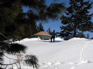
The South Idaho Park N’ Ski area is a great place to stay and play. The trails in this area are used to access the Idaho City Backcountry Yurt System.
For Mores Creek Summit conditions, visit https://www.nwrfc.noaa.gov/snow/snowplot.cgi?MRKI1.
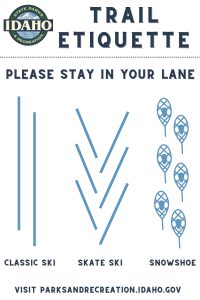
Remember, this is a multi-use trail system open to skiers, snowshoers, fat-tire bikers, and hikers. Please preserve the tracks for skiers by utilizing the trail lane intended for your user group.
| Details | Beaver Creek Summit Park N’ Ski |
|---|---|
| Location | 25 m N of Idaho City off Hwy 21 |
| Difficulty | Intermediate – Advanced |
| Distance | 3 m |
| Grooming | No |
| Snowshoeing | Yes |
| Yurt | Yes – Stargaze Yurt |
| Backcountry ski potential | Yes – fabulous! |
| Restroom | No |
| Dogs | Yes |
| About | This ungroomed out-and-back trail is designed especially for backcountry Nordic folks, whether on skis or snowshoes. You’ll understand how it got its name after you make your way to the top of Stargaze Point (1.5 miles one way) where you’ll find a 360 degree view of the Boise National Forest that includes Pilots Peak, Wilson Butte, Sunset Peak, Rock Creek and Scott Mountain. At over 6,500 feet, it’s the perfect Telemark skiing on many north and west facing slopes where there is deep powder most winter seasons. |
| More Information | Non-Motorized Trails Facebook |
| Parking | The Park N’ Ski parking lot is just before the snowplow turn around on the left side of Hwy 21, about 300 yards before the Beaver Creek Summit. Do not park in the snowplow turn around parking lot. From the parking lot ski/snowshoe along the shoulder of Hwy 21 for about 300 yards until you reach the highest point, Beaver Creek Summit. At the summit turn left on an old road bed marked with a sign post saying “Stargaze Trail.” |
| Maps | Beaver Creek Summit trail map Beaver Creek Summit location map Beaver Creek Summit Winter Parking Rules |
| Details | Banner Ridge Park N’ Ski |
|---|---|
| Location | 23 m N of Idaho City off Hwy 21 |
| Difficulty | Intermediate – Advanced |
| Distance | 22 m/35.4 km |
| Grooming | Yes – set track for traditional kick and glide |
| Snowshoeing | Yes |
| Yurt | Yes – Banner Ridge and Elkhorn Yurts |
| Backcountry ski potential | Yes |
| Restroom | Yes |
| Dogs | Yes on ungroomed trails only |
| About | If you like to crank out the miles on your skis, backcountry ski or cruise around on snowshoes either on-trail or off-trail, the Banner Ridge area is packed with opportunity and fun. It’s a pretty steep 1.3-mile climb from the trailhead to the ridge, but once you’re on top, there are many loops, big views and open bowls to enjoy from there. |
| More Information | Non-Motorized Trails Facebook |
| Maps | Banner Ridge trail map Banner Ridge location map Banner Ridge Winter Parking Rules |
| Details | Gold Fork Park N’ Ski |
|---|---|
| Location | Location 20 miles north of Idaho City off Highway 21 |
| Difficulty | Beginner – intermediate |
| Distance | Total 21.4 m/34.4 km; Gold Fork Loop – 5.1 m /8.2 km; Skyline Loop 4 m/6.4 km |
| Grooming | Yes – set for traditional kick and glide |
| Snowshoeing | Yes |
| Yurt | Yes – Whispering Pine and Skyline Yurts |
| Backcountry ski potential | Yes on the Gold Fork side |
| Restroom | Yes |
| Dogs | Yes on all trails |
| About | The Gold Fork Park N’ Ski area provides access to two complete trail systems on either side of Hwy 21. One trail tours the Gold Fork area, the other loops the Skyline area and connects to the greater Banner Ridge/Beaver Creek trail systems. A separate ungroomed snowshoe trail tours a ridge in the Gold Fork area. There’s also a short snowshoe trail from the Skyline yurt. This is a great place to take kids for an easy, low key outing. |
| More Information | Non-Motorized Trails Facebook |
| Maps | Gold Fork trail map Gold Fork location map Gold Fork Winter Parking Rules |
| Details | Whoop-Um-Up Park N’ Ski |
|---|---|
| Location | 18 m N of Idaho City on Hwy 21 |
| Difficulty | Beginner – intermediate |
| Distance | 6.6m/10.6km ski trails |
| Grooming | No |
| Snowshoeing | Yes |
| Yurt | Yes – Rocky Ridge Yurt |
| Backcountry ski potential | No |
| Restroom | Yes |
| Dogs | Yes |
| About | Snowshoers with dogs love Whoop-Um-Up because this is one of the areas where dogs are welcome. Dogs are also welcome in the Rocky Ridge yurt. Be aware that the parking area is shared with snowmobiles, so you will encounter snow machines as you gear up for your adventure. Trails can be a bit rugged in this area with a few steep and challenging downhill sections along the creek trail. |
| More Information | Non-Motorized Trails Facebook |
| Maps | Whoop-Um-Up trail map Whoop-Um-Up location map Whoop-Um-Up Parking Guide |