Official Government Website
The Idaho Motorized Trails Program
The Motorized Trails Program was created in 1970 to ensure quality motorized recreational opportunities remain available by providing for maintenance, education, and enforcement partnerships.
The Motorized Trails Program mission is to provide leadership statewide in the area of OHV recreation; to work with land managers to provide maintenance on designated trails, develop new opportunities, provide safety and education classes, and provide comments on all motorized travel planning within Idaho through the use of designated funding.
The Motorized Trails Program’s summer activities consist of the following:
- Working with land managers to provide maintenance on designated OHV trails through the Trail Ranger and Trail Cat programs
- Providing OHV education opportunities
- Partnering with OHV law enforcement programs
- Participating in statewide travel planning
- Working with OHV clubs and organizations to fulfill OHV trails maintenance contracts
Motorized Trails Program Funding
- OHV Certificate of Number fees
- OHV percentage of State gas tax
- Federal Recreation Trails gas tax fees
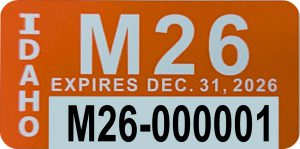
The Idaho ATV/Motorbike (Motorized Trails) program is funded through certificate of number fees purchased by the enthusiast. On January 1 of each year, every motorbike (dirtbike), ATV, UTV, or specialty off-highway vehicle (SOHV) operated on public or private land must be numbered to legally operate. The public exemptions from numbering an off-highway vehicle exists if the vehicle is only for plowing snow or agricultural purposes. The cost of the certificate of number is $12. Idaho Off-Highway Vehicle (OHV) certificate of number sticker fees fund education programs, trail clearing, and maintenance projects throughout the state, as well as support valuable ATV/UTV and motorbike safety courses for all ages.
Economic Importance of Off-Highway Vehicle Recreation in Idaho
How your certificate of number fees are broken down?
- $1.50 vendor fee
- 15% is utilized for administration and the production of certificate of number stickers
- $1 goes to county sheriffs for dedicated OHV law enforcement
- $1 goes to Idaho Department of Lands to provide OHV opportunities
- The remaining 85% goes to trail maintenance, construction and education programs
What are the certificate of number fees used for?
- ATV, UTV and Motorbike safety programs for all ages
- Trail maintenance on OHV trails by the IDPR Trail Ranger program
- Trail maintenance and construction on OHV trails by the IDPR Trail Cat & Mini-Excavator program
- Online OHV trail mapping application
- Grants for OHV trail construction, maintenance, signing and trailhead facilities
Lands Analyst
The Lands Analyst works diligently to meet the department’s strategic plan of: “No net loss of motorized or non-motorized access to recreational trails.” This is pursued by analyzing federal land management actions that impact recreation opportunities, then providing official comment to those agencies to suggest improvements or mitigation to protect access opportunities. These actions may include travel management plans and watershed improvement projects, among other initiatives to protect and enhance recreational access to public lands.
Learn about some of the access management changes over time that have impacted Idaho citizens’ ability to enjoy public lands at this Story Map.
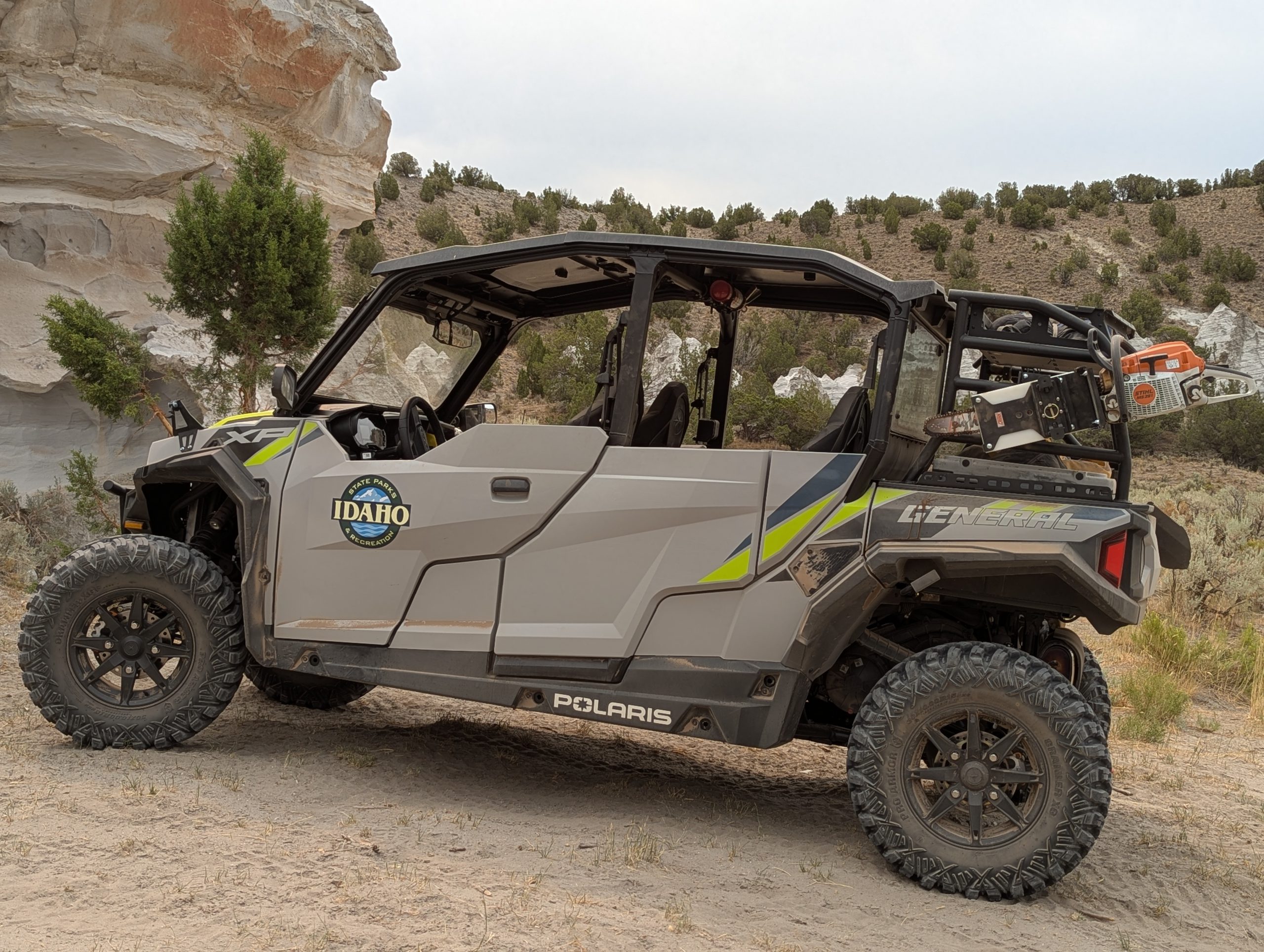
Trail Ranger Program
Apply Today
Want to be a Trail Ranger?
Click here to apply for Trail Ranger Position
Trail Ranger trail maintenance reports are conveniently available on the Idaho ATV/Motorbike Program Facebook.
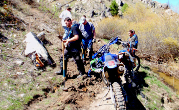
Trail Cat Program
The Trail Cat program performs heavy maintenance on OHV trails. This program builds new OHV trail when needed but spends the majority of time rebuilding ATV or single-track trails that need maintenance. The motorized trail program works with land managers annually to obtain a list of trails that are in need of light maintenance. A mini dozer takes care of the work for the ATV trails and can build about one mile of ATV trail a day, depending upon the terrain. A mini-excavator can build about 1/4 mile of single-track trail a day in various terrain.
Making more miles of trail available to trail users disperses use and reduces environmental impacts and user conflict.
Learn more
Contact the specialist in your area:
South Idaho
Vacant or call (208) 447-6992
North Idaho
Bailey Lerwill or call (208) 881-7211
East Idaho
Brian Dilenge or call (208) 701-7078
Education Program
The OHV Education Program provides classes that are offered throughout the state for anyone who will be operating an OHV including an all-terrain vehicle (ATV), motorbike, or utility type vehicles (UTV). The course includes training on safety and ethical use of OHVs.

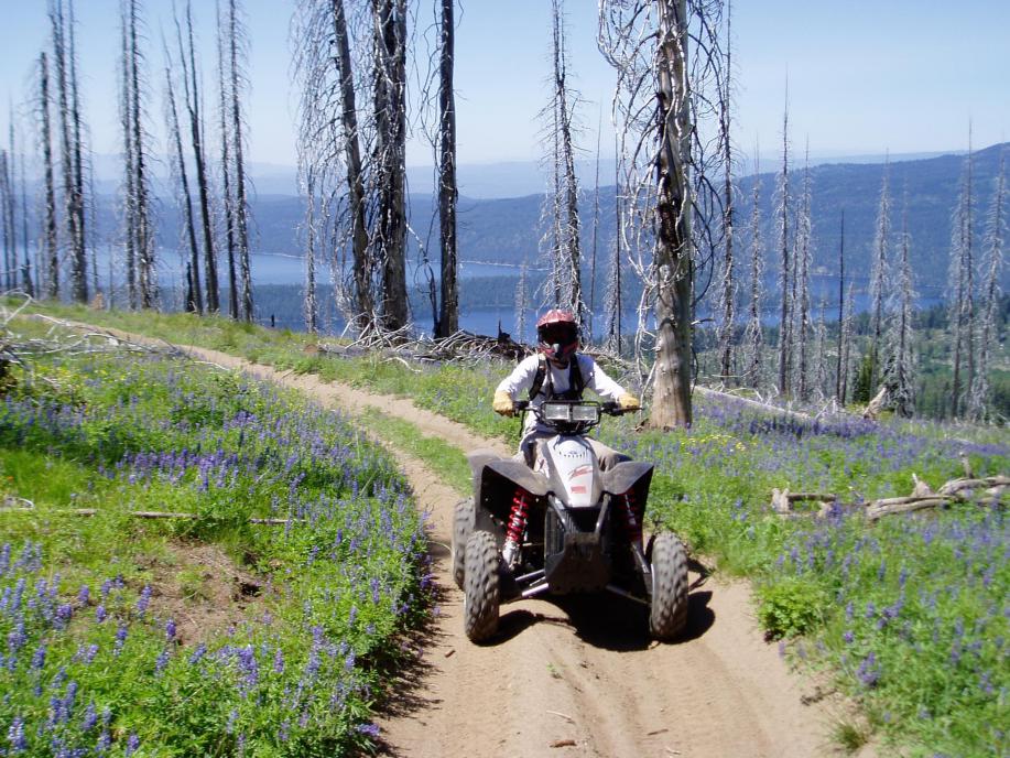
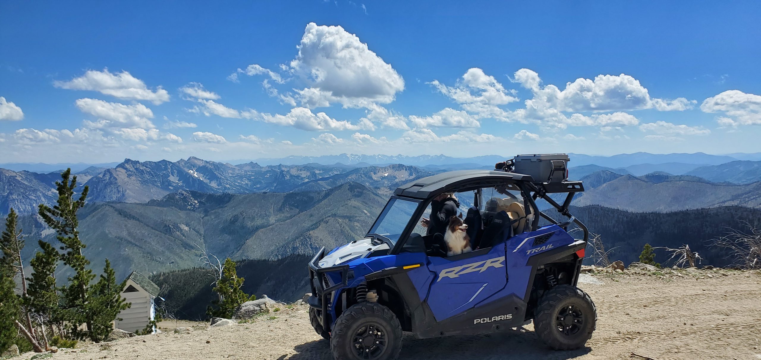
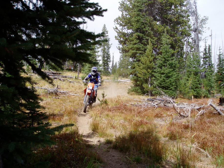
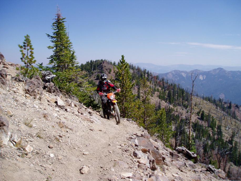
Riding in Idaho
The Idaho Department of Parks and Recreation wants to make sure you are prepared, educated and legal before you take to the trail on your off-highway vehicle (OHV). Be sure to stay on trails when you venture out on your OHV.
IDPR Mapping Application
To find all types of trails across the state, visit IDPR’s Idaho Trails App. Plan your routes from your PC or mobile device, filter the map to show only the types of routes you want to see, then create custom georeferenced map files (GeoPDFs) for offline mobile app navigation or print maps to paper.
Funded by OHV sticker purchases, the web-based Idaho Trails app requires no login to use freely.
Route and trail information is combined into a unified-format interactive map. The underlying technology allows for instant updating of validated changes. The map is continuously validated to US Forest Service Motor Vehicle Use Maps (MVUMs), Bureau of Land Management (BLM) Travel Management Area Maps, and Department of Lands (IDL) Recreation Access maps. On-the-ground IDPR Trail Ranger activities, plus direct collaboration with land management agencies such as trail re-route projects, results in more-timely map updates compared to other mapping resources.
Featured Map Locations & Views
This sample of predefined map views shows how you can explore in the Summer Idaho Trails app, including adjusting Map Layers to see only the route types you want to ride:
- Land of Yankee Fork State Park, Bayhorse Townsite (all routes)
- McCroskey State Park (all routes)
- Danskin OHV Area, ATV Trails view (motorcycle layer removed)
- Owyhee Front UTV Routes (motorcycle and <50″ removed)
Other Map Sources
Some maps may be obtained in paper format at Forest Service and BLM offices around the state, while some maps may be in digital format only.
Digital options of common maps are available; some designed for GPS-enabled navigation and route tracking purposes. To navigate offline using “GeoPDF” maps such as USFS MVUMs and BLM Travel Maps, install a free or subscription-based mobile app that has GeoPDF import and GPS geolocation capabilities. Learn more in the GeoPDF-compatible Apps and Devices section below.
You can create customized GeoPDFs to use in offline apps, tailored to your area of interest, your vehicle type, and your preferred basemap type, by using the Offline Maps tool in IDPR’s Idaho Trails App.
GPS technology in your mobile device combined with GeoPDFs can help you be aware of your current location and track your route to find your way back. GeoPDFs may also be downloaded to your PC for review in a PDF reader and printed to paper.
GeoPDF Sources
In-App
One common mobile app, Avenza® Maps, features a “Map Store” where you can search for available GeoPDF maps inside the app’s interactive map, or find maps by text-based search using keywords such as “Boise MVUM” or “Challis BLM Travel”.
Note: As of April 2026, Avenza® Maps Store both on web or in-app, will no longer be updated for new map version if/when released after about March of 2026. Notably, 2026 USFS MVUM updates will not be available through Avenza Store and must instead be downloaded directly from the USFS web site to obtain the most current, 2026+ versions. Furthermore, for geolocation (tracking, pins, etc.) to function within custom imported maps in Avenza® Maps, a paid subscription to the app is now required as of April 2026. This cost will apply to navigating with all 2026+ MVUMs downloaded from USFS web site and custom maps created of Idaho Trails.
Web Sites and User-Created
Some GeoPDFs may be obtained –or are only available, from sources outside Avenza’s Map Store, such as from the web sites linked below.
You may also create custom GeoPDF maps from IDPR’s Idaho Trails web app. These map files can be viewed on a PC, or imported into any free or subscription-based GeoPDF-capable app once saved to a mobile device.
If the same GeoPDF map is available from Avenza’s Map Store versus by direct download from a web site, the in-app Map Store method may sometimes be the best option for obtaining the map. The exception will be if the Map Store edition is not the most up-to-date version of a map (e.g. 2026+ MVUMs).
Direct-download and In-App Sources
Featured Routes
Grand Exploration Motorized Trail (GEM)
The GEM Trail is a long-distance (289 GIS miles) OHV-legal touring route with multiple options, stretching currently from Elk City, Idaho County, to near Avery, Shoshone County. The Trail was defined under an ongoing partnership fostered by the Clearwater Basin Collaborative (CBC) beginning in 2016. Partners include USDA Forest Service (USFS), Bureau of Land Management (BLM), Idaho Department of Lands (IDL), Idaho Transportation Department (ITD), IDPR, the Counties of Idaho, Clearwater, and Shoshone, and private landowners from timber companies to individuals. More info here and here.
IDPR displays the GEM Trail as a Featured Route in the Idaho Trails map service, and also hosts downloadable GeoPDFs. Each version highlights the continuous route concurrent with existing designated public routes managed by various agencies plus private routes generously permitted for public access by partner landowners. Posting of route signage is partially complete and is ongoing.
Import GEM Trail maps in the Avenza Maps App via the Avenza® Store*
GEM Trail Maps – Direct Download (see note 3):
- GEM Basic Format Basemap, overall view
- GEM Detailed Format Basemap, overall view
- GEM Detailed Format, 8-map Series
US Forest Service MVUM, BLM Travel, and IDL Recreation Maps
| USFS MVUMs (Regions 1 & 4) | BLM Travel Management | Idaho Department of Lands |
|---|---|---|
|
|
||
* Avenza® Map Store links go to their web-based map collection.
Maps you select post into a shopping cart and then become available for import upon logging into the app on your device. Selecting and downloading maps directly from within the app’s Map Store is usually the simpler way to obtain common maps. However, searching in the web-based Avenza® Map Store may yield better results for difficult-to-find maps.
Note: Versions of maps on Map Store may no longer be the most current available past April 2026, notably USFS MVUMs which are annually updated (Region 4 Forests in Idaho). GEM Trail Maps with private route segments are anticipated to be revised in mid-2026 and will no longer be available in Avenza Store once updated.
Note 1) Add a search term after “mvum” such as “boise” or “panhandle” to refine the results to the Forest’s MVUM you are looking for. Be aware that only 2025 and prior USFS MVUMs are available in Map Store.
Note 2) Add a search term for an area of interest such as “murphy” to find the BLM Travel Map you are looking for. Not all BLM lands feature formal Travel Maps. Be aware that only 2025 and prior BLM Travel Maps are available in Map Store. Use BLM-hosted maps instead.
Note 3) To avoid limitations of the free version of the Avenza® Maps app (April 2026+: geolocation features will function only with paid version of Avenza), it is recommended to instead use the Avenza’s Map Store to obtain maps. However, custom map importing should be used for maps that are known-updated since March 2026 or for maps that can only be obtained from outside the Avenza® Map Store such as those you create from trails.idaho.gov. (How?)
GeoPDF-compatible Apps and Devices
Alternatives to the standard-bearer Avenza® Maps app for utilizing the geolocation features of GeoPDF maps offline, as of this writing include: Feana Offline Maps (new April 2026; free, with ads), CalTopo (subscription required; GeoPDFs imported as “Sheets”), Esri Field Maps (pro-oriented, free for basic functionality; GeoPDFs import as basemaps), the TrailTech Voyager Pro console (Polaris; proprietary device; see How-to-import-PDFs video here), and the REVER app (free and subscription options). (The owner of GeoPDF technology, TerraGo Technologies, publishes an app to utilize GeoPDFs which is only available privately to developers.)
One-Year and Two-Year options available

Purchase Online
Direct link to purchase Recreation Permits online.
Stickers will be mailed to you, and your email receipt is your temporary permit.
If you need to review your current, unexpired recreation permits and they do not appear when you access the online system, please call 1-888-922-6743 for assistance.
Purchase In-person

REQUIREMENTS FOR OHV OPERATION
Trails
These are the requirements for motorbikes, ATVs, UTVs, and Specialty Off-highway vehicles operating off-highway on a designated trail, open riding area or motocross track.
- A valid IDPR OHV certificate of number sticker for resident and nonresident IC 67-7122
- A DOT approved helmet under age 18. IC 49-666
- A muffler and Forest Service approved spark arrestor. Your muffler must be at or below 96dB at the half-meter test, SAE J1287. IC 67-7125
State & Federal Roads
This includes Idaho Department of Lands, Bureau of Land Management, U. S. Forest Service, Idaho Department of Parks and Recreation, Idaho Department of Fish and Game, and privately owned roads open to OHV use. Contact the landowner or manager for information on roads open to OHV use.
- OHV Education Certificate for unlicensed operators. IC 49-302(11)a U.S. Forest Service Roads only.
- Valid driver’s license (except under the age of 16 when supervised by a licensed adult operator). IC 49-301 or IC 49-302 “supervised” means the supervising licensed adult must be in a position, on another OHV to provide close support, assistance or direction, or if on the ground, within three hundred (300) feet of the unlicensed operator.
- Liability insurance or alternative insurance. IC 49-1223 or IC 49-1232
- Valid IDPR OHV certificate of number sticker for resident and nonresident IC 67-7122
- A DOT approved helmet under age 18. IC 49-666
- Muffler and U.S. Forest Service approved spark arrestor. Your muffler must be at or below 96dB at the half-meter test, SAE J1287. IC 67-7125
City & County Roads
The following requirements must be met on city, county, and highway district roads. Check with local jurisdiction for information on roads open to OHV use.
- Valid restricted vehicle license plate. IC 49-402(4)
- Valid IDPR OHV certificate of number sticker affixed to restricted vehicle license plate for resident and nonresident. IC 67-7122
- Valid driver’s license. IC 49-301
- Liability insurance or alternative insurance. IC 49-1223 or IC 49-1232
- A DOT approved helmet under age 18. IC 49-666
- Muffler and U.S. Forest Service approved spark arrestor. Your muffler must be at or below 96dB at the half-meter test. SAE J1287. IC 67-7125
For safe operation on roads the following equipment is recommended:
- Brake light
- Headlight and taillight after dark/poor visibility.
- Horn audible at 200 feet.
- Mirror showing roadway 200 feet behind the OHV.
- Be sure to check with local jurisdictions for specific ordinances.
Rangeland
Idaho’s public lands allow for many uses, including ranching. To learn how to recreate responsibly around livestock on public land, please read these ten tips and visit the Idaho Rangeland Resources Commission website.