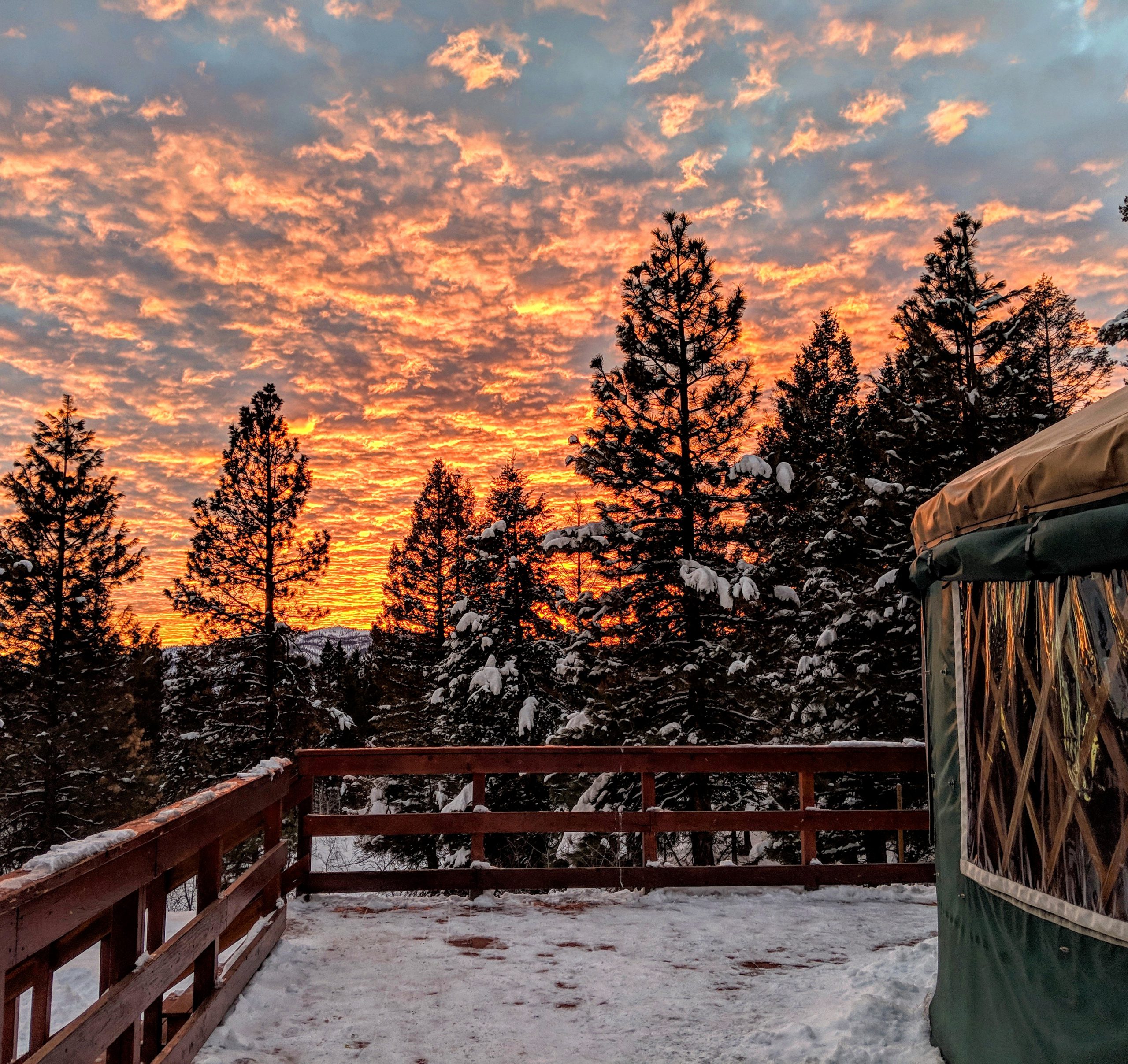
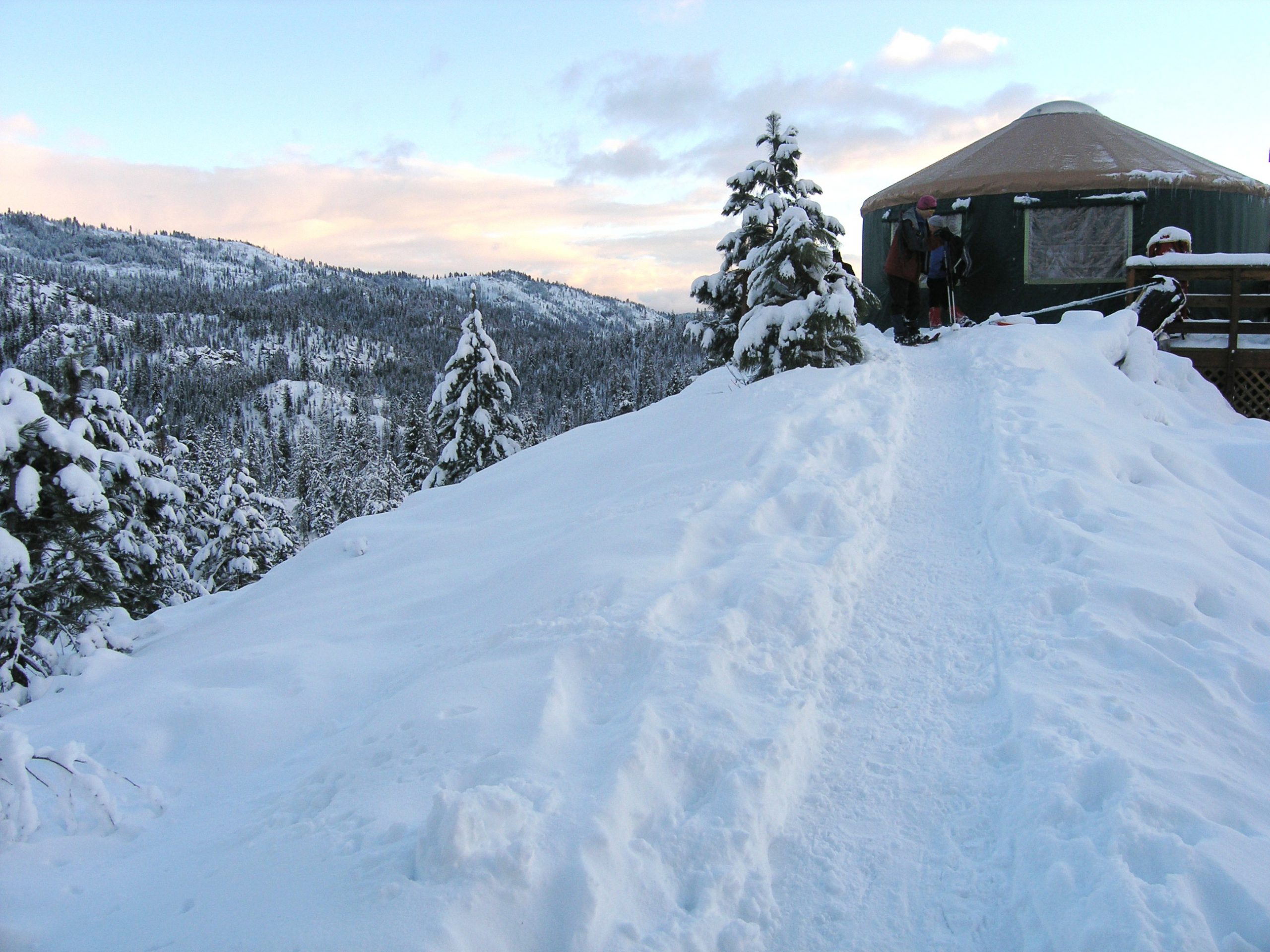
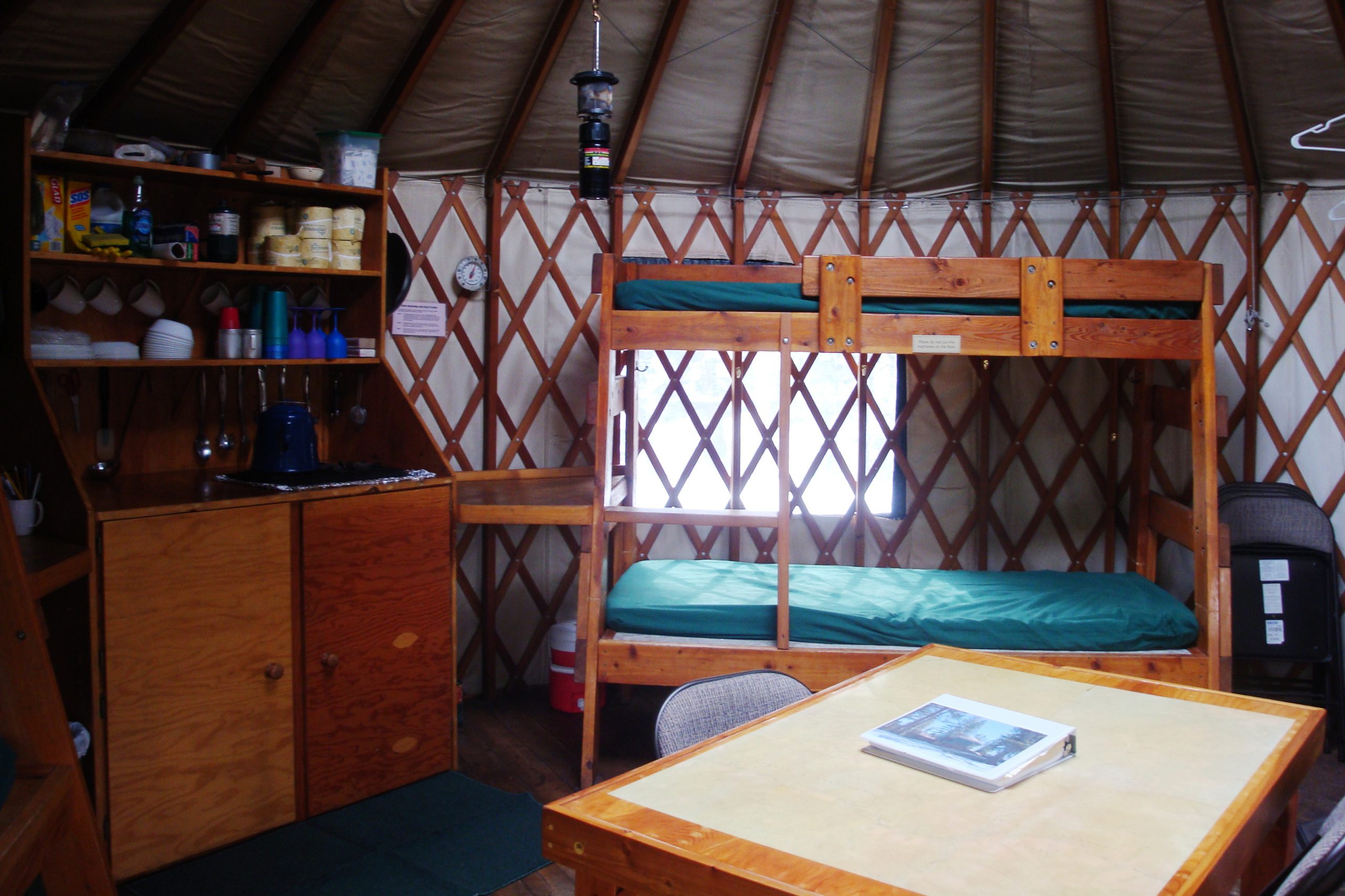
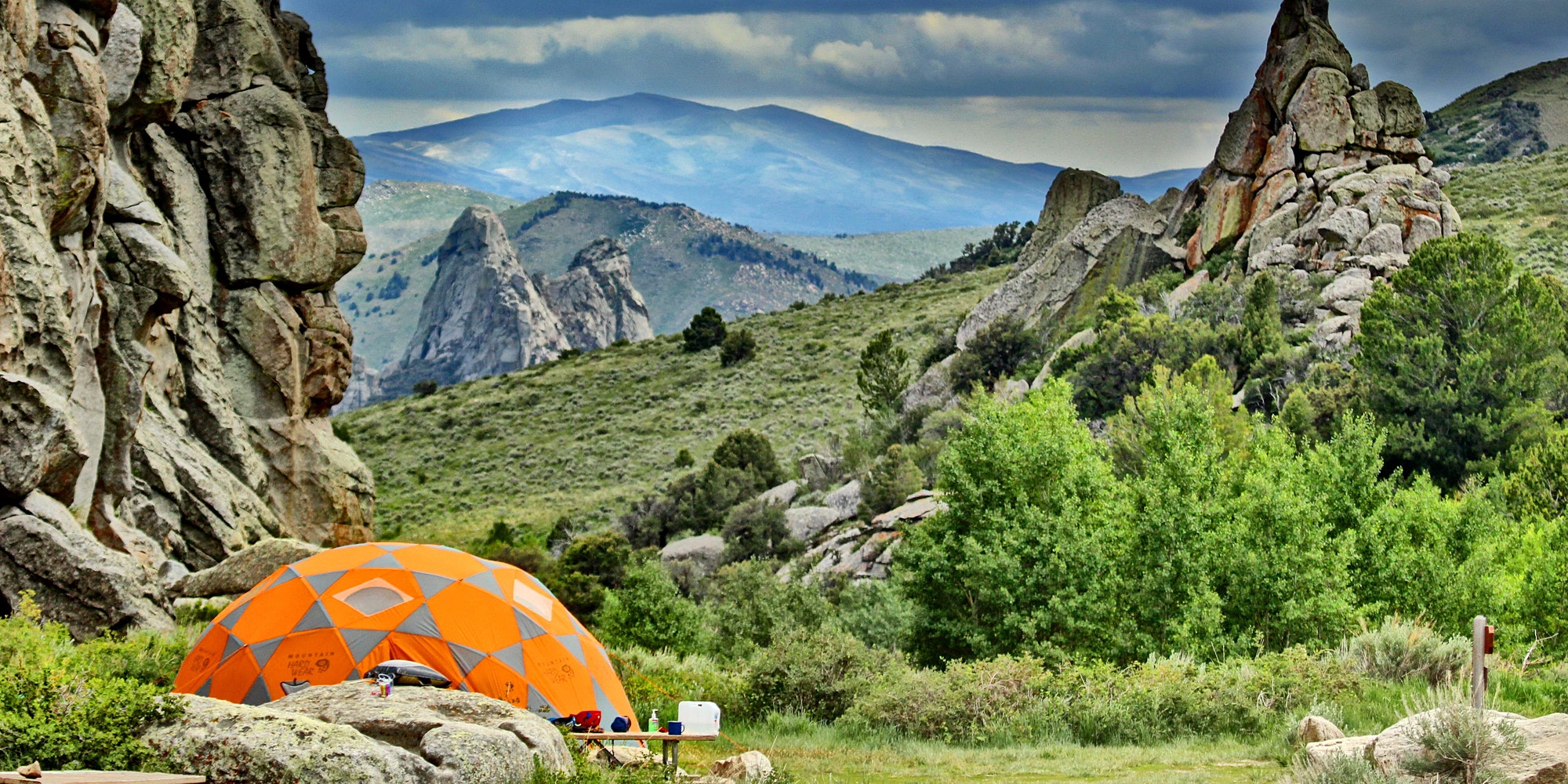
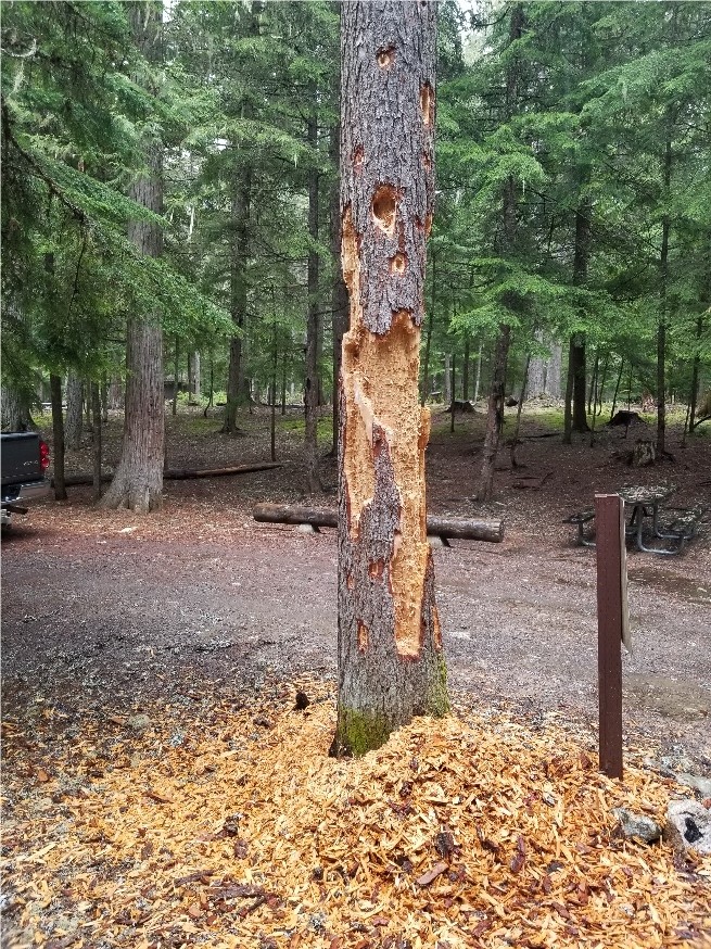
Yurts
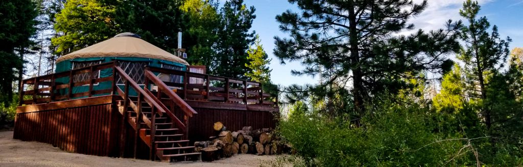
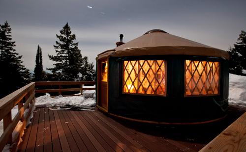
About the Idaho City Backcountry Yurts
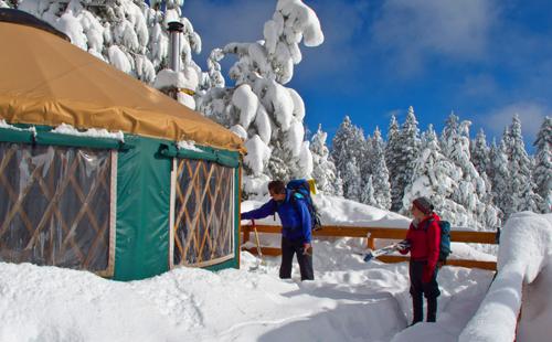
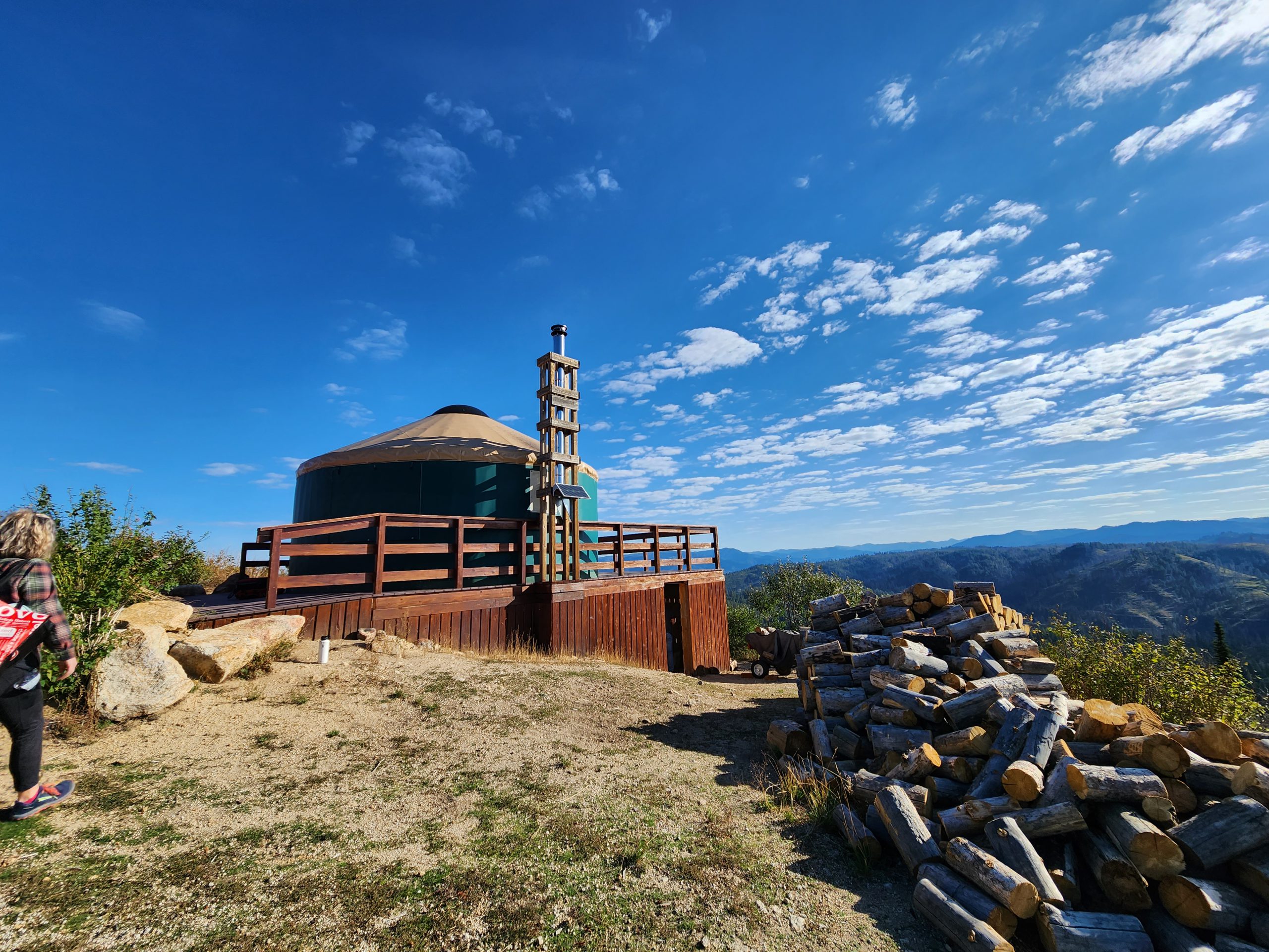
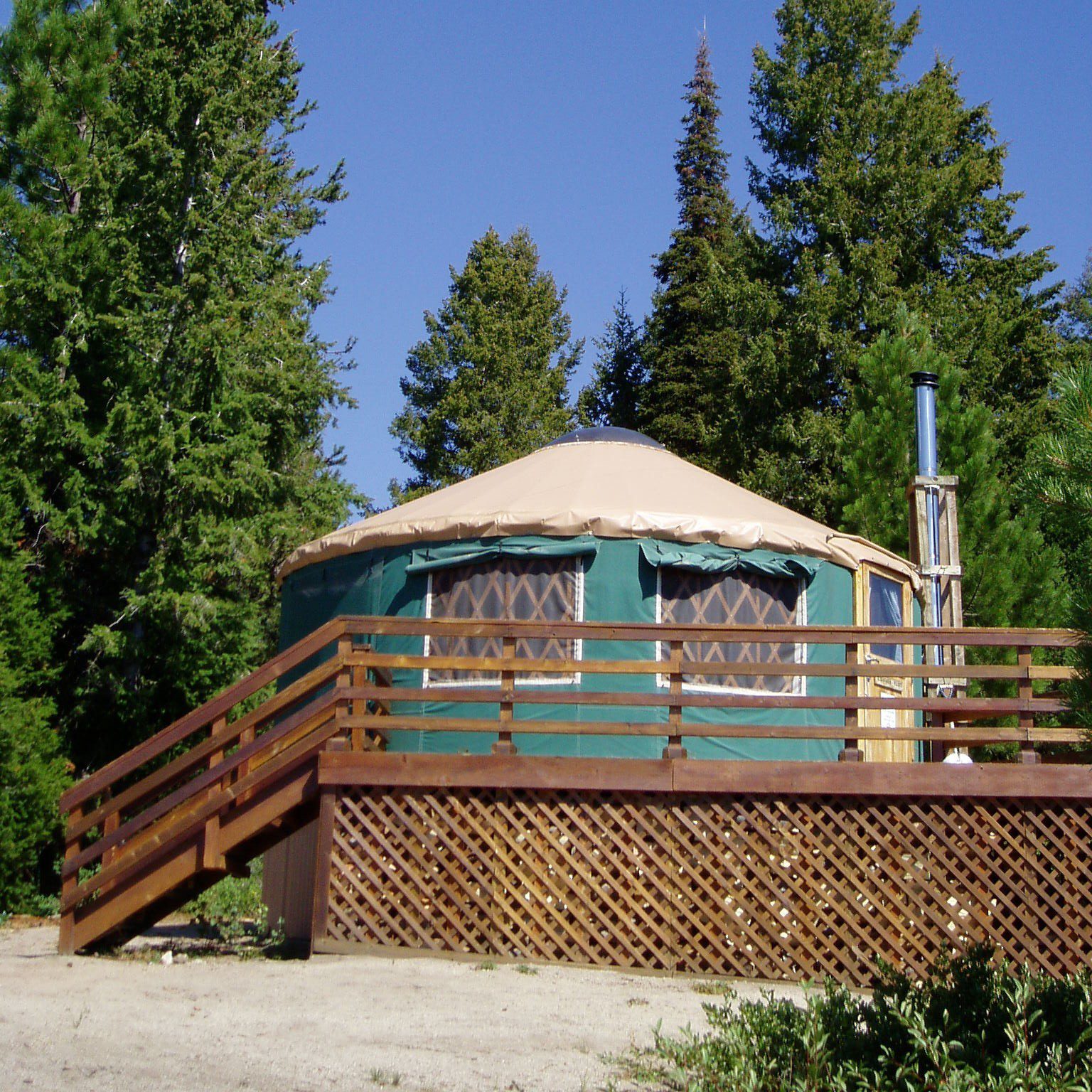
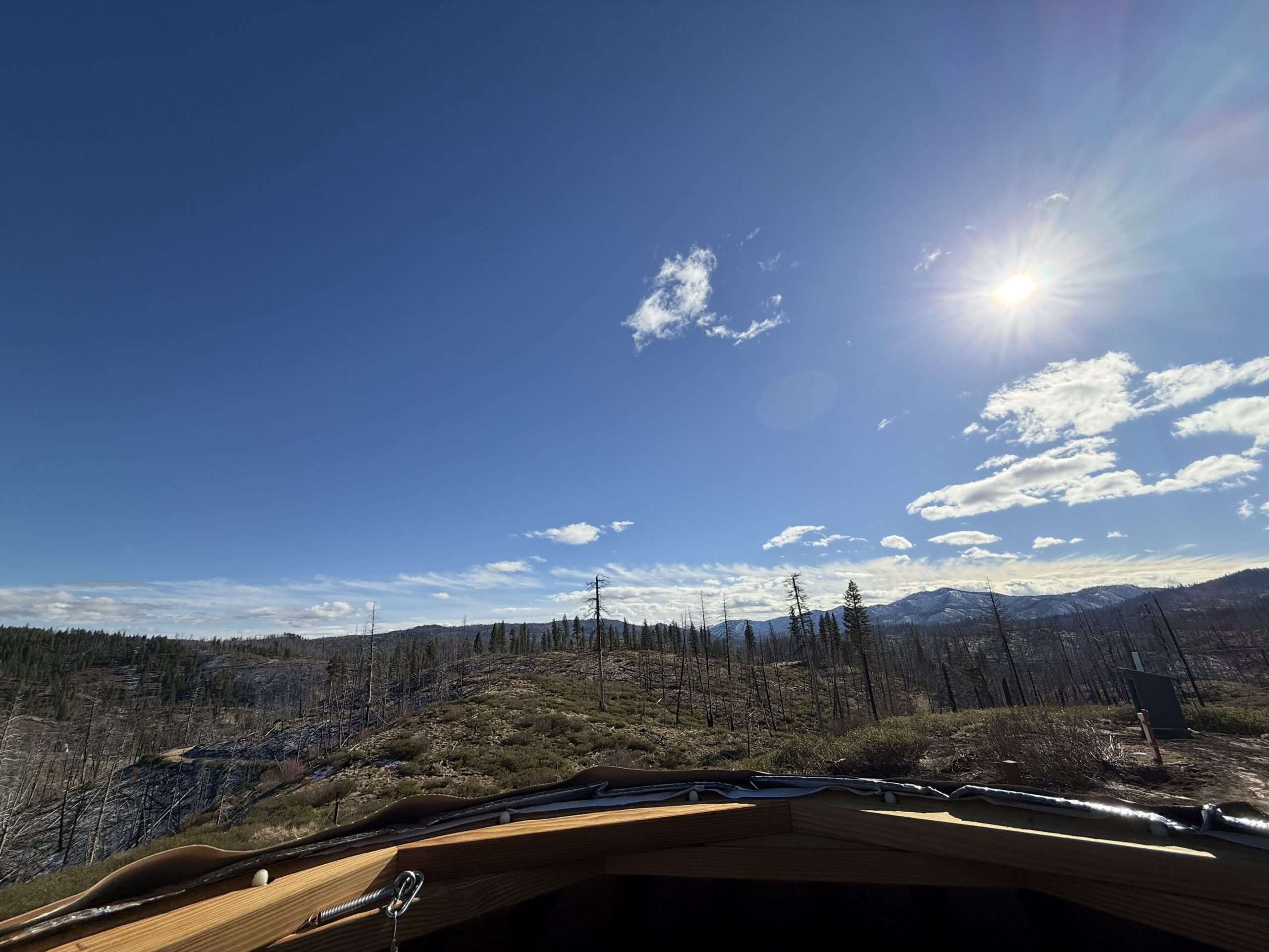
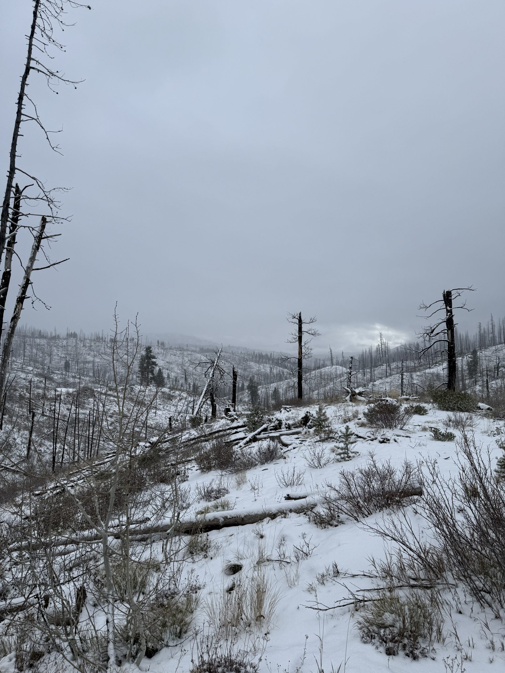
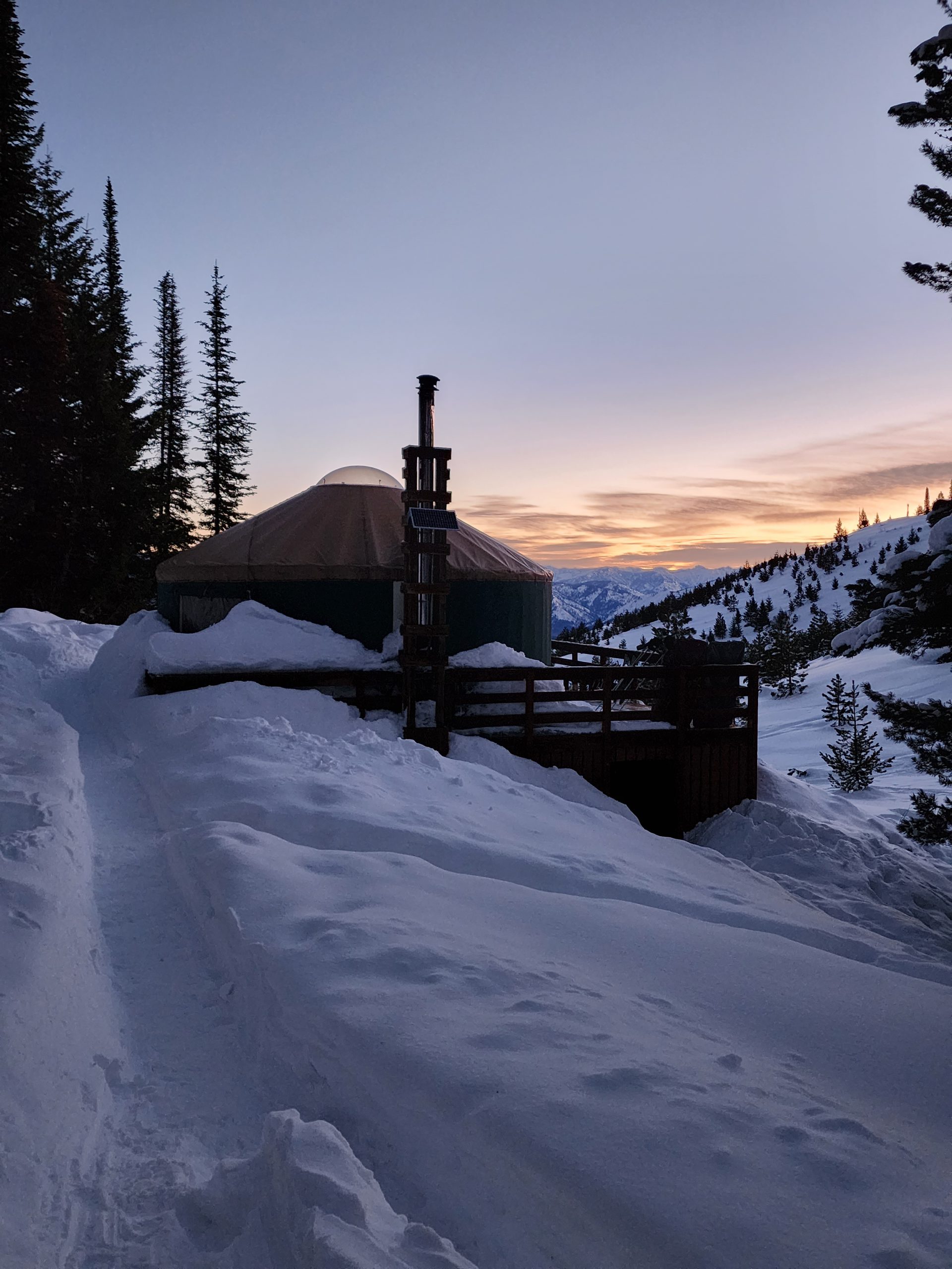
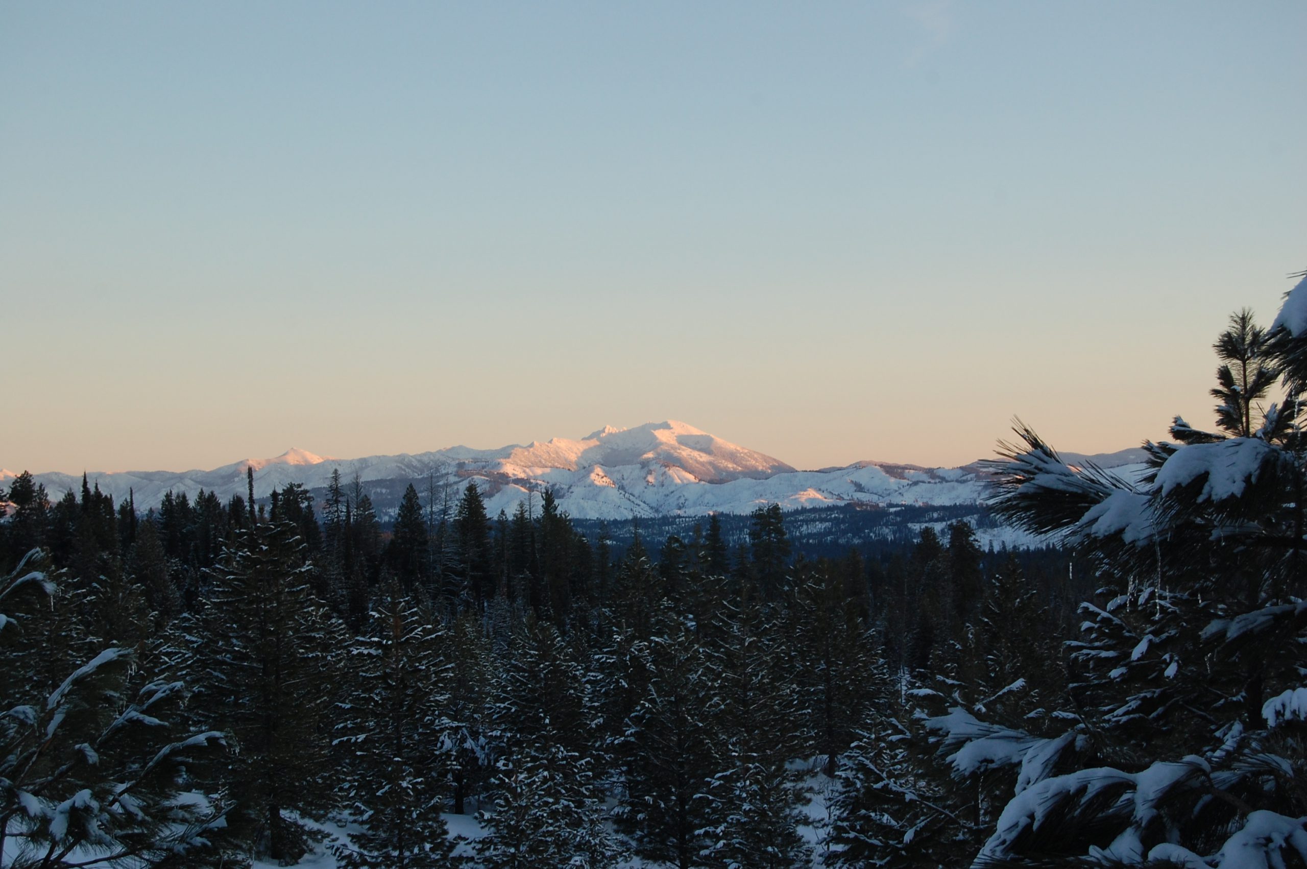
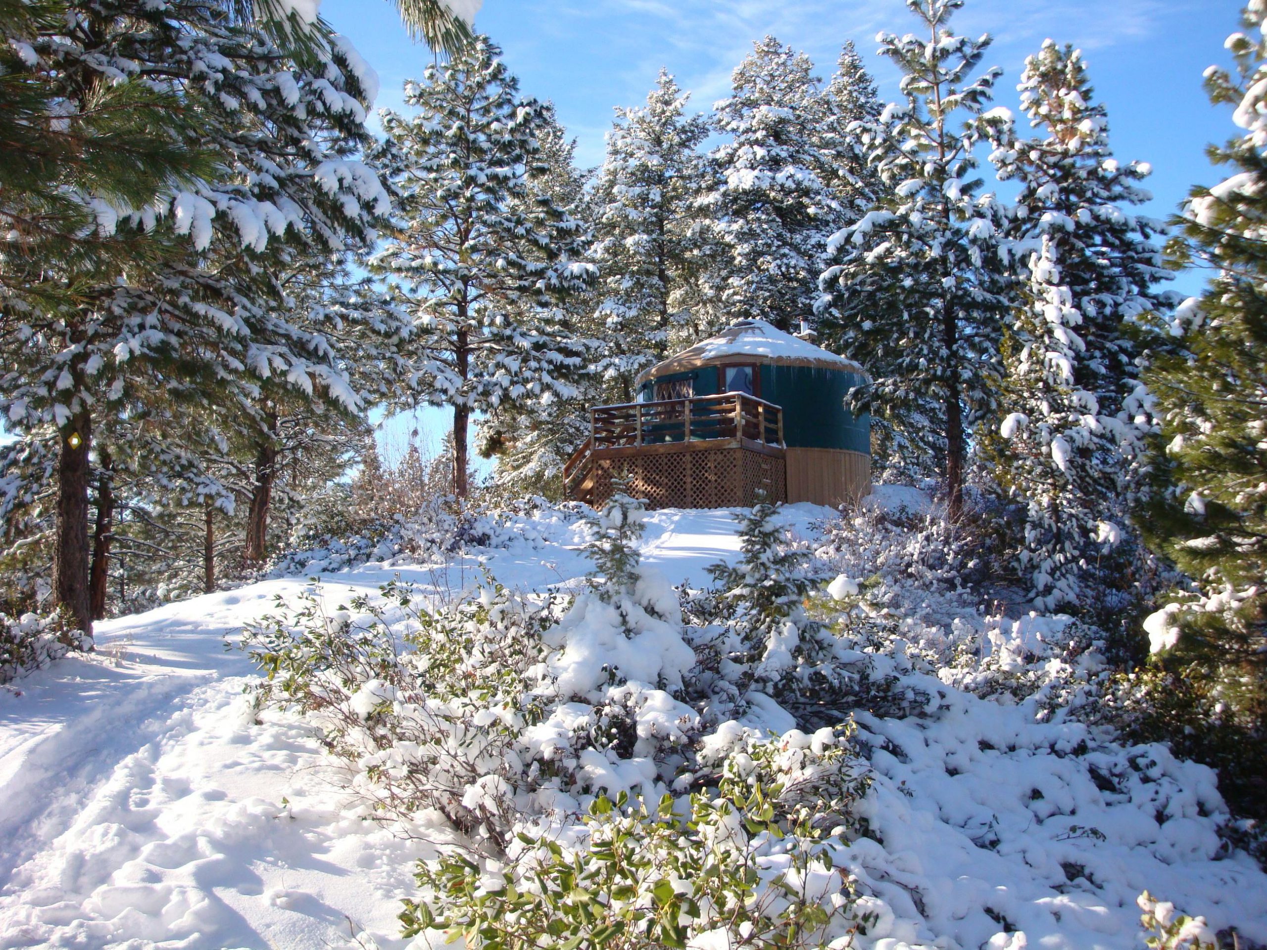
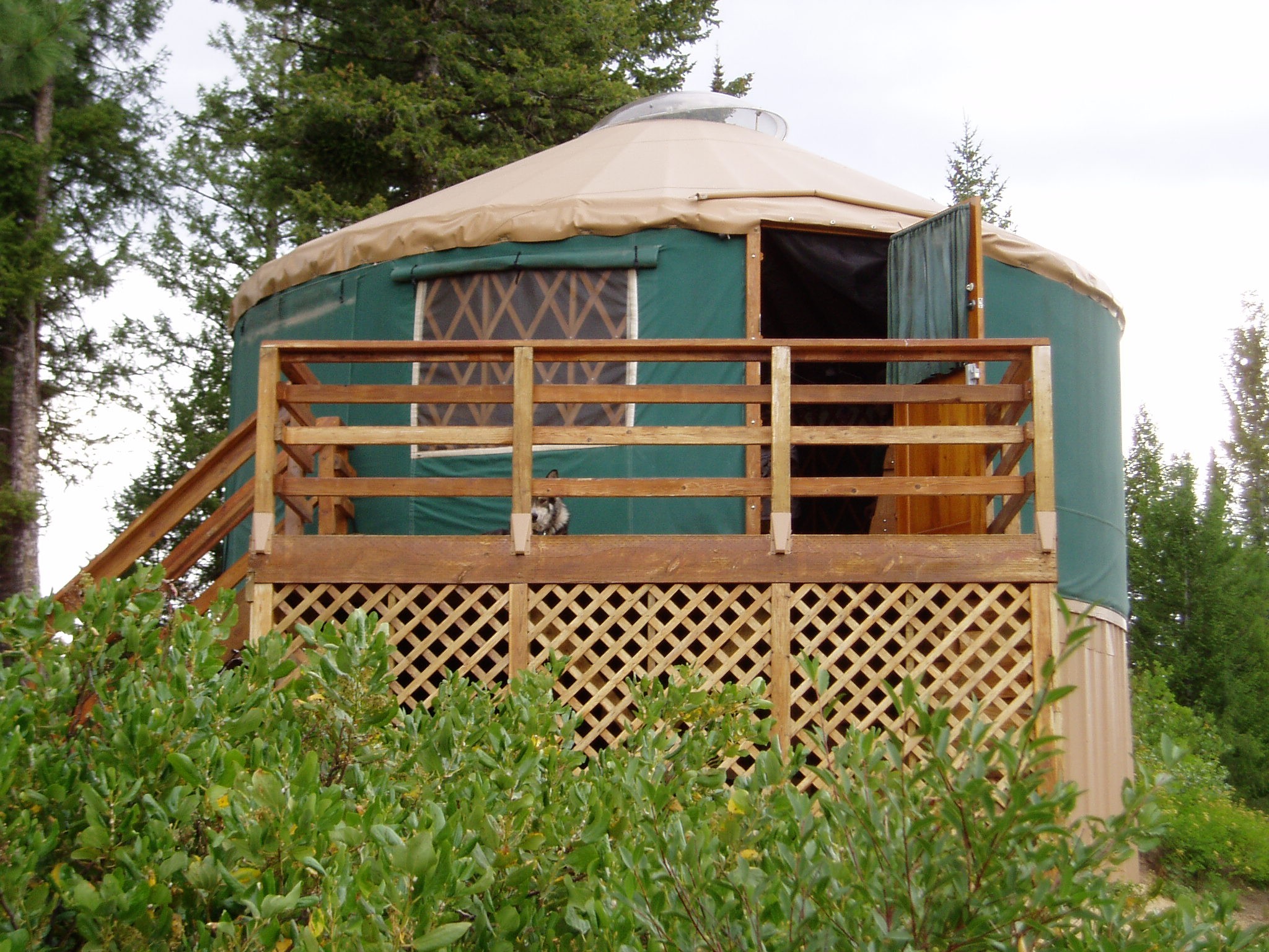
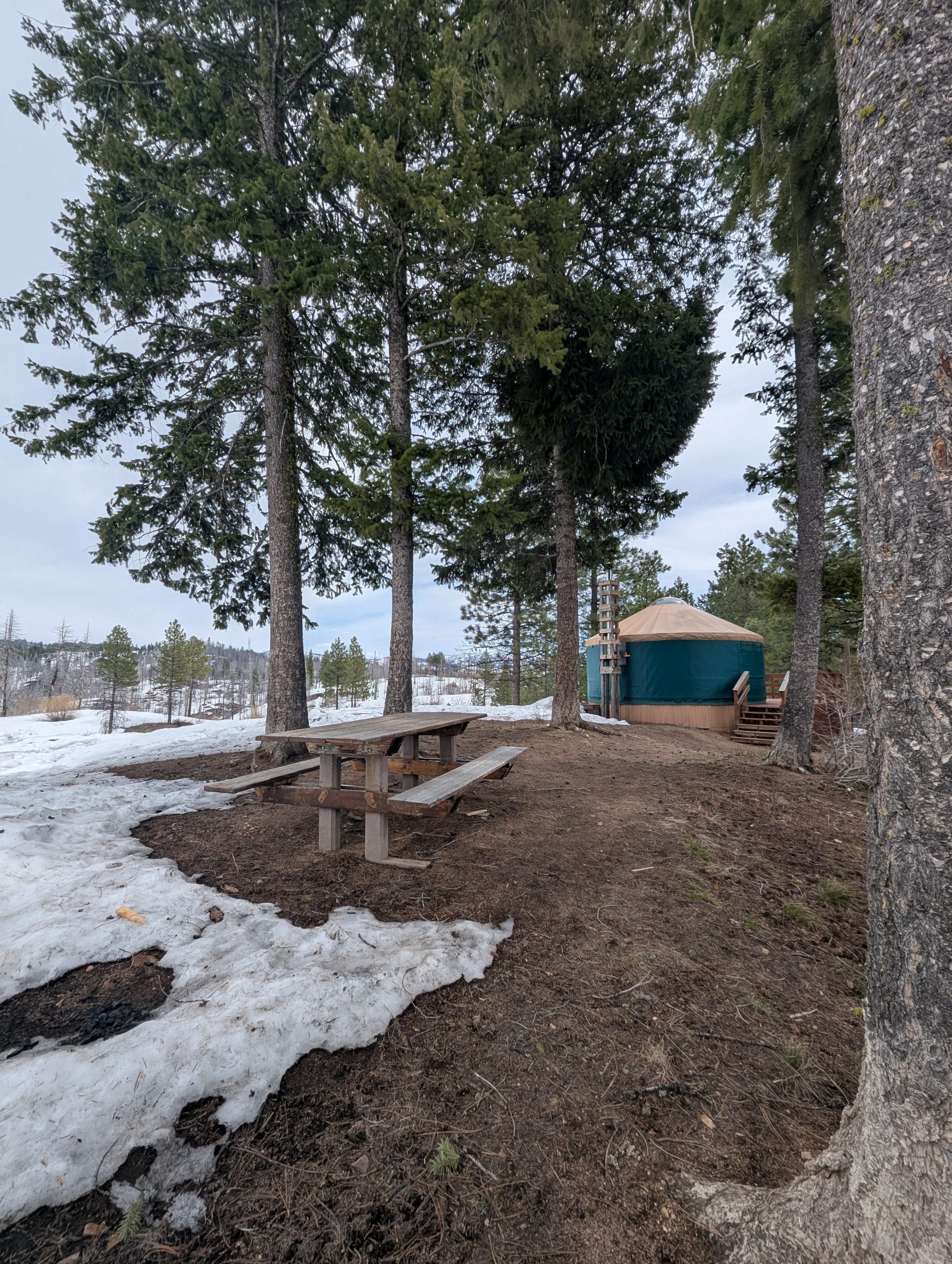
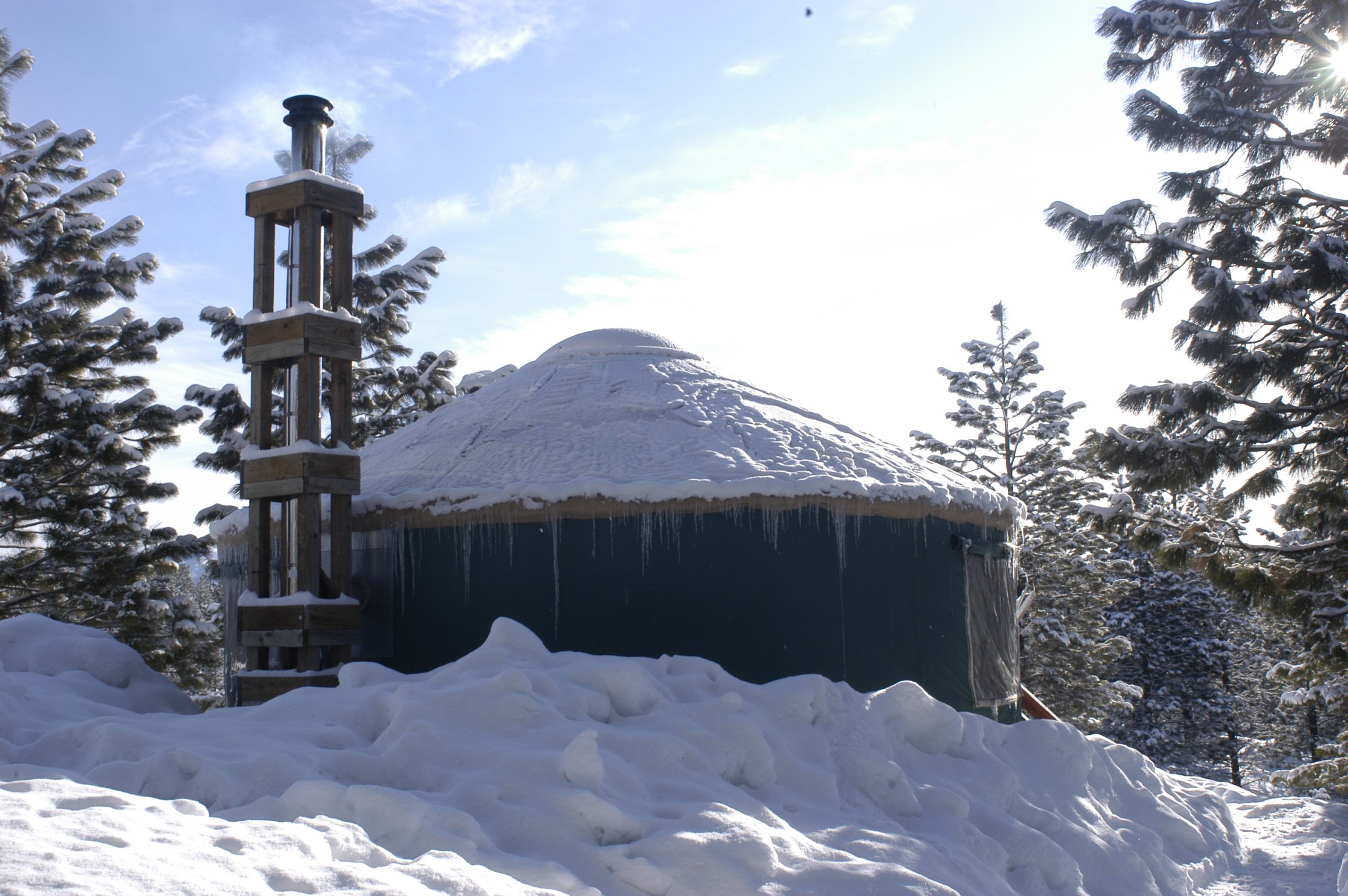
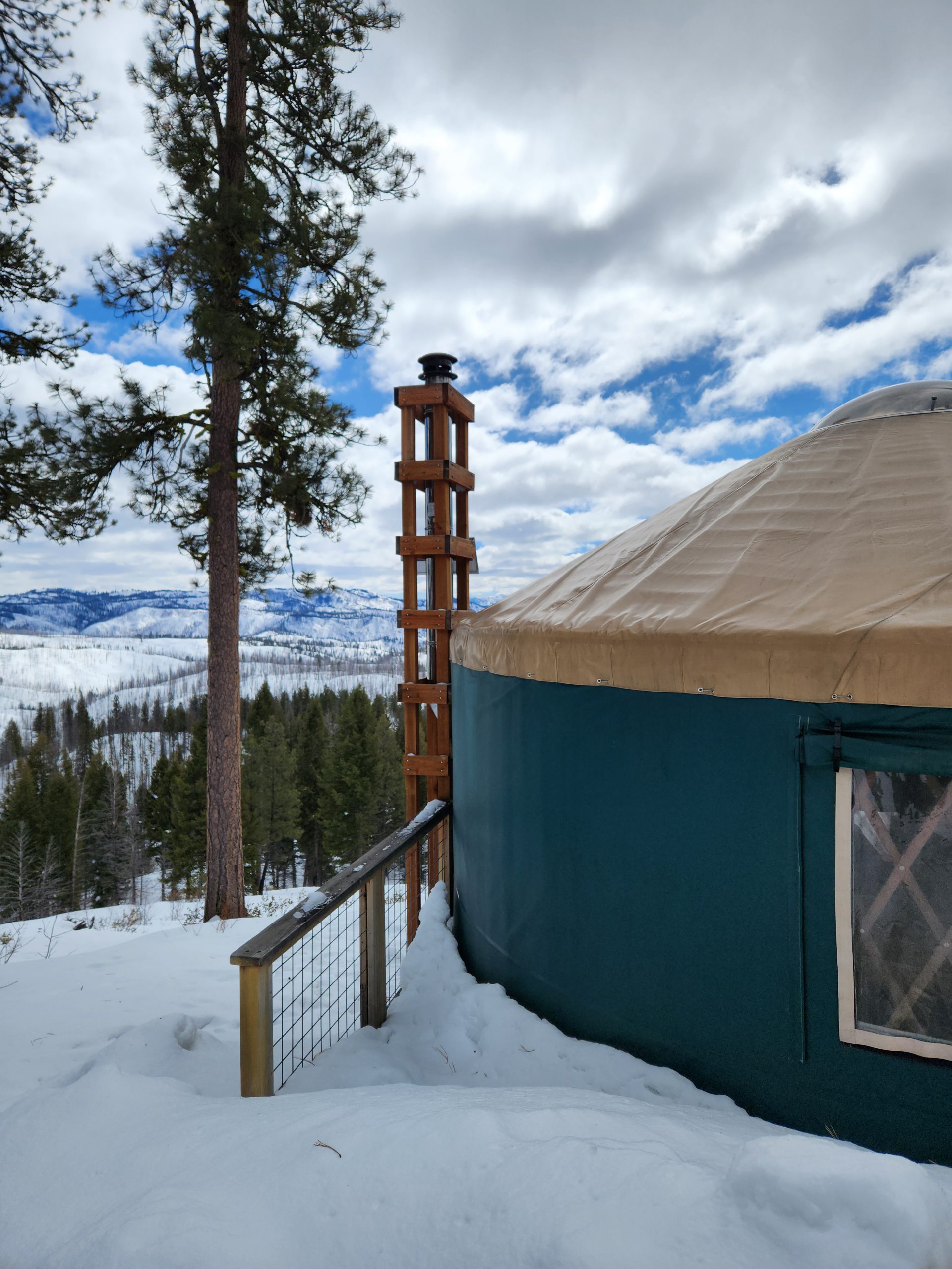
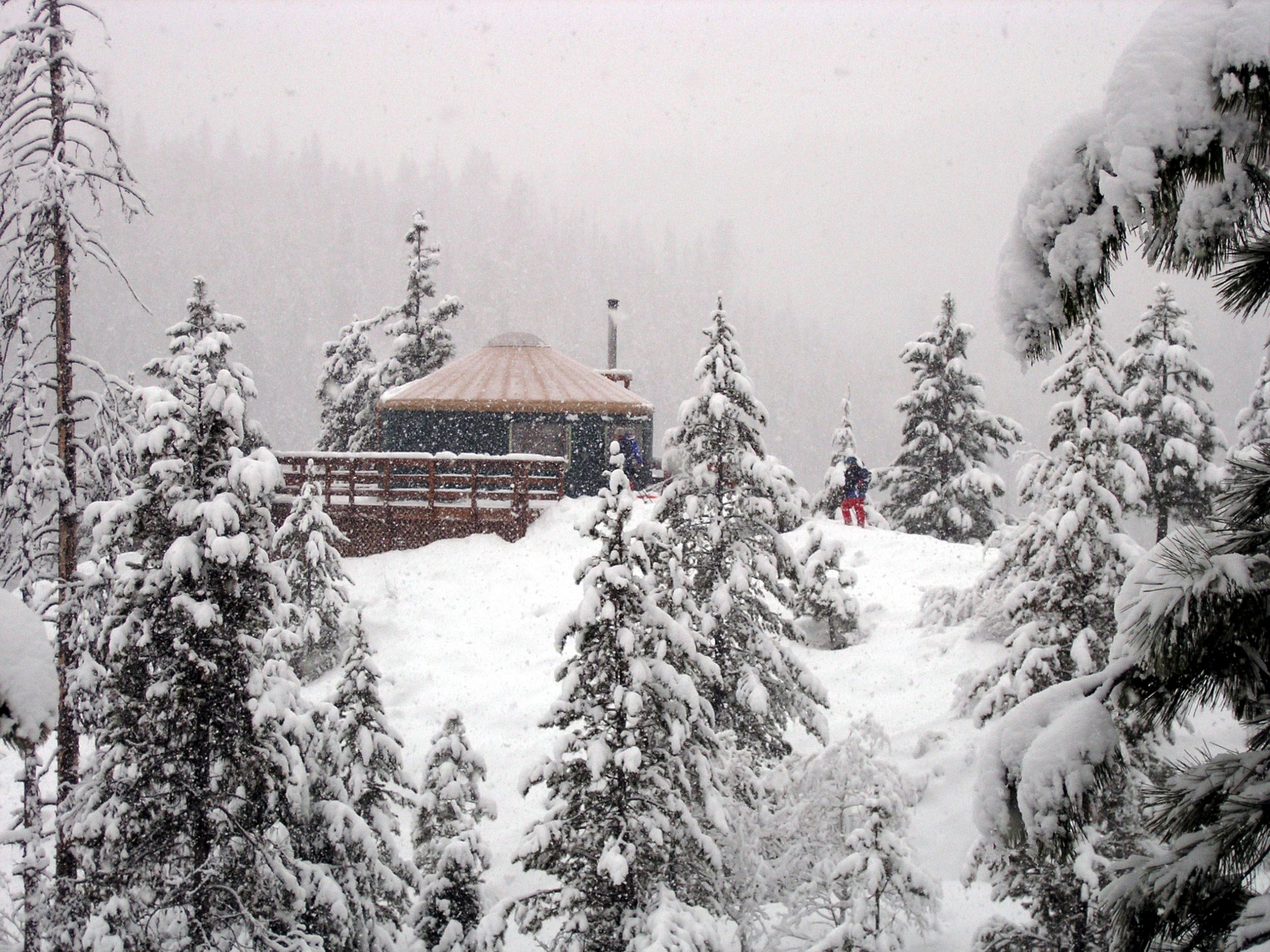
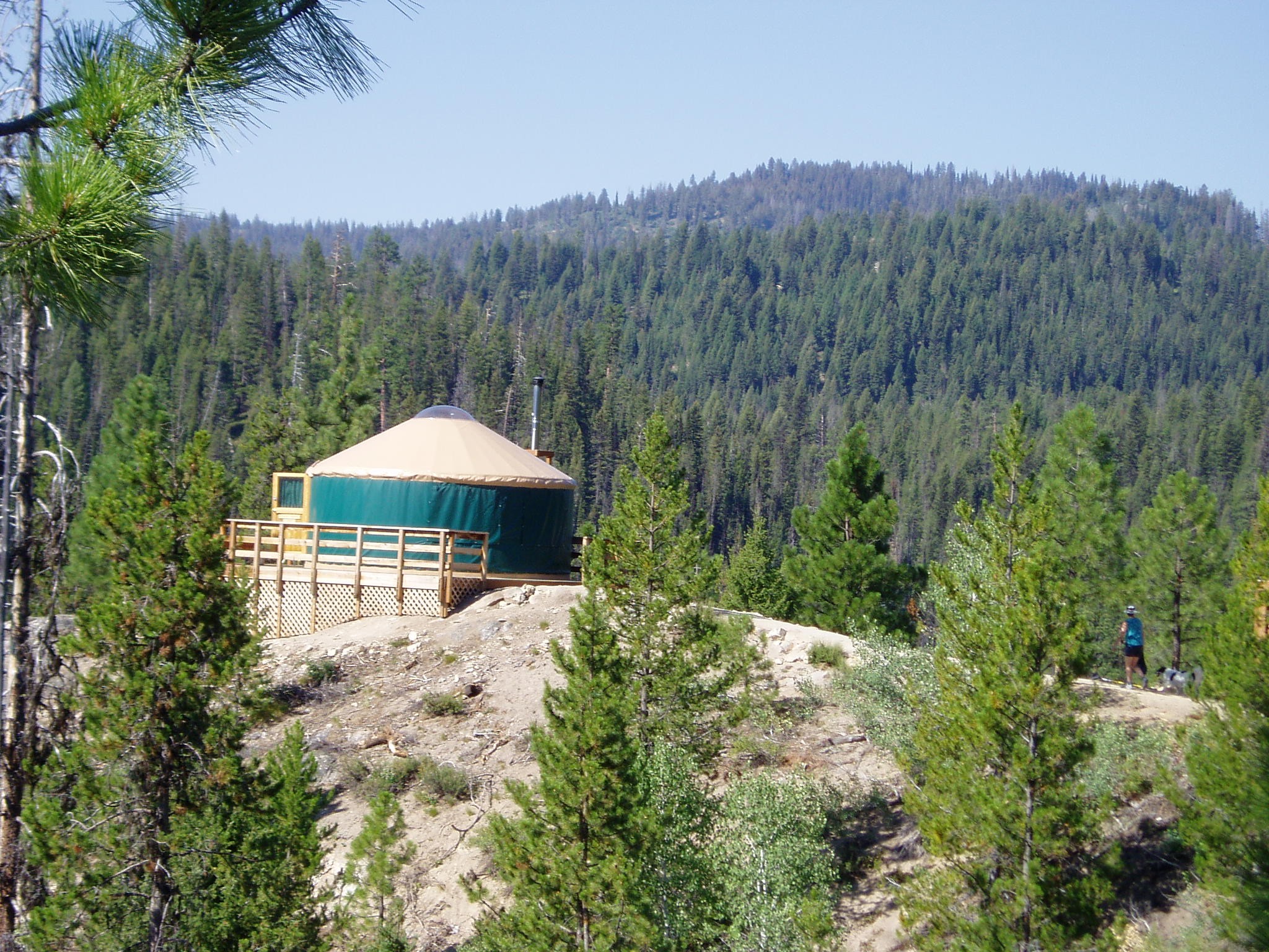
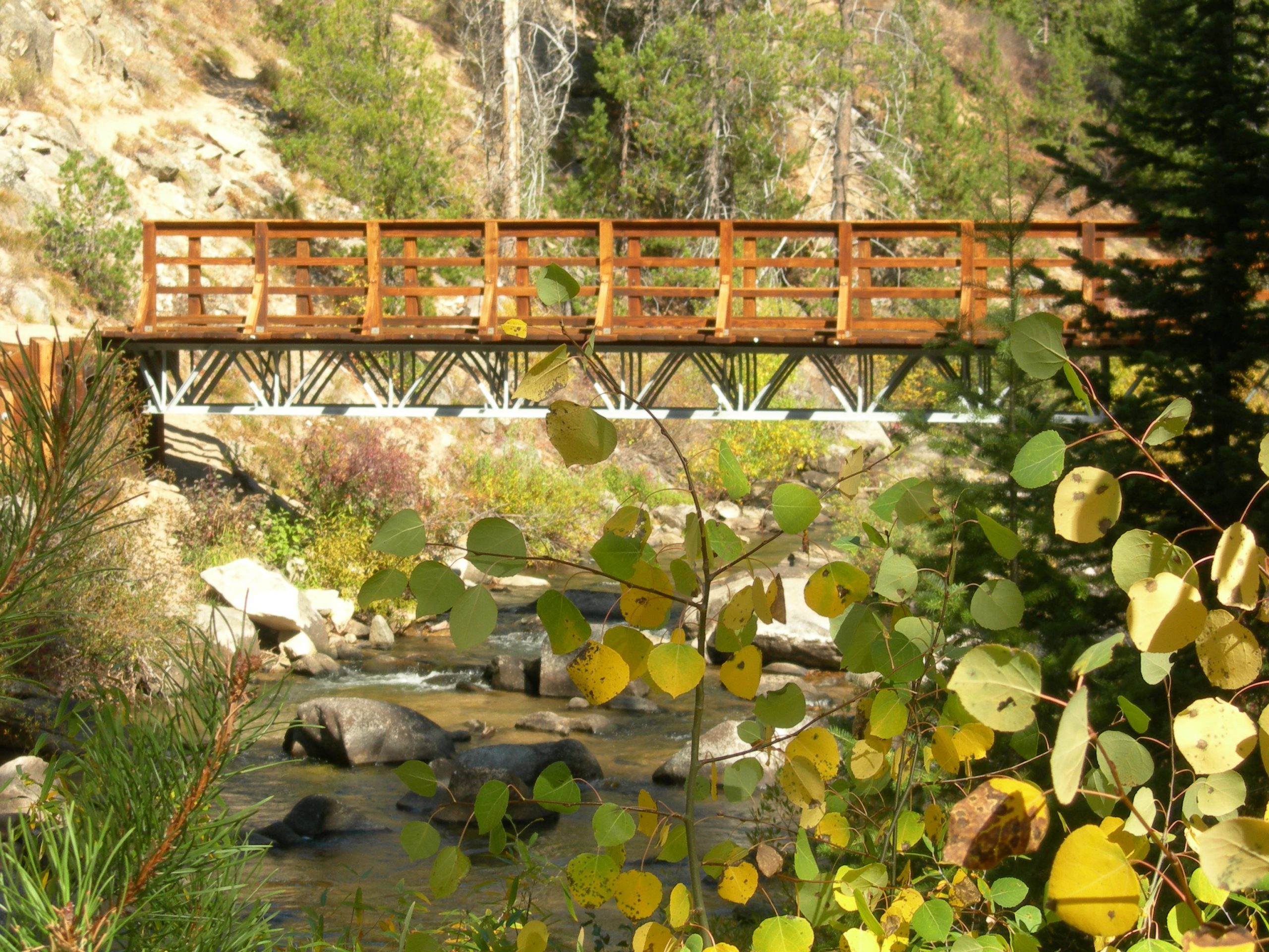
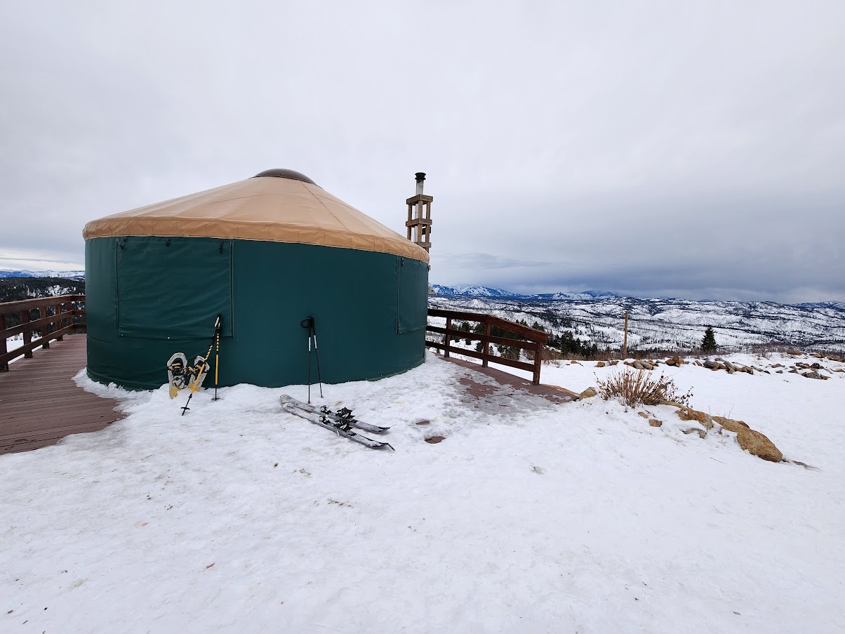
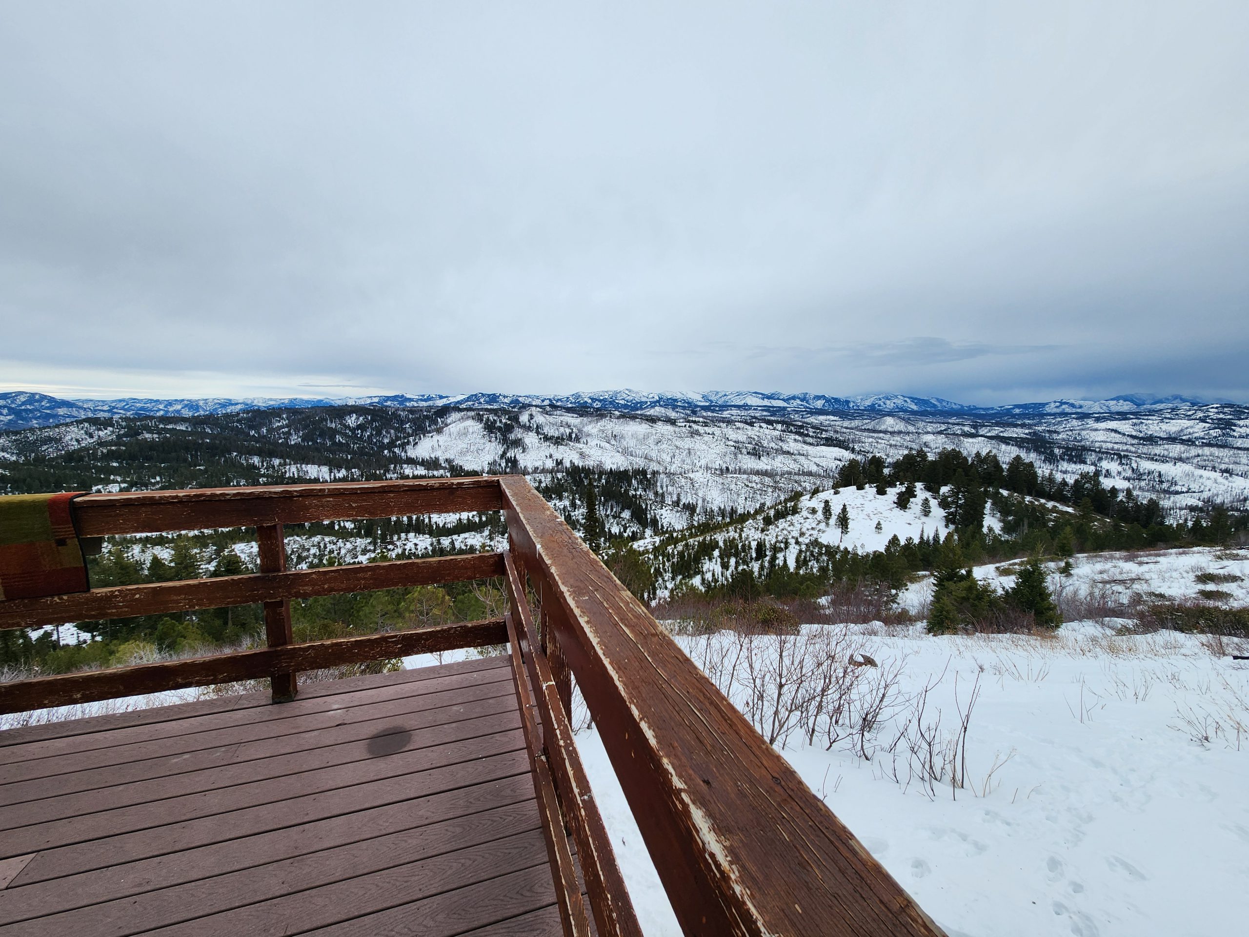
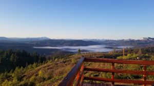
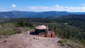
The Idaho City yurt system started in the fall of 1996 with construction of the Banner Ridge Yurt. From its inception, the yurt system was intended as a place for outdoor enthusiasts to enjoy the beauty of Idaho’s mountains year-round. You can choose from seven incredible backcountry yurts (Petersen, Banner Ridge, Elkhorn, Skyline, Hennessy, Rocky Ridge, and Stargaze) which are accessible year-round. The yurts are located about 1.5 hours (56-63 miles) north of Boise, ID.
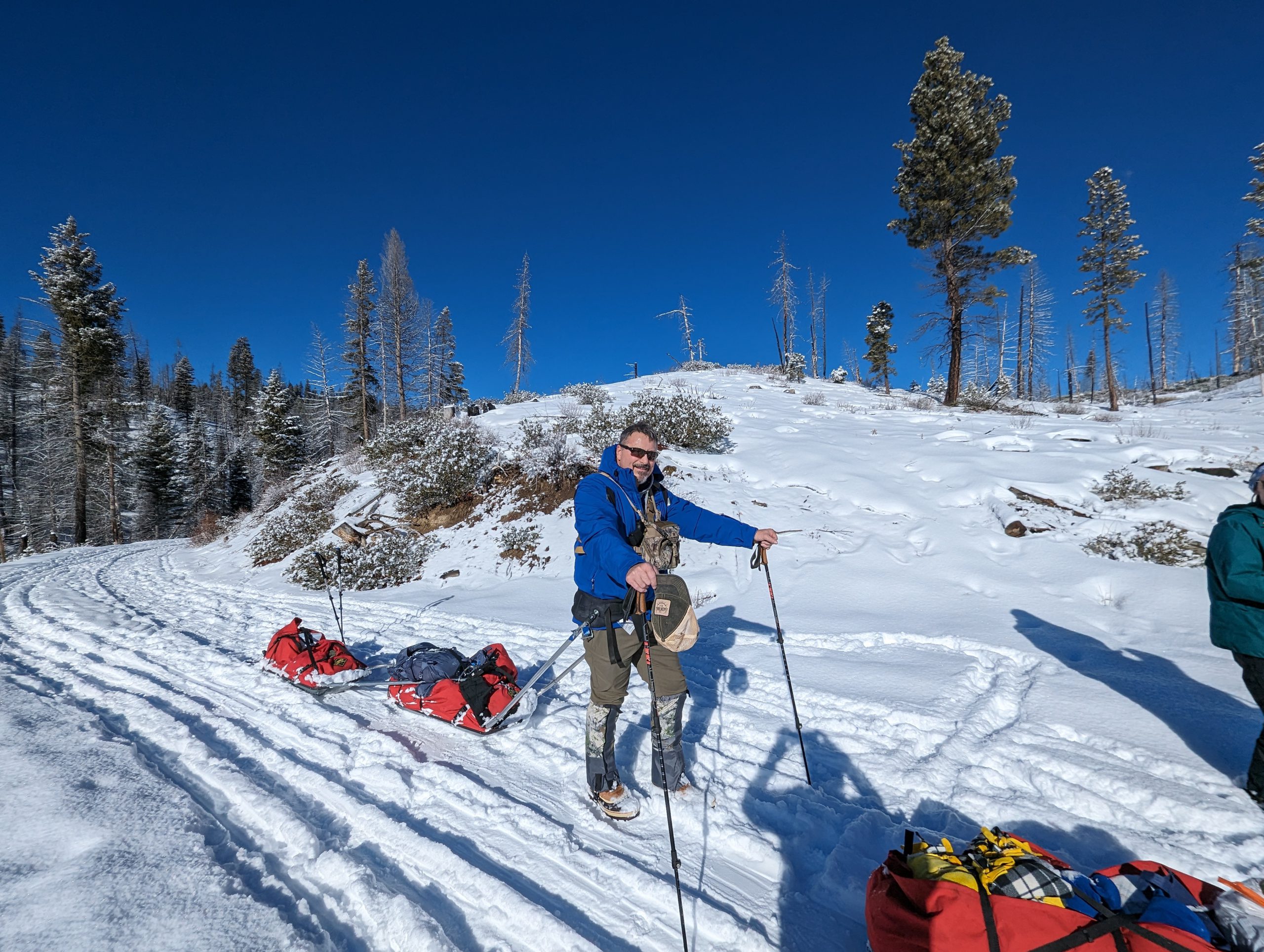
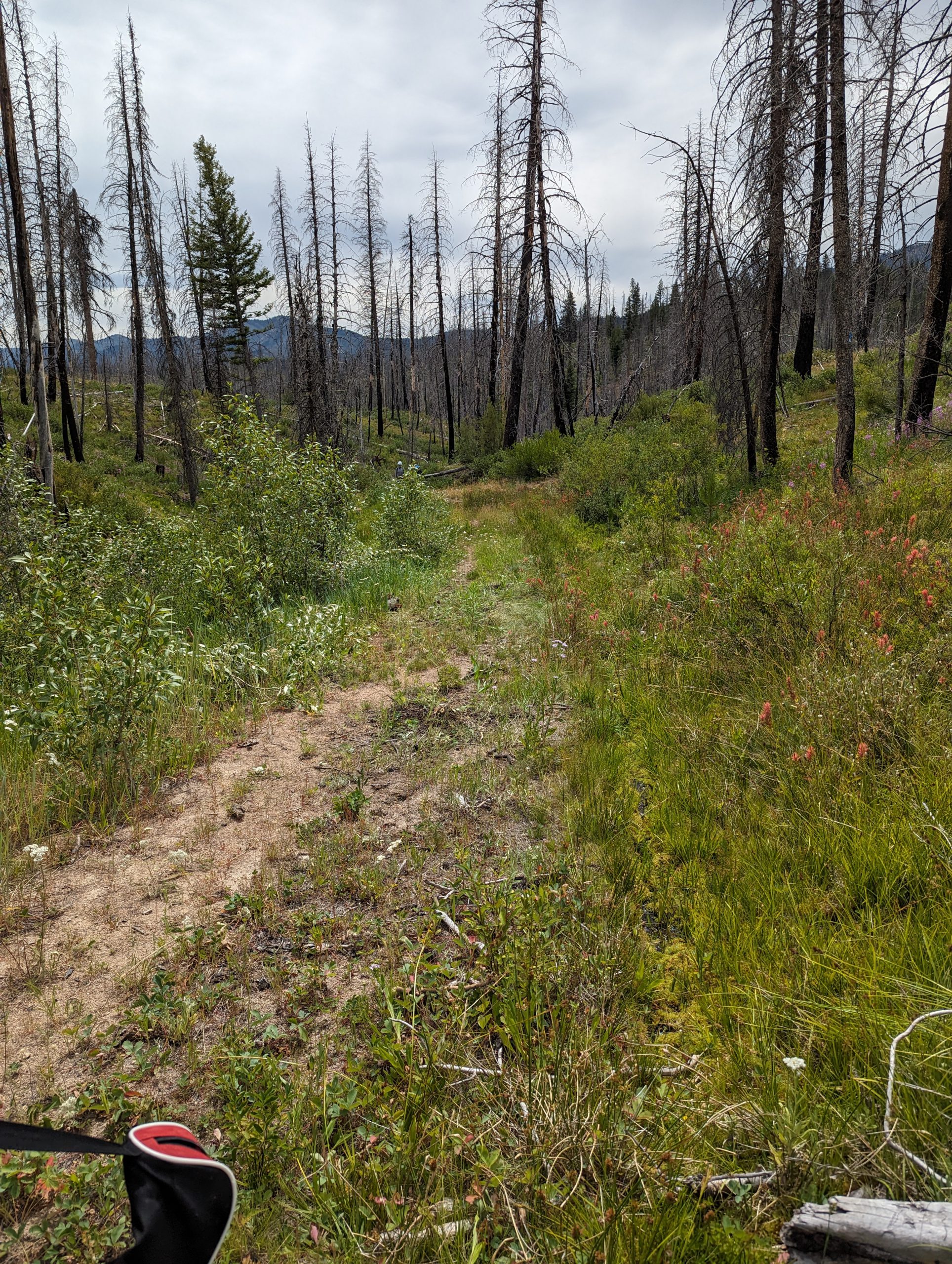
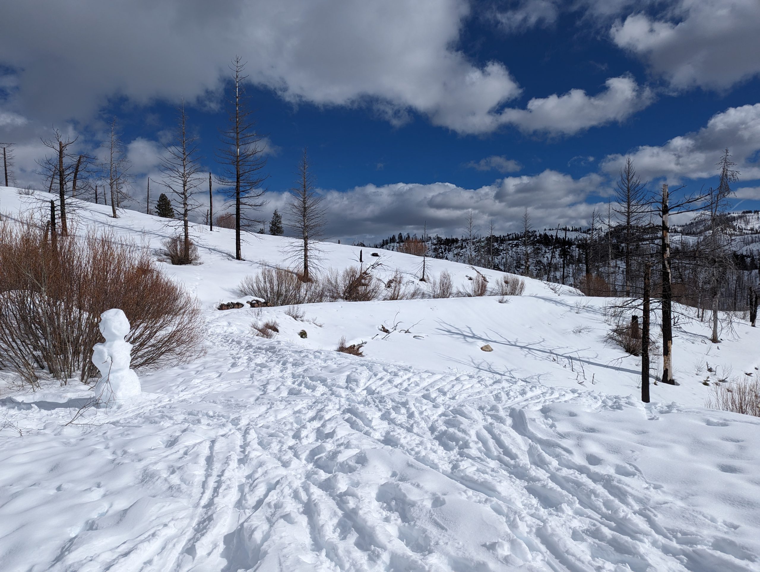
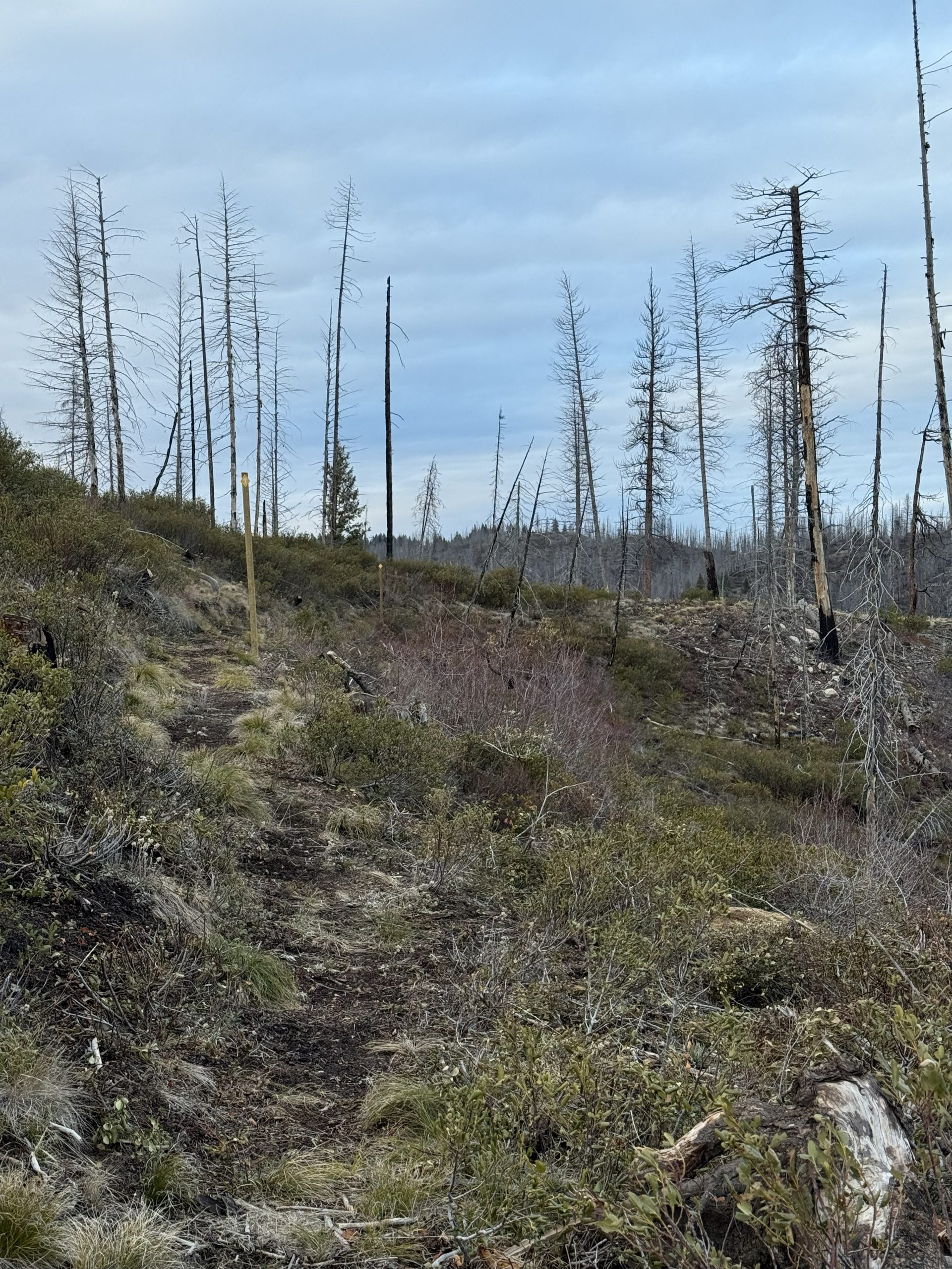
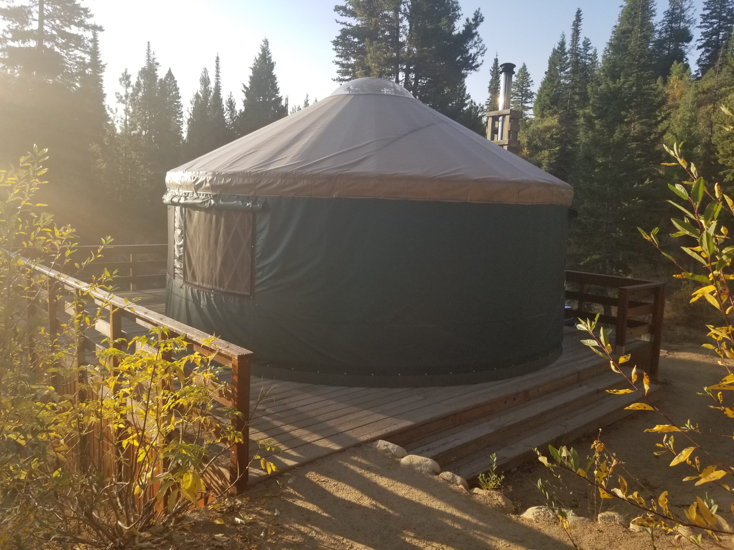
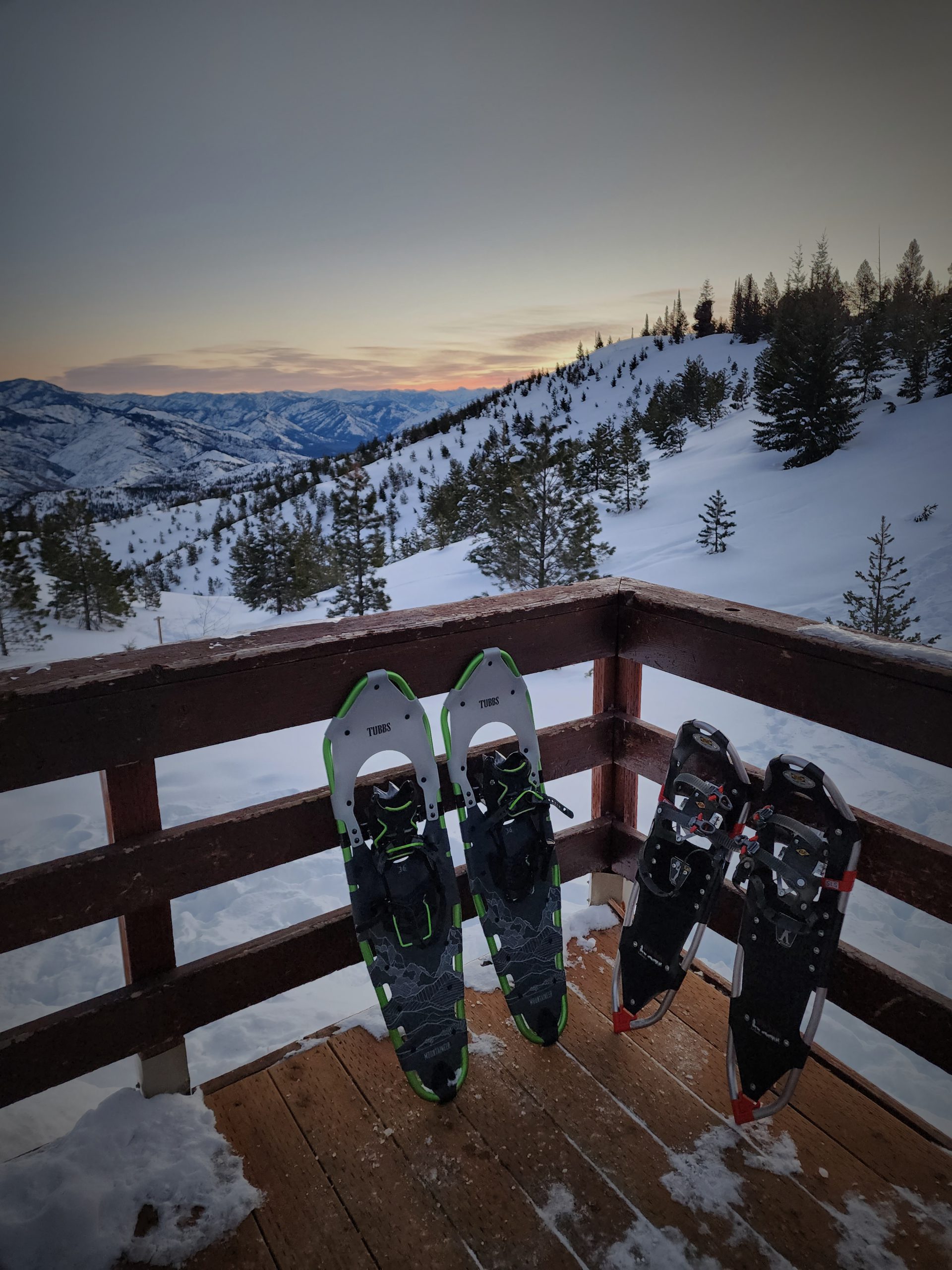
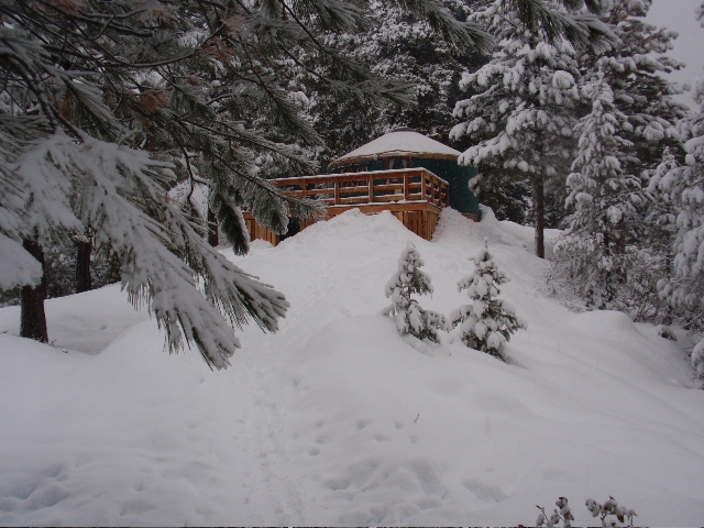
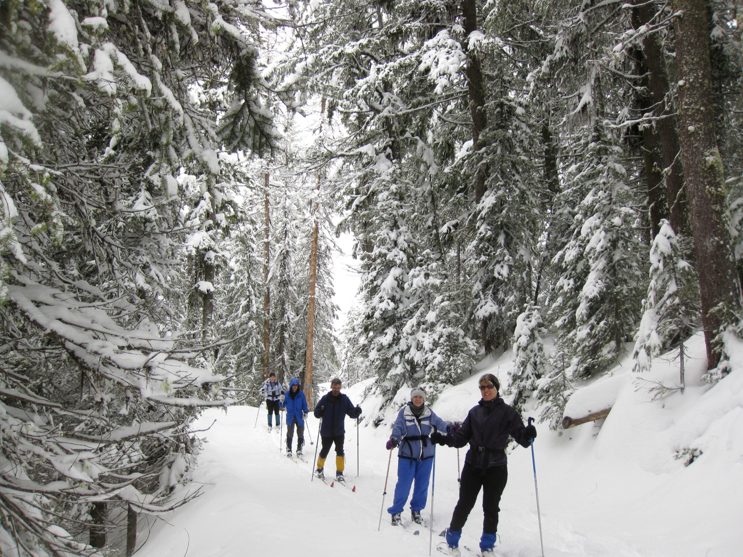
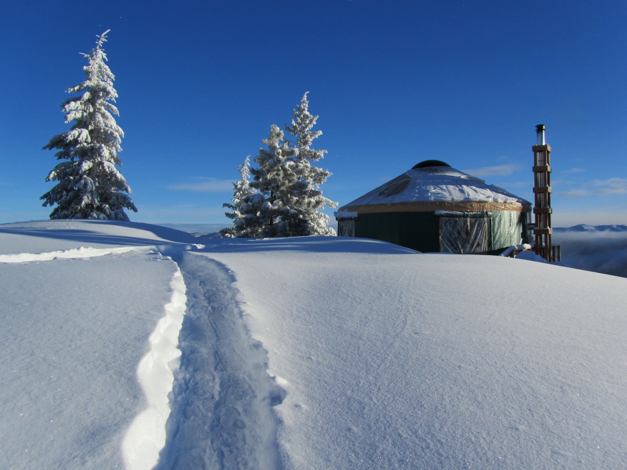
In summer, the yurts are accessed by a few hundred yard hike. In winter, they are accessed by a 1-3 mile ski or snowshoe trek. During spring and fall, users should be prepared for both summer and winter conditions. Condition updates are posted on the Idaho Non-Motorized Trails Program Facebook page.
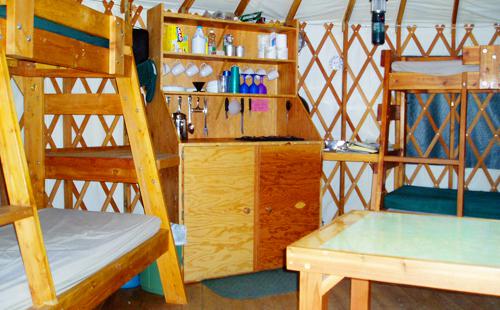
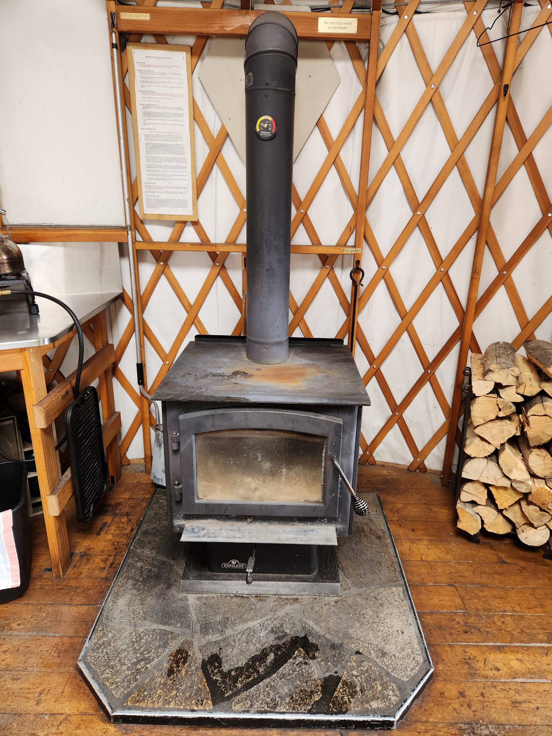
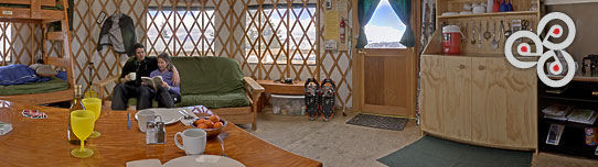
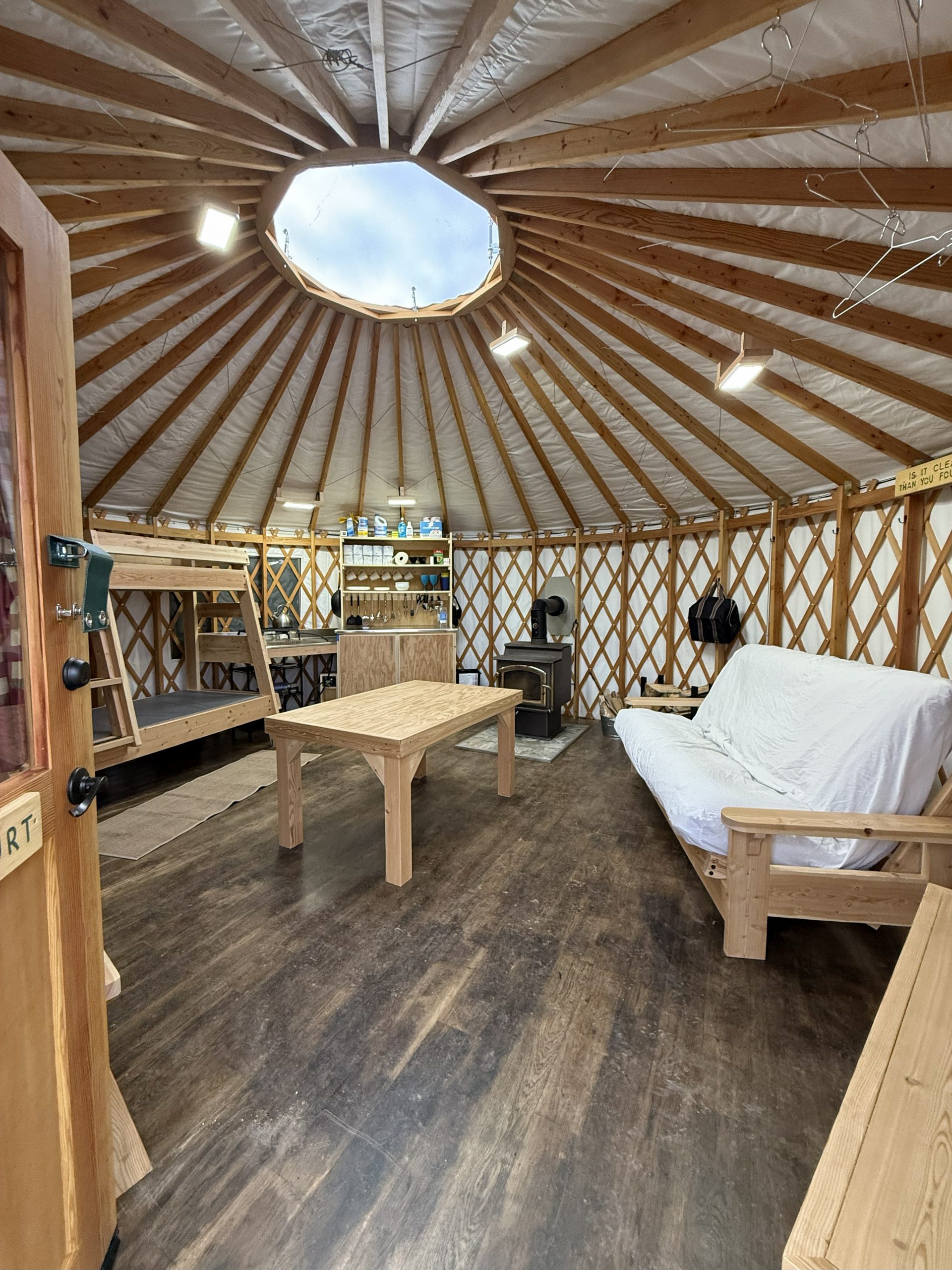
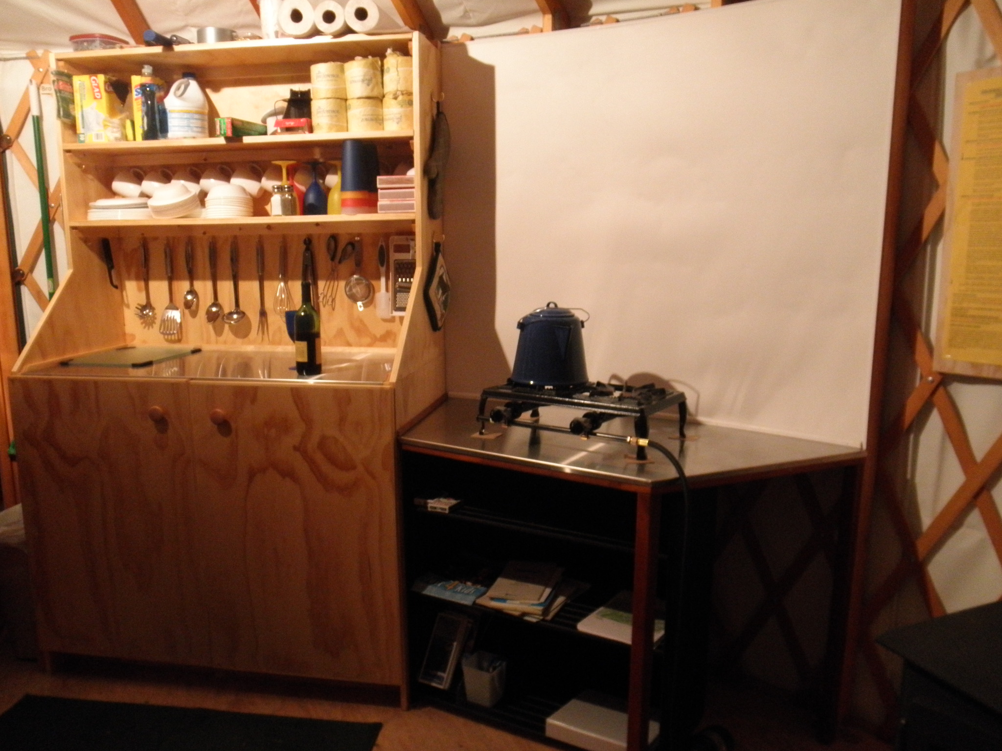
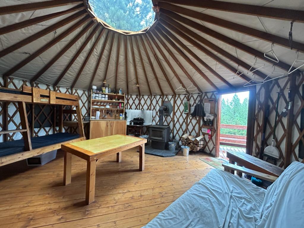
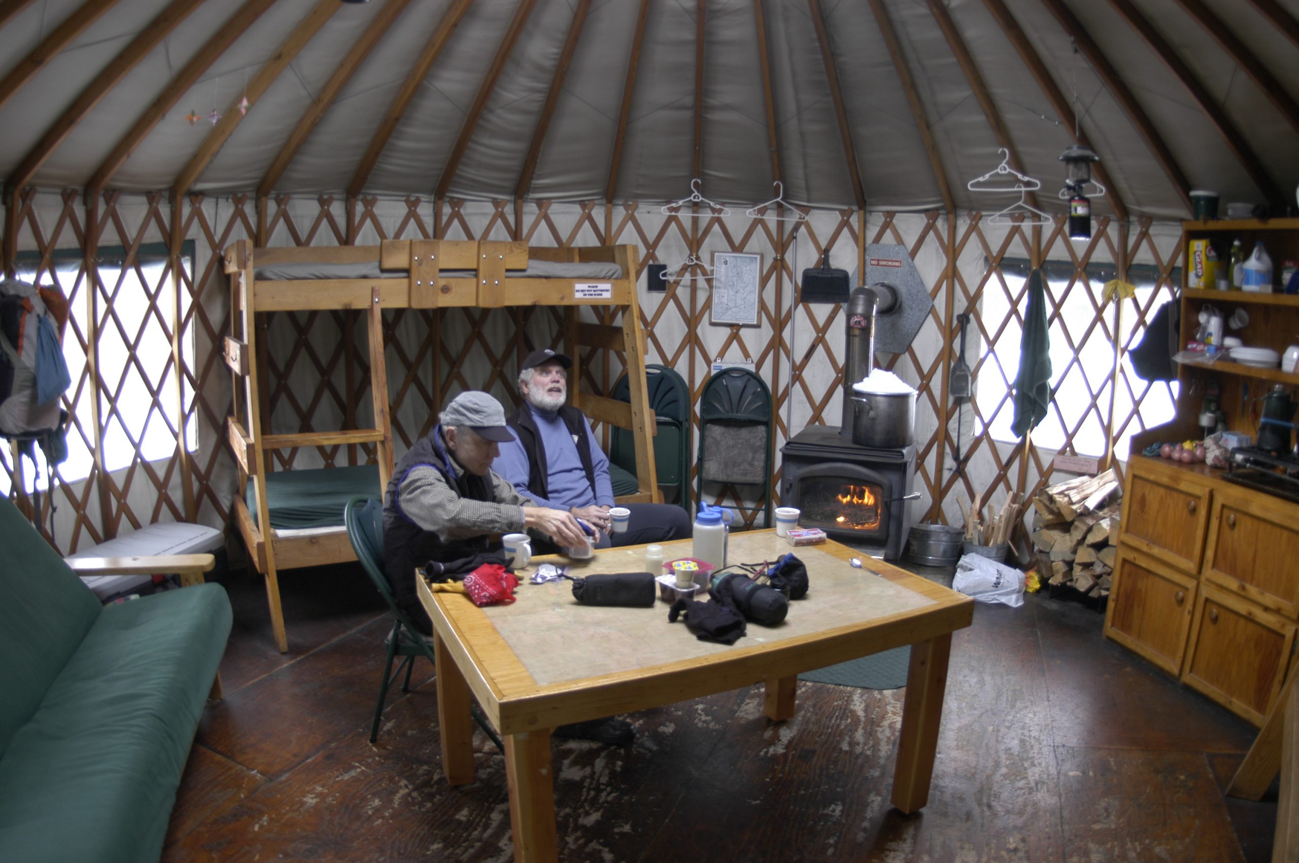
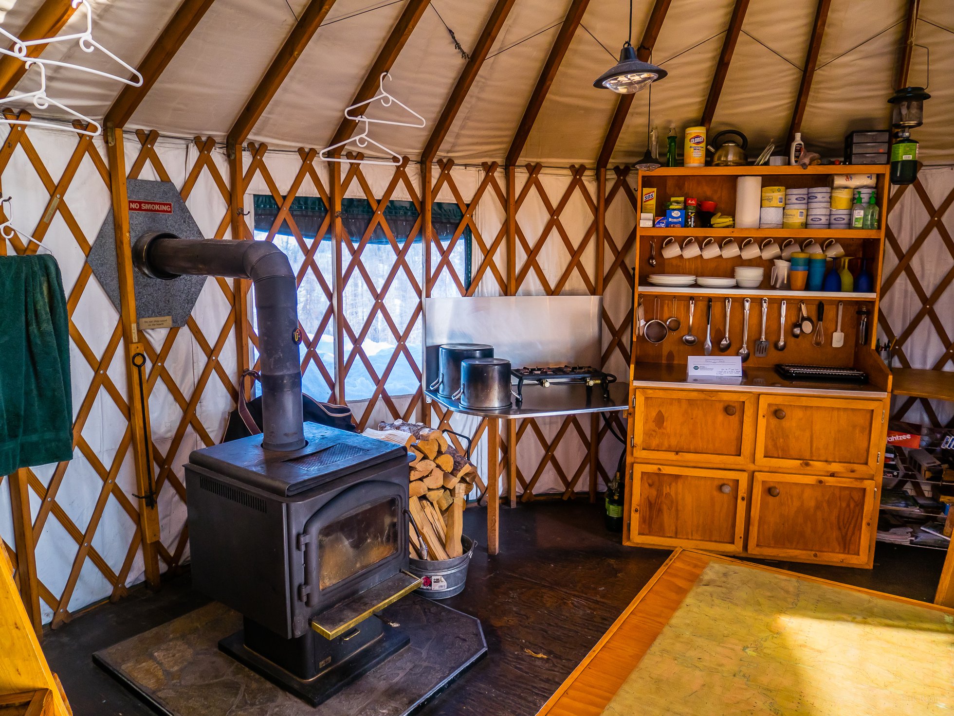
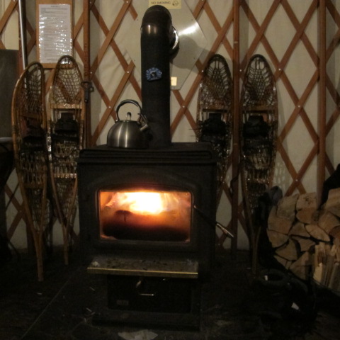
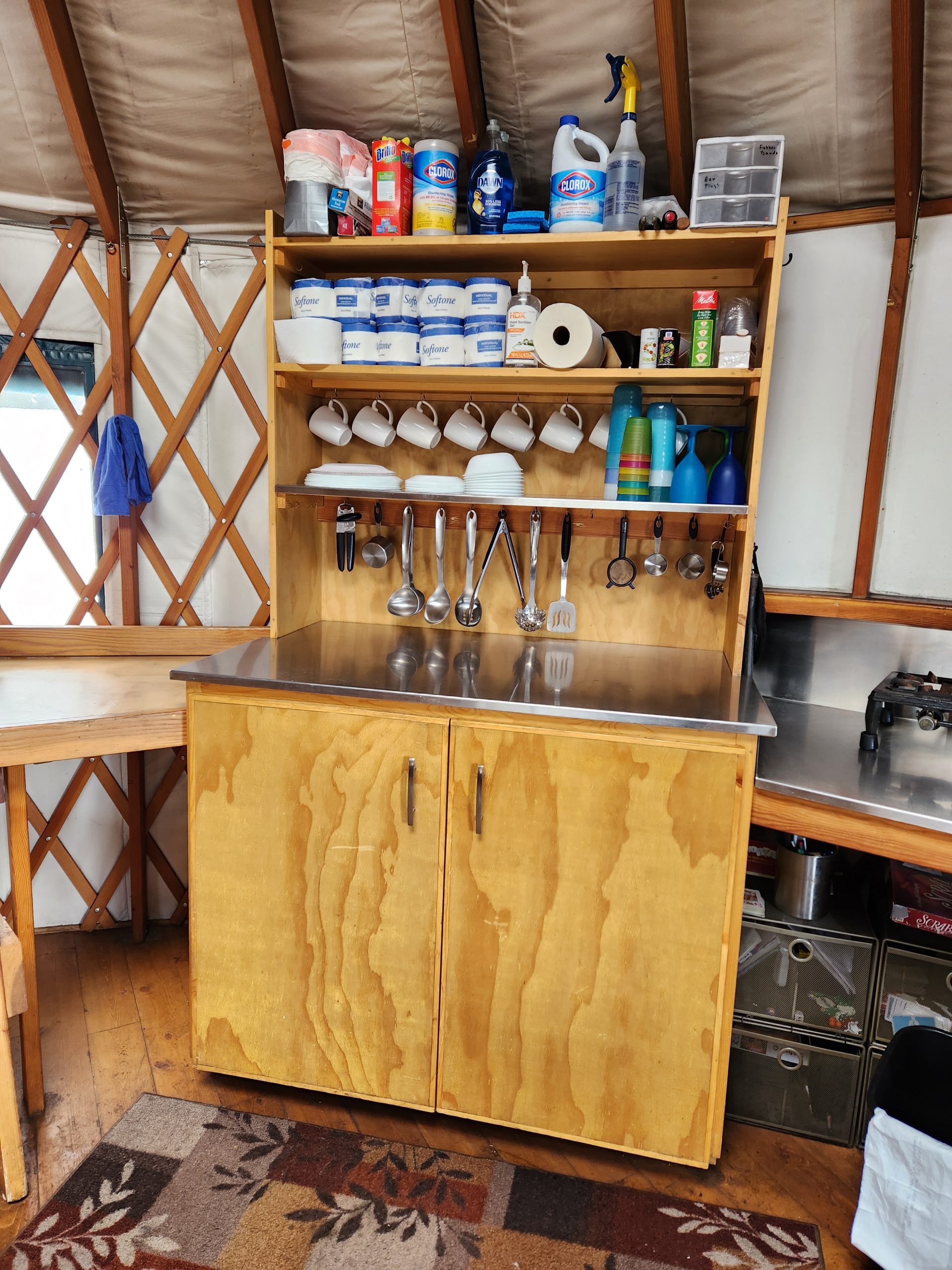
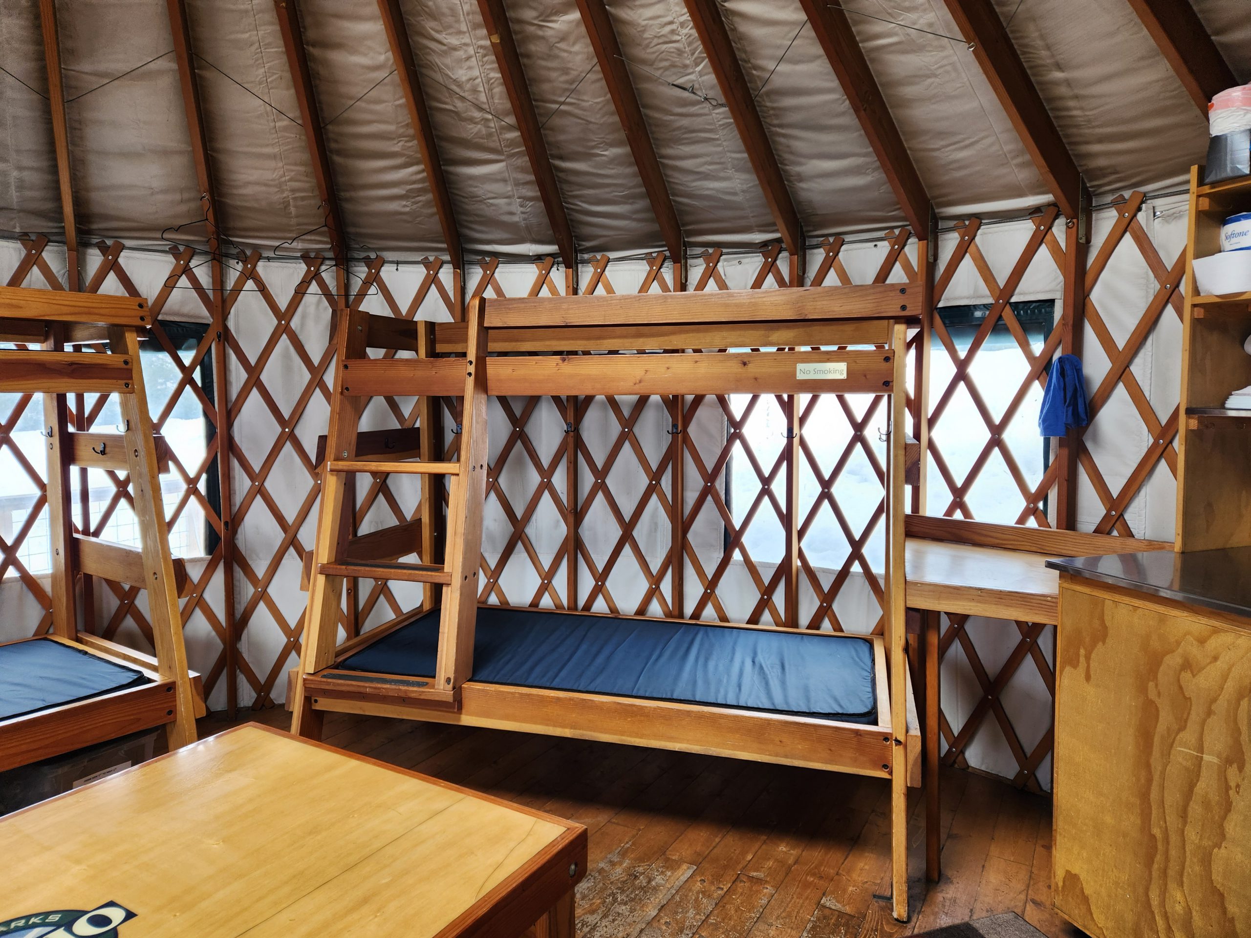
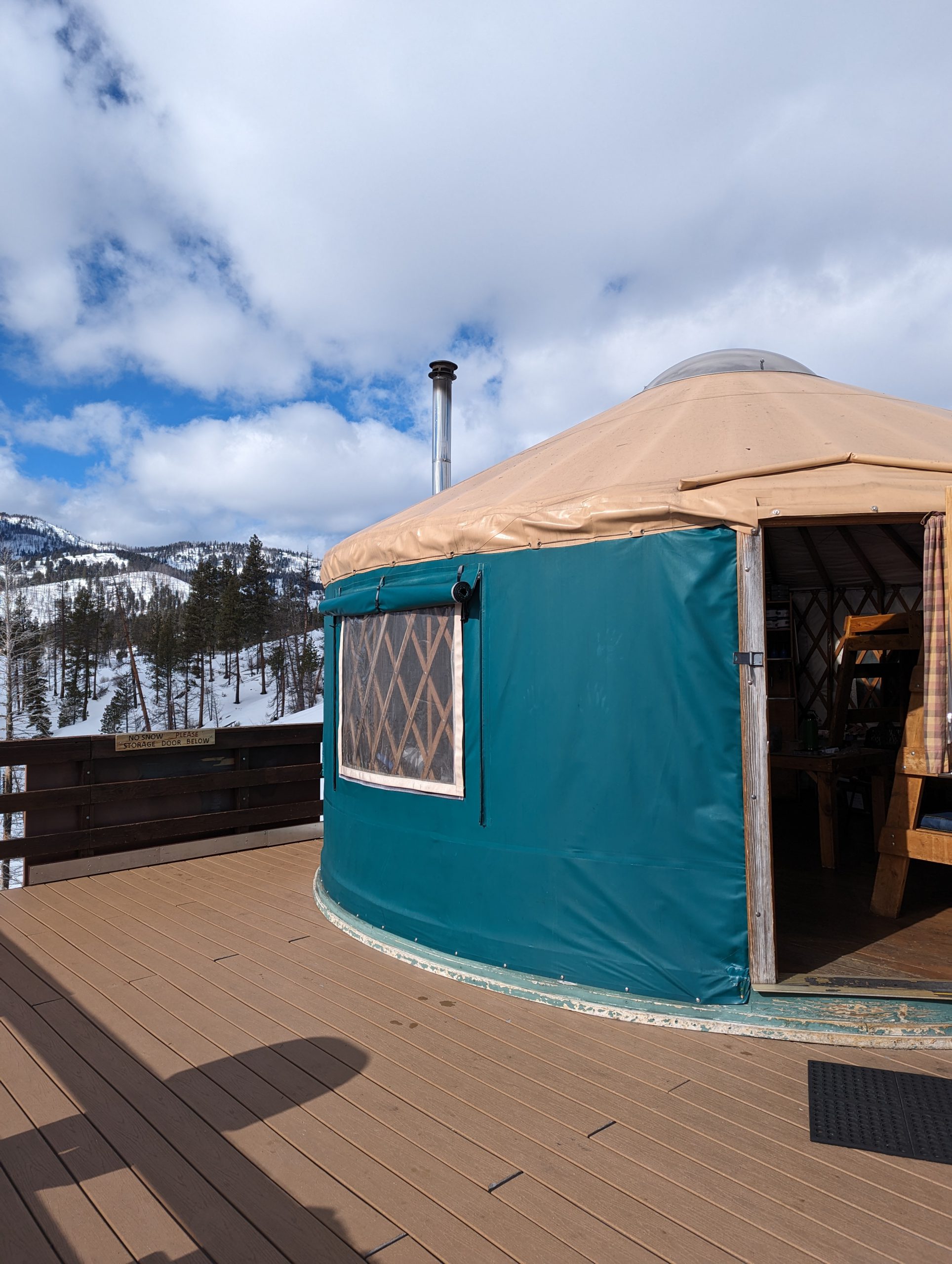
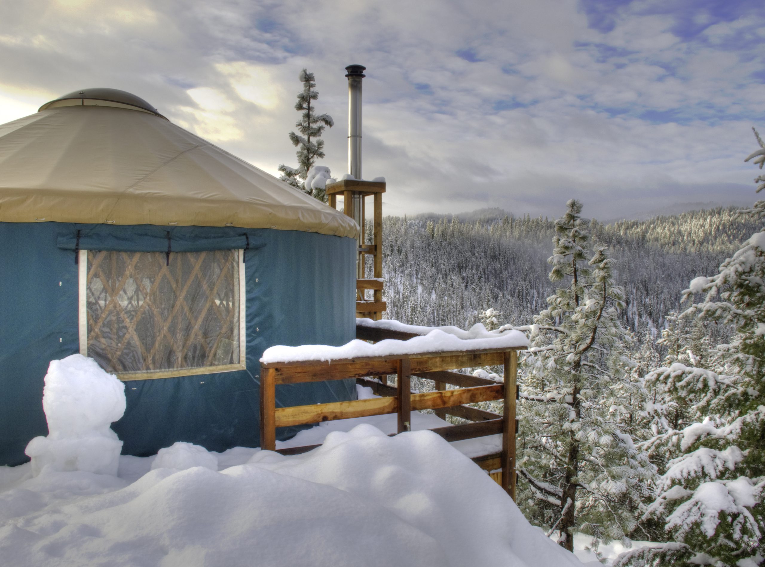
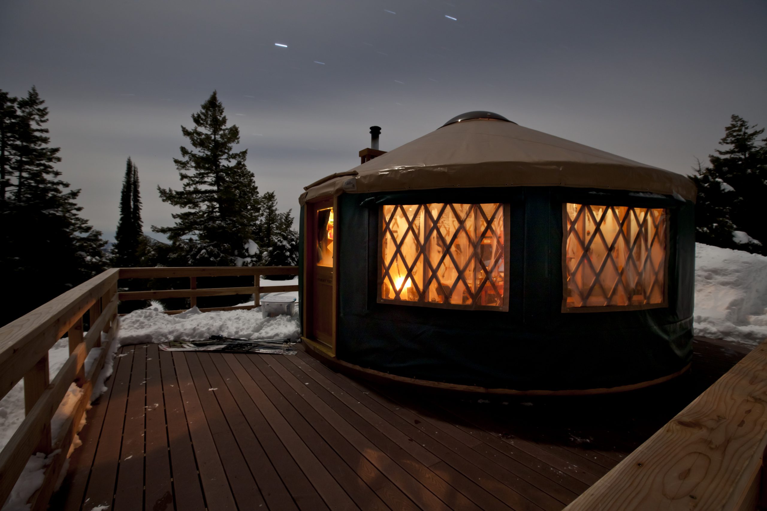
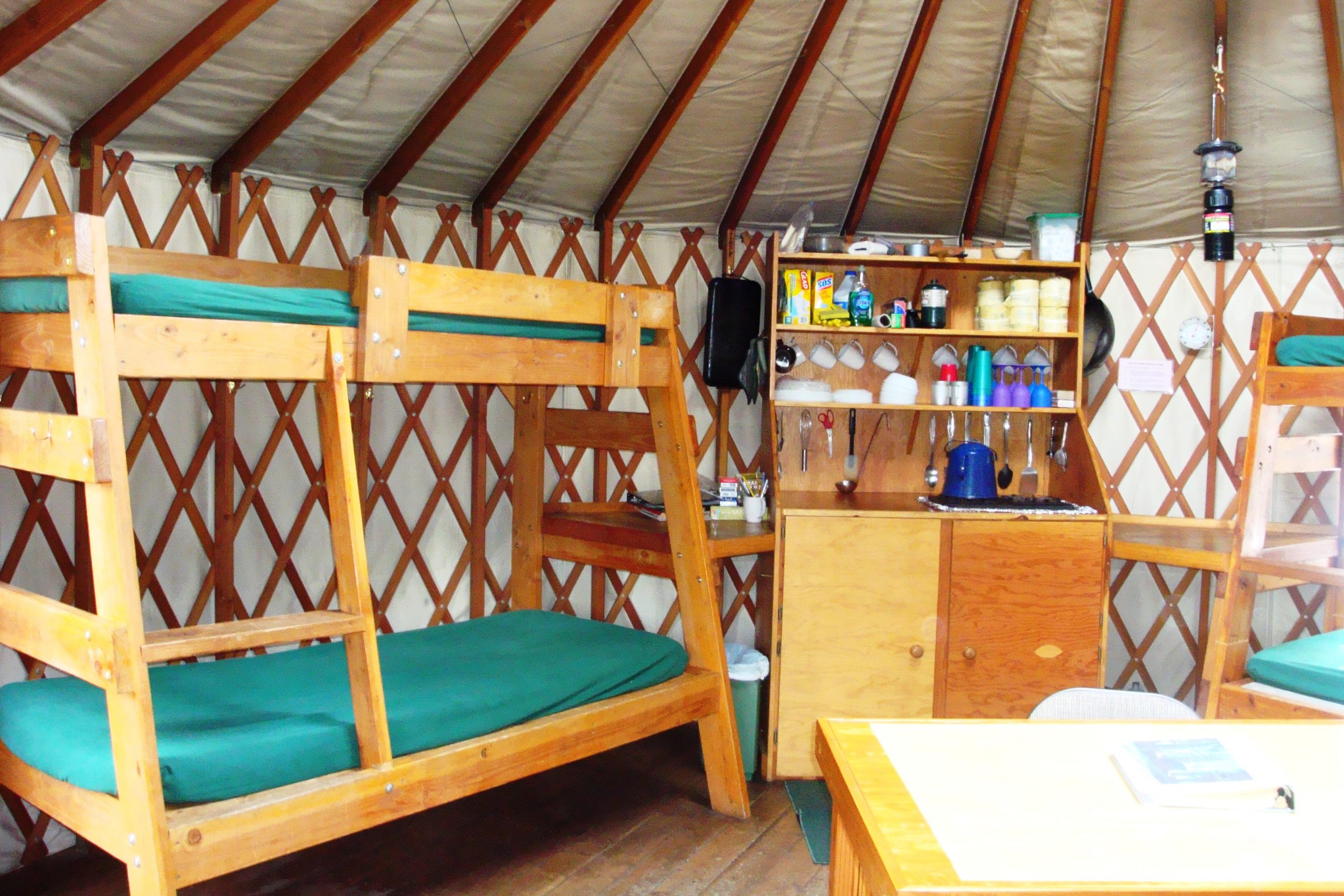
Each yurt sleeps six people in a comfortable, well-furnished atmosphere with high mountain views, no neighbors, and access to a wide variety of recreational opportunities including hiking, mountain biking, horseback riding, Nordic and Telemark skiing, and snowshoeing. Our backcountry yurts have plenty to offer outdoor enthusiasts at any level, whether beginner or experienced.
To find the summer or winter guide for a yurt, click the tab for yurt you’re visiting. Each yurt tab links to both the summer and winter guides.


Reservation Information
Nightly Rates
The Idaho City Backcountry Yurts are transitioning to a dynamic pricing model, meaning prices will vary depending on demand. The maximum fees are listed below.
For Idaho residents: $ Up to 115 per night
For non-residents: $Up to 150 per night
There is a $10 plus tax non-refundable reservation fee charged at the time of booking.
Use fees are per night for a party of up to 6. Additional fees are $12 per person per night for a party greater than 6, with a maximum of 9 allowed.
From November 15th through April 30th, yurt users parking in Whoop Um Up, Gold Fork, Banner Ridge, or Beaver Creek parking lots are required to have a Park N’ Ski pass.
Cancellation Policy
If a cancellation for a Backcountry Yurt occurs 21 or fewer calendar days prior to arrival, customer forfeits the first night or daily usage fee (base rate). If the cancellation occurs more than 21 calendar days prior to arrival, a cancellation charge of $50.00 will be assessed. At no time shall the customer be charged a cancellation fee that exceeds the base rate paid for the facility.
Cancellation exceptions for air quality concerns will be made if the Air Quality Index reading is at 151 or more. Reservations can be cancelled for a full refund if we are contacted within 48 hours of the arrival date. Please use the Idaho Department of Environmental Quality’s Air Quality Map to monitor the conditions at the yurts in real time.
To cancel a reservation Monday – Friday from 8:15AM – 4:45PM MST, please call (208) 514-2444. To cancel a reservation after business hours, please email IDPR Customer Support. When cancelling a reservation, please have your reservation number available.
Questions? Email the program or call 208-514-2418.
Maps and Information
The maps below are geo-referenced. If you open them using a geo-referenced map reader, like Avenza, as long as you download the map while in phone service, you can use your phone’s GPS tracking after leaving service.
- Summer Trail Map
- Winter Trail Map
- Park ‘N Ski Location Map
- Winter Park ‘N Ski Parking Rules
- Trail Descriptions
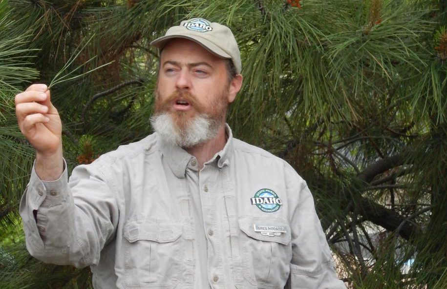
- Whitebark Pine Information
The Idaho Department of Parks and Recreation Backcountry Yurt Program operates on United States Forest Service Land under agreements with the Boise National Forest.
Current Conditions
For updates on grooming status and trail conditions, visit the Idaho Non-Motorized Trails Program Facebook page.
For air quality, visit the Real-Time Air Monitoring Map by the Idaho Department of Environmental Quality.
For the 7 day forecast in Idaho City, visit weather.gov.
For regional snow conditions, including depth, visit the National Water and Climate Center’s interactive map.
For road conditions, visit the 511 website.
If you plan on recreating in avalanche terrain, visit Avalanche.org
Pet Policy
For the health, safety, and enjoyment of all of our guests and staff the following Pet Policy has been established.
All the yurts are pet-friendly all year around. However, pet allowance is a privilege and is based on your cooperation.
Please be a responsible pet owner and respect the following rules:
- There is a two-pet limit.
- You are liable for the health and welfare of your pet(s) at all times.
- Pets must not be left unattended in the yurt at any time.
- Pets must be clean, house-trained, parasite, and disease free.
- Please pick up after your pet around the yurt and on trails.
- Remember, there will be other guests arriving just after your visit. Please clean up animal hair and sanitize the yurt before you leave.
- You authorize IDPR to assess charges to the credit card on file at registration for any and all damages discovered in or around the yurt prior to or after departure, including but not limited to pet odor and stains, repair or replacement of property, excessive cleaning charges, and/or loss of revenue caused by a pet, including an ADA compliant service dog 28 CFR 36.302 (c) (8).
Idaho City Backcountry Yurts in the News
- Check out The Ultimate Guide from The Mandagie Family and Visit Idaho. The guide includes everything from how to get there, where to park, and what to pack.
- Watch this video about the summer opportunities at the Idaho City Backcountry Yurts.
- Check out this story by Idaho News 6 about winter at the Idaho City Backcountry Yurts.
- Watch Pete Zimowsky of the Idaho Statesman describe his winter experience at an Idaho City Backcountry Yurt.
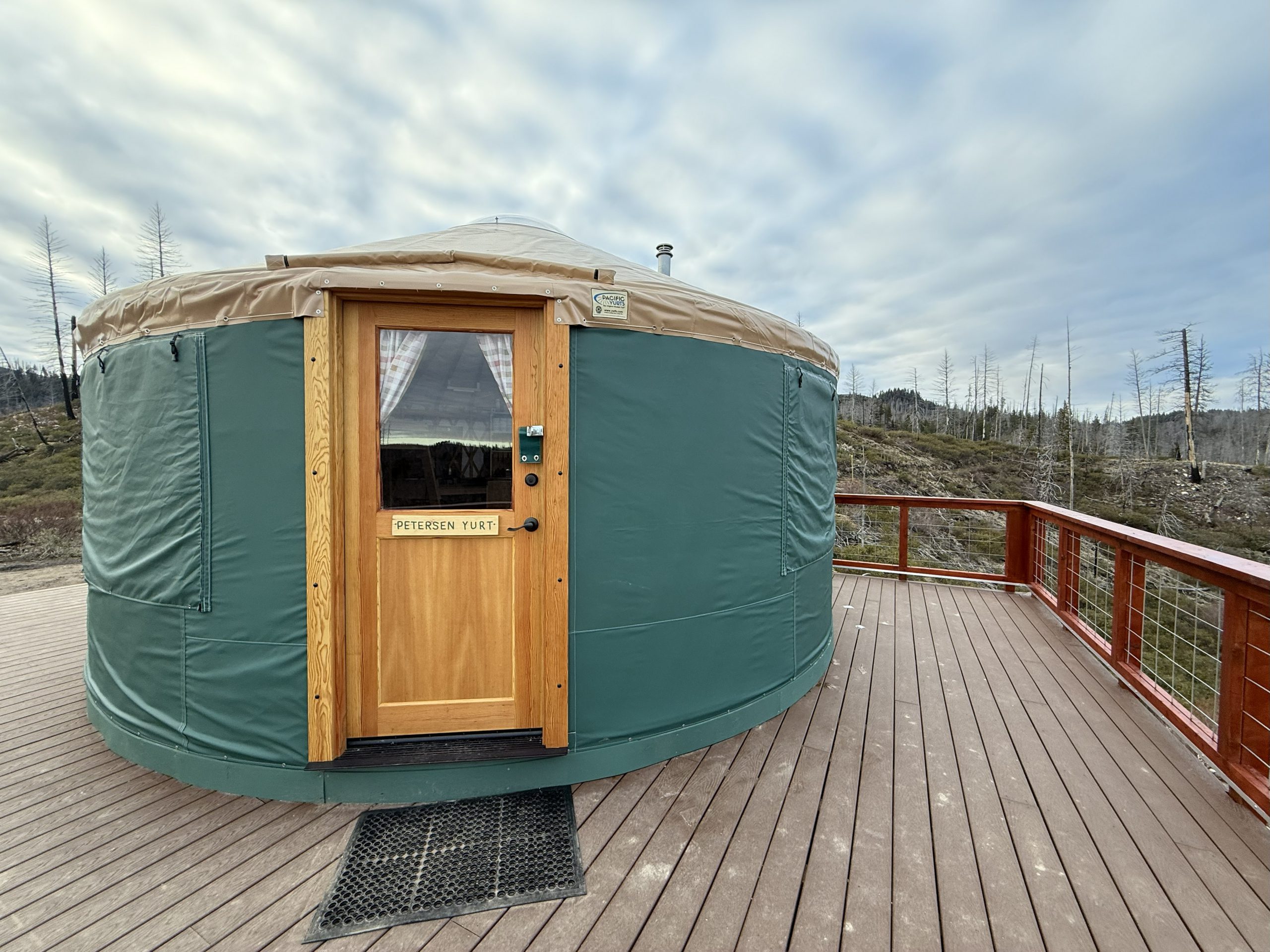
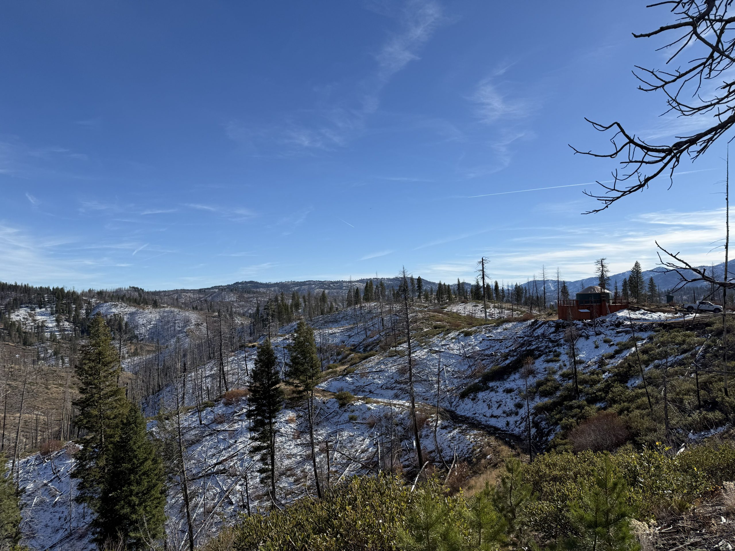
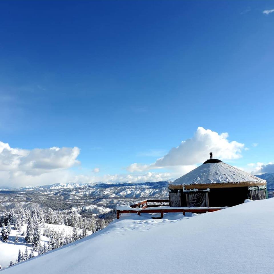
About Petersen Yurt
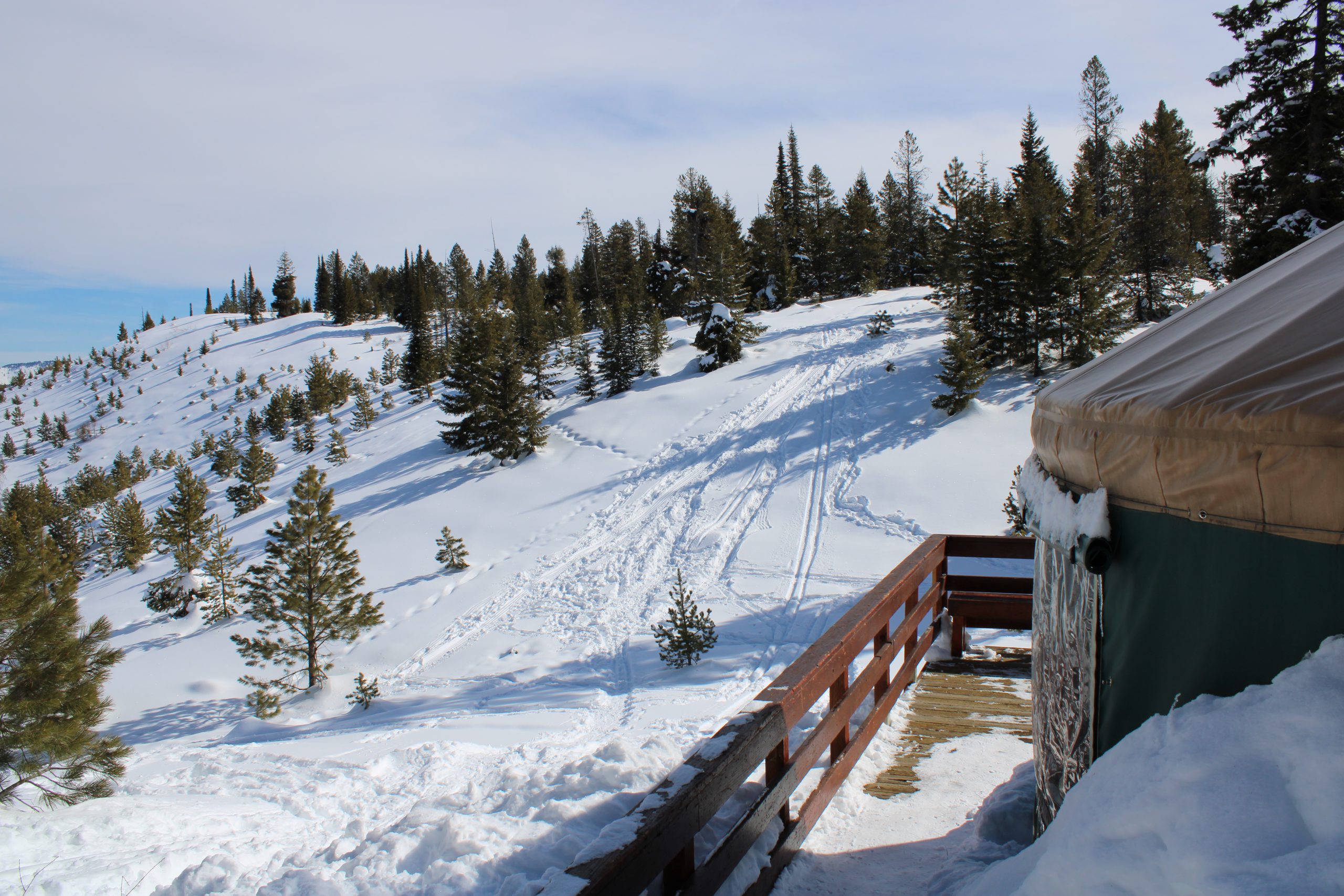
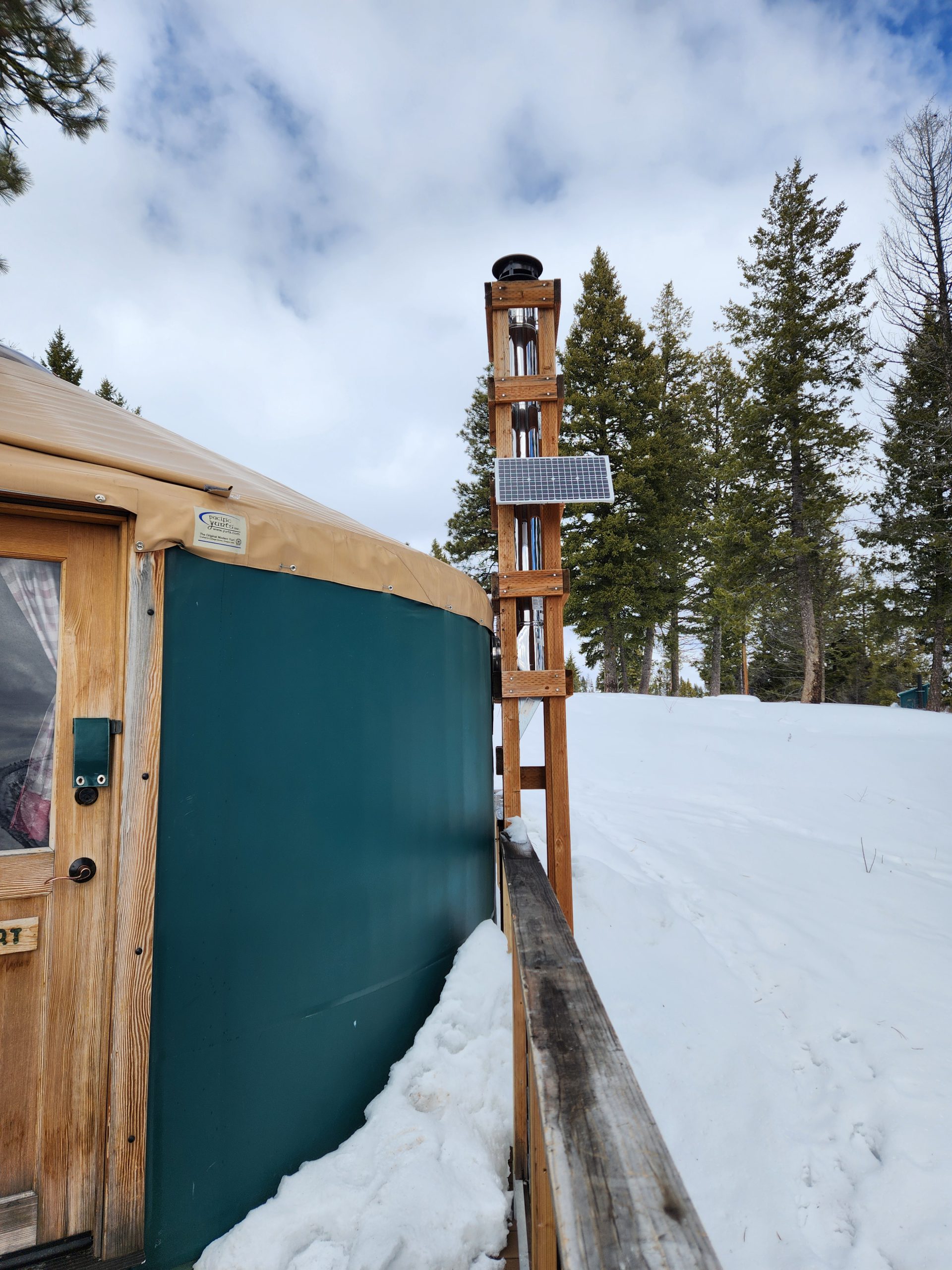
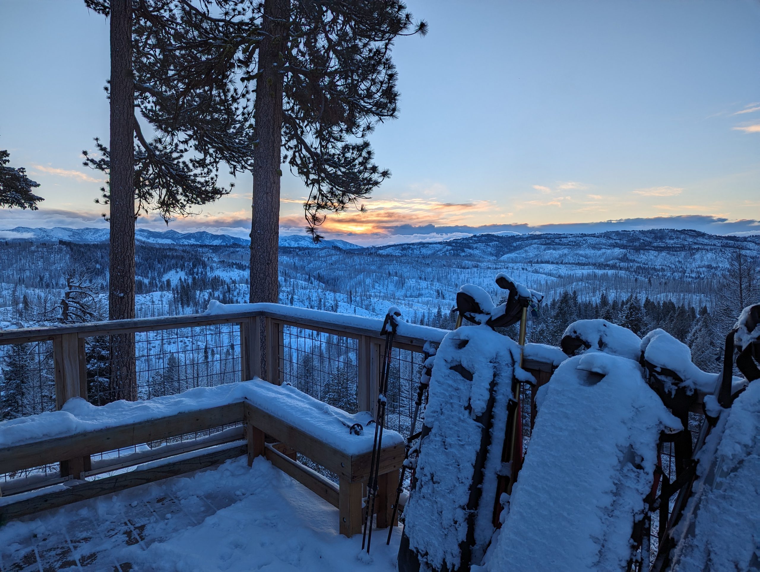
The Petersen Yurt is the newest yurt in the Idaho City system, offering year-round access to outstanding trails and wide-open views. Set on a high knob, it features a large deck with clear sightlines to Pilots Peak, Sunset Peak, the Trinity Mountains, Steele Mountain, Wolf Mountain, and the Crooked River Valley. Built to replace the Whispering Pines Yurt lost in the 2016 Pioneer Fire, Petersen brings a fresh backcountry getaway to one of the area’s most scenic ridges.
When the yurt is snow-free, guests can drive a high-clearance vehicle within a couple hundred feet of the front door. During the winter months, guests park in Gold Fork Park N’ Ski parking lot and ski or snowshoe about 1.3 miles to access the yurt.
Check out the summer yurt guide, winter yurt guide, summer trails map, winter trails map, and winter parking guidance.
We recommend a high-clearance, all-wheel drive vehicle when traveling to the Idaho City Backcountry Yurts.

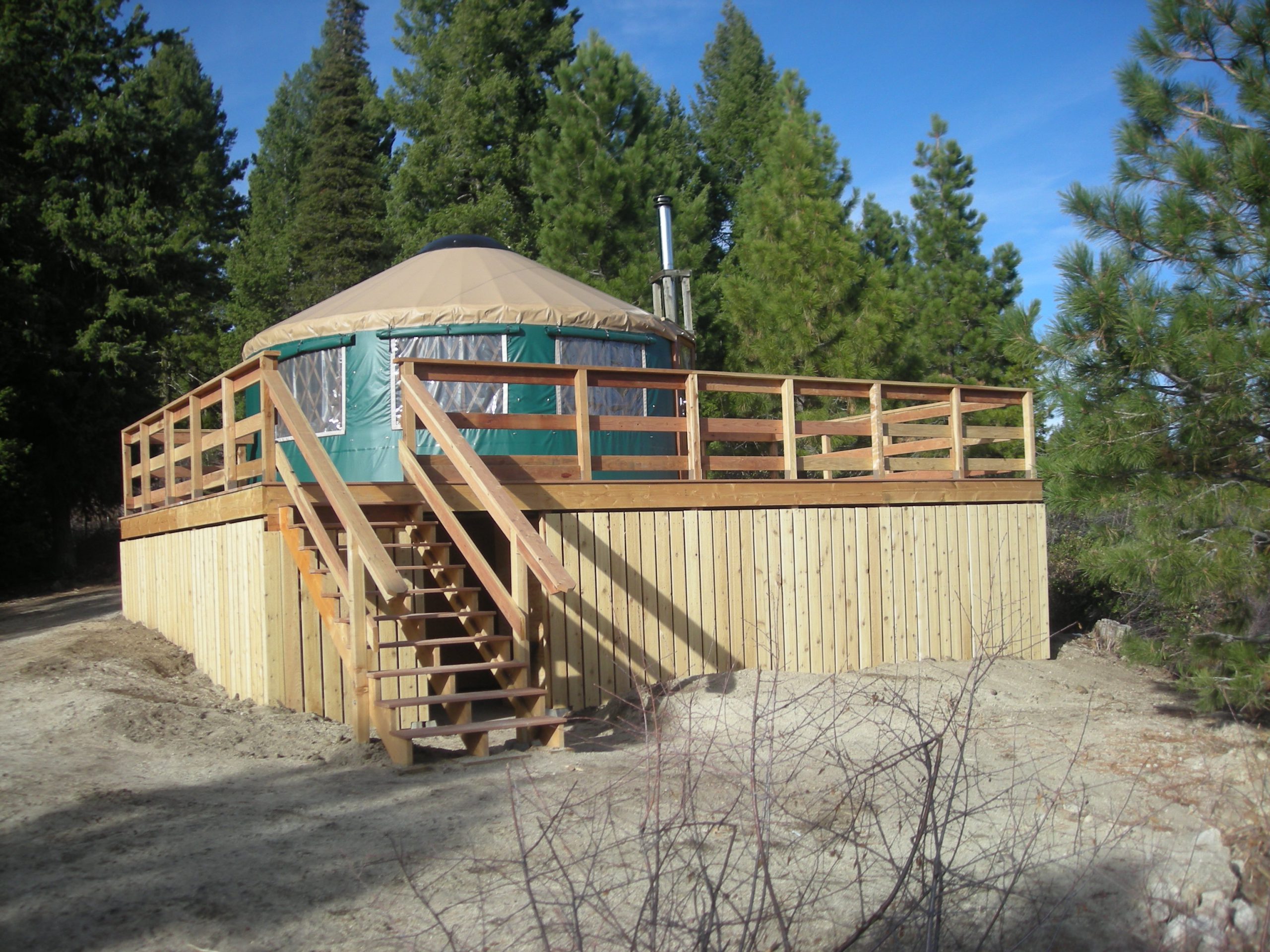
About Banner Ridge Yurt
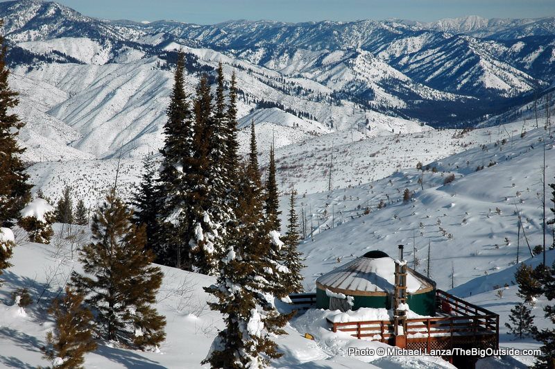
Banner Ridge backcountry yurt is located just off a high ridge in a protected north‐facing bowl. It offers spectacular views of the South Fork of the Payette River, Bear Valley and Scott Mountain. When the yurt is snow-free, guests can drive with a high-clearance vehicle within a few hundred yards of the front door. During the winter months, guests park in Banner Ridge Park N’ Ski parking lot and ski or snowshoe about two miles to the yurt.
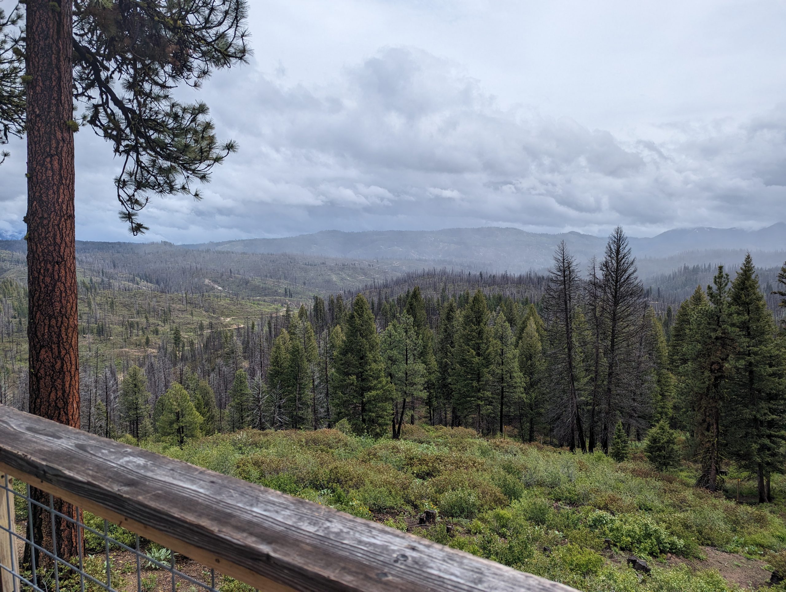
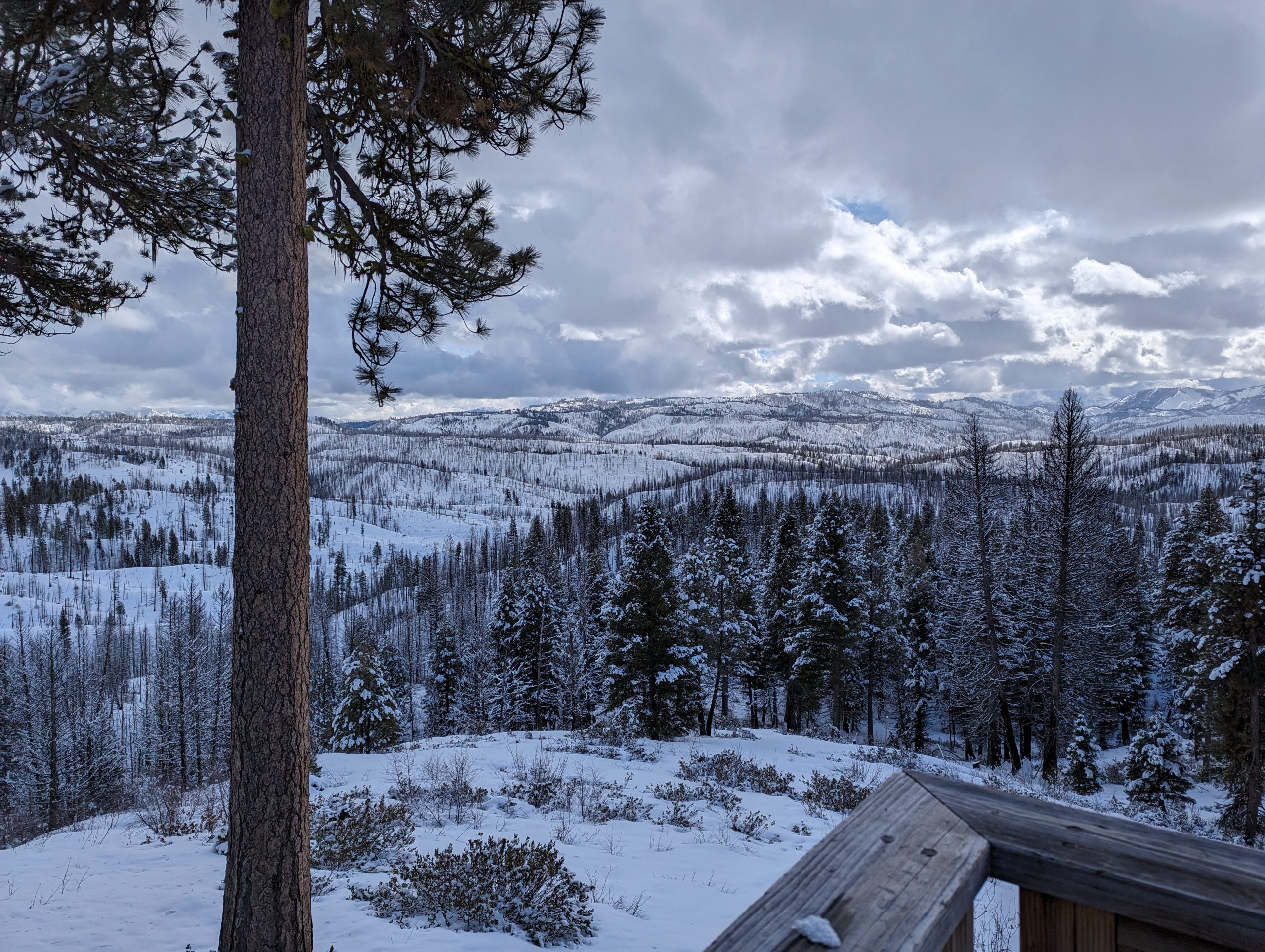
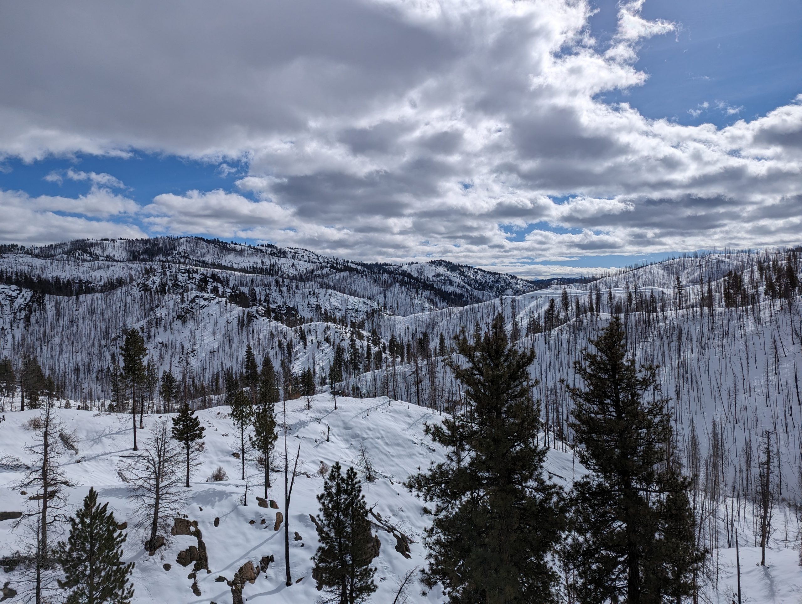
During the warmer months, there are many miles of high elevation primitive roads and trails available for hiking, mountain biking and stock users. Nearby, off-highway vehicle users can find trails to enjoy. One backcountry road near the yurt descends 3,000 feet in 12 miles to Kirkham Hot Springs, a primitive soaking pool along the South Fork of the Payette River. During the winter, the yurt is a telemarker, snowshoer, Nordic skier and snowboarder’s haven with its long, open slopes, thousands of feet of untracked powder. Banner Ridge Yurt also provides access to more than 20 miles of groomed and 20 miles of ungroomed ski and snowshoe trails just outside the front door.
Check out the summer yurt guide, winter yurt guide, summer trails map, winter trails map, and winter parking guidance.
We recommend a high-clearance, all-wheel drive vehicle when traveling to the Idaho City Backcountry Yurts.


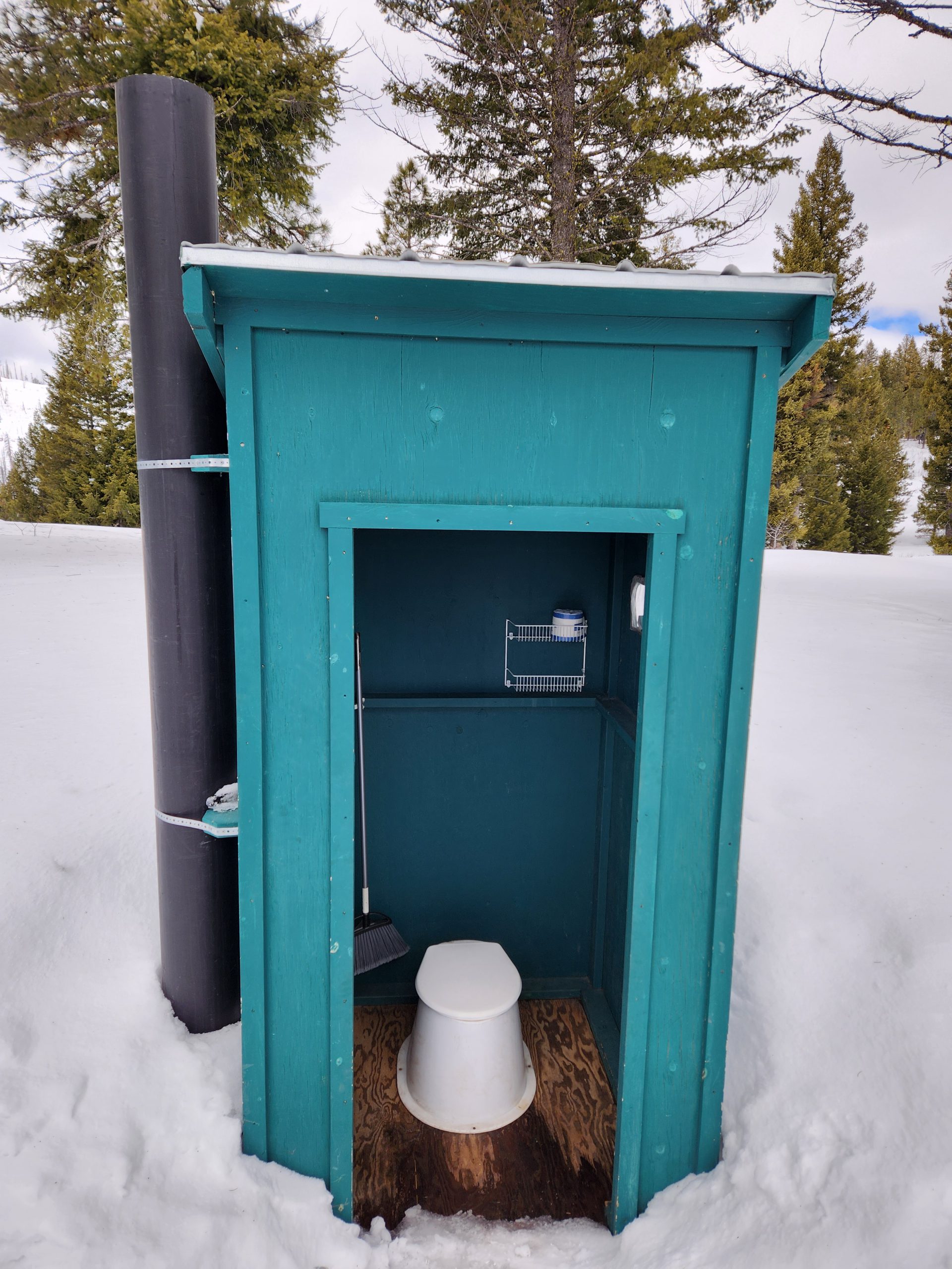
Site Amenities:
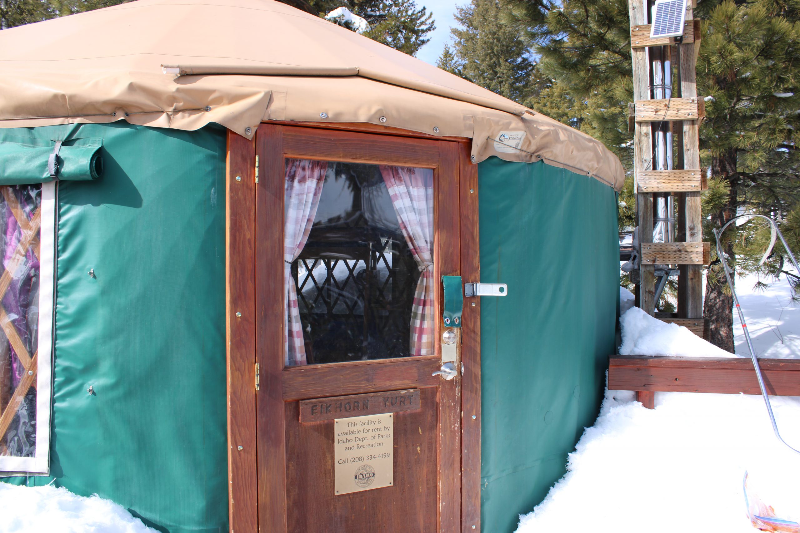
About Elkhorn Yurt
The Elkhorn Yurt is conveniently located for both winter and summer trail users. This yurt is the most remote of all the Idaho City yurts. When the yurt is snow-free, guests can drive within a few hundred yards of the front door. During the winter months, guests park in Banner Ridge Park N’ Ski parking lot and ski or snowshoe about three miles to access the yurt.
Guests have direct access to over 27 miles of groomed and 20 miles of ungroomed ski trails. The 270° view to the east, south and west is spectacular, especially in the evening. From the yurt you can see Jackson Peak, Wolf Mountain, Steele Mountain, the Trinity range, Sunset Peak, and Pilot Peak. The open, rolling terrain below the yurt provides off‐trail skiers a chance to polish their skills. The nearby ungroomed Cougar trail provides access to a prime telemark skiing area. During the summer months, over 50 miles of decommissioned roads and single‐track trails can be accessed from this yurt, which is located about halfway around the Elkhorn Loop trail. Nearby, off-highway vehicle users can find trails to enjoy.
Check out the summer yurt guide, winter yurt guide, summer trails map, winter trails map, and winter parking guidance.
We recommend a high-clearance, all-wheel drive vehicle when traveling to the Idaho City Backcountry Yurts.

Be Advised: From September 15th through June 15th, the gate to access Skyline Yurt is closed at Highway 21. To access Skyline during this period, whether there is snow or not, yurt guests must hike 2.3 miles from Goldfork parking lot to the yurt.
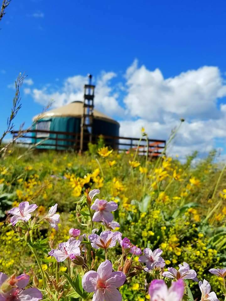
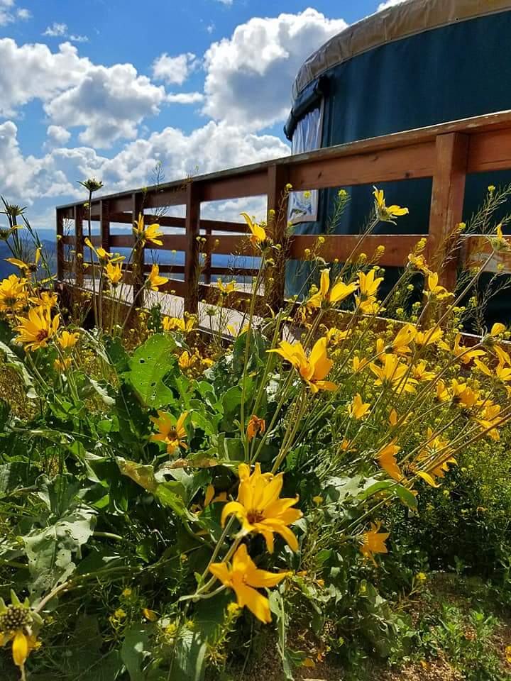
About Skyline Yurt
The Skyline Yurt is located on a high sunny knob, which provides a 200-degree view to the east, south and west. When the yurt is snow-free, guests can drive with a high clearance vehicle within a few hundred feet of the front door. During the winter months, guests park in Gold Fork Park N’ Ski parking lot and ski or snowshoe about two and a half miles to access the yurt.
The view from Skyline Yurt is one of the best in the Boise National Forest. From the yurt deck you can see Wolf Mountain, Steele Mountain, Sunset Peak, and Pilot Peak. Nearby, off-highway vehicle users can find trails to enjoy. Numerous large spruce trees nearby provide a nice, shaded area for picnics. In the fall, flaming red, yellow, and orange aspens frame the mountain peaks to the east. A protected tent area is available for extra people.
During the winter months, Skyline Yurt is conveniently situated off the groomed Skyline trail, a popular loop used by Nordic skiers and snowshoers. The yurt provides access to over 20 miles of groomed and 20 miles of ungroomed winter trails. The yurt is The open, rolling terrain below the yurt provides beginner Telemarkers a chance to polish their skills.
Check out the summer yurt guide, winter yurt guide, summer trails map, winter trails map, and winter parking guidance.
We recommend a high-clearance, all-wheel drive vehicle when traveling to the Idaho City Backcountry Yurts.
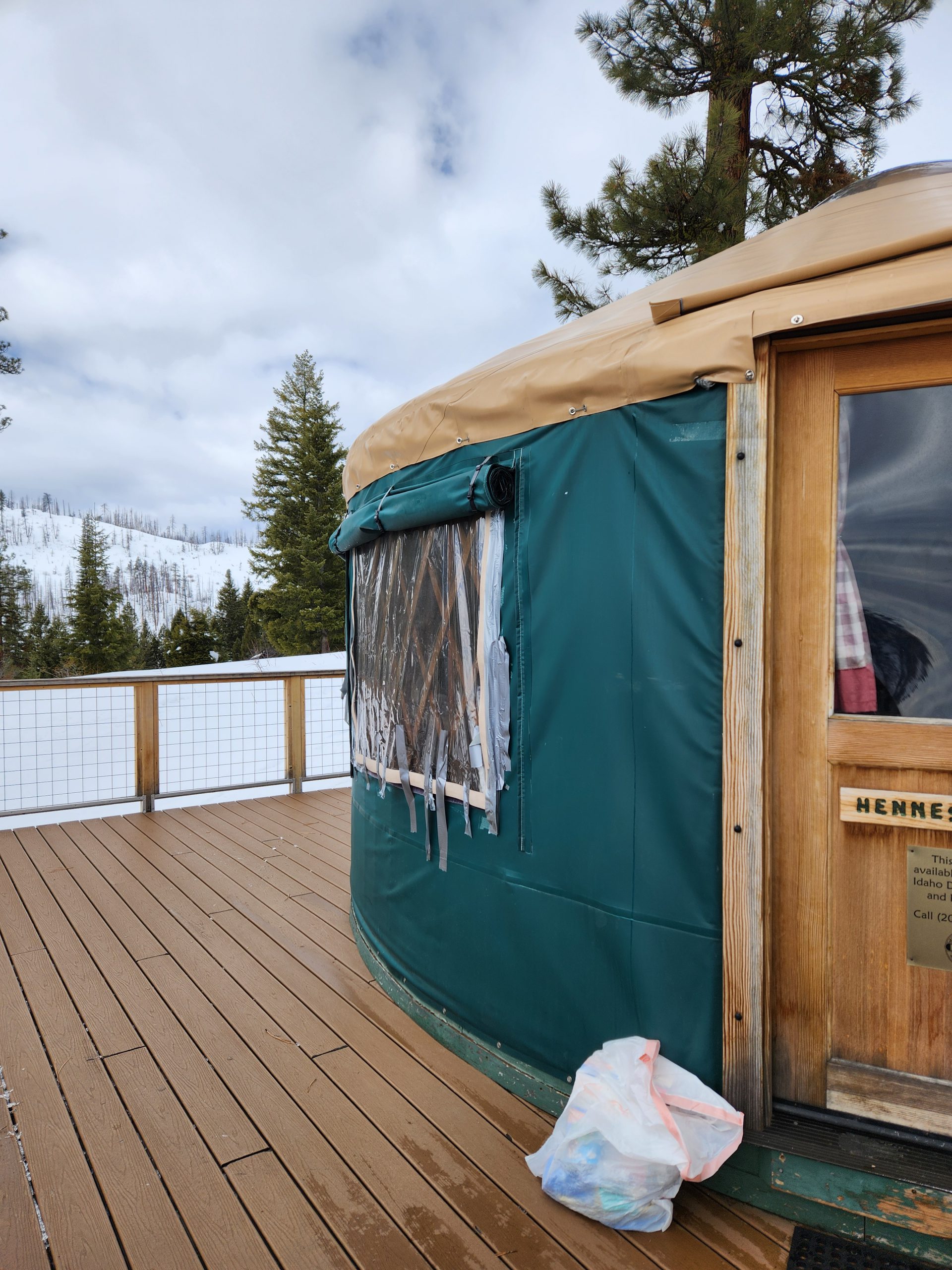
About Hennessy Yurt
Hennessy Yurt is the newest yurt in the Idaho City system. It is located on a high, unburned knob with great views. When the yurt is snow-free, guests can drive a high-clearance vehicle within a couple hundred feet of the front door. During the winter months, guests park in Gold Fork Park N’ Ski parking lot and ski or snowshoe about two miles to access the yurt.
The Hennessy Yurt replaced the Whispering Pines Yurt that was burned during the 2016 Pioneer Fire. The elevated yurt deck is a great place to enjoy the views or experience a mountain thunderstorm. From the large yurt deck you can see Pilots Peak, Sunset Peak, Trinity Mountains, Steele Mountain, Wolf Mountain, and the Crooked River Valley. If you want a quiet getaway in the forest, this is your place. Check out this article from Pacific Yurts to learn more about the yurt’s namesake.
Check out the summer yurt guide, winter yurt guide, summer trails map, winter trails map, and winter parking guidance.
We recommend a high-clearance, all-wheel drive vehicle when traveling to the Idaho City Backcountry Yurts.


About Rocky Ridge Yurt
Rocky Ridge Yurt is perched on the end of a finger ridge and provides a spectacular 180-degree view to the east, south, and west. When the yurt is snow-free, guests can drive with a high-clearance vehicle within a few hundred yards of the front door. During the winter months, Rocky Ridge Yurt is about a two mile ski or snowshoe from Whoop-Um-Up Park N’ Ski parking lot. The trails to access Rocky Ridge Yurt are not groomed.
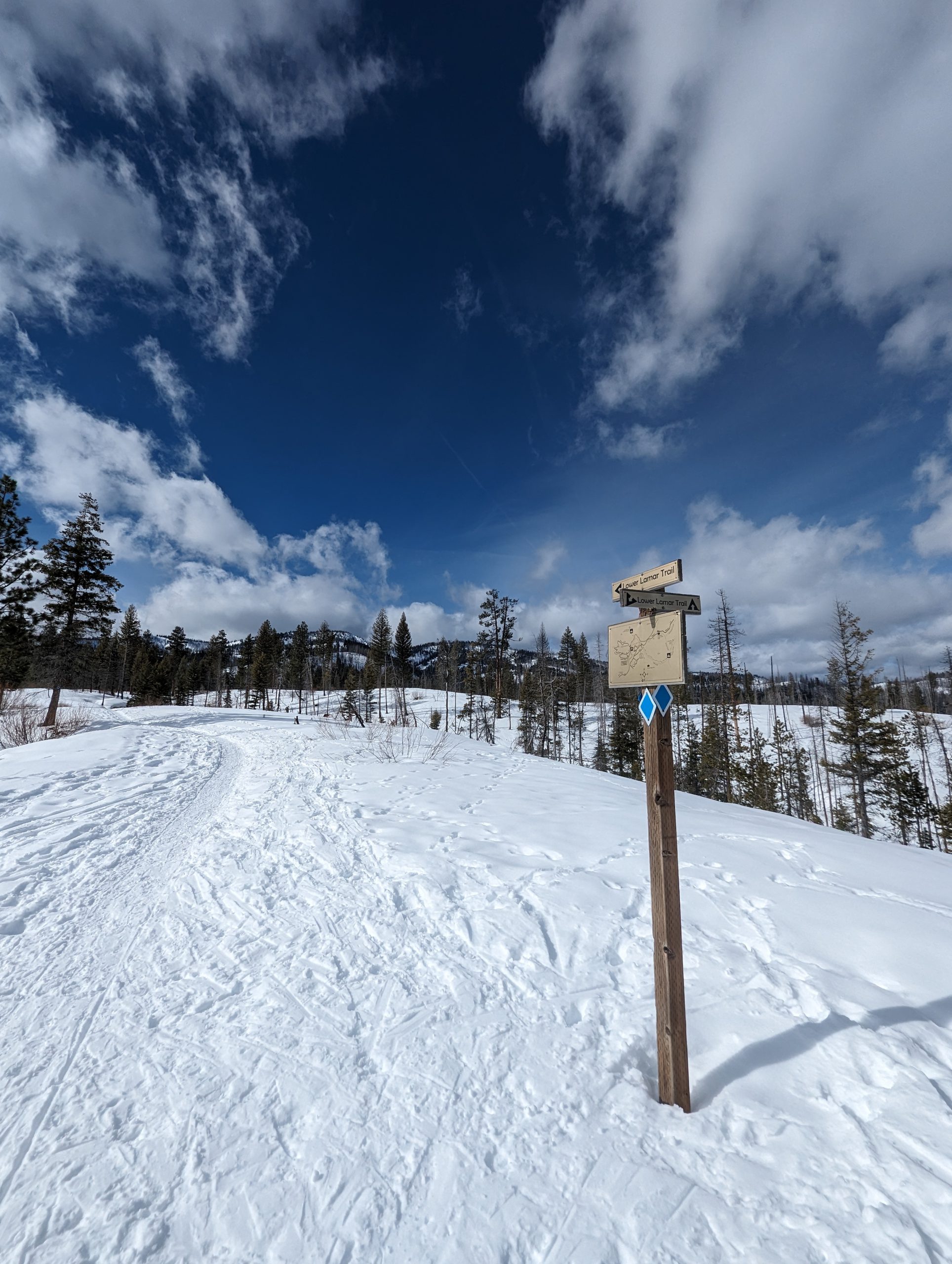
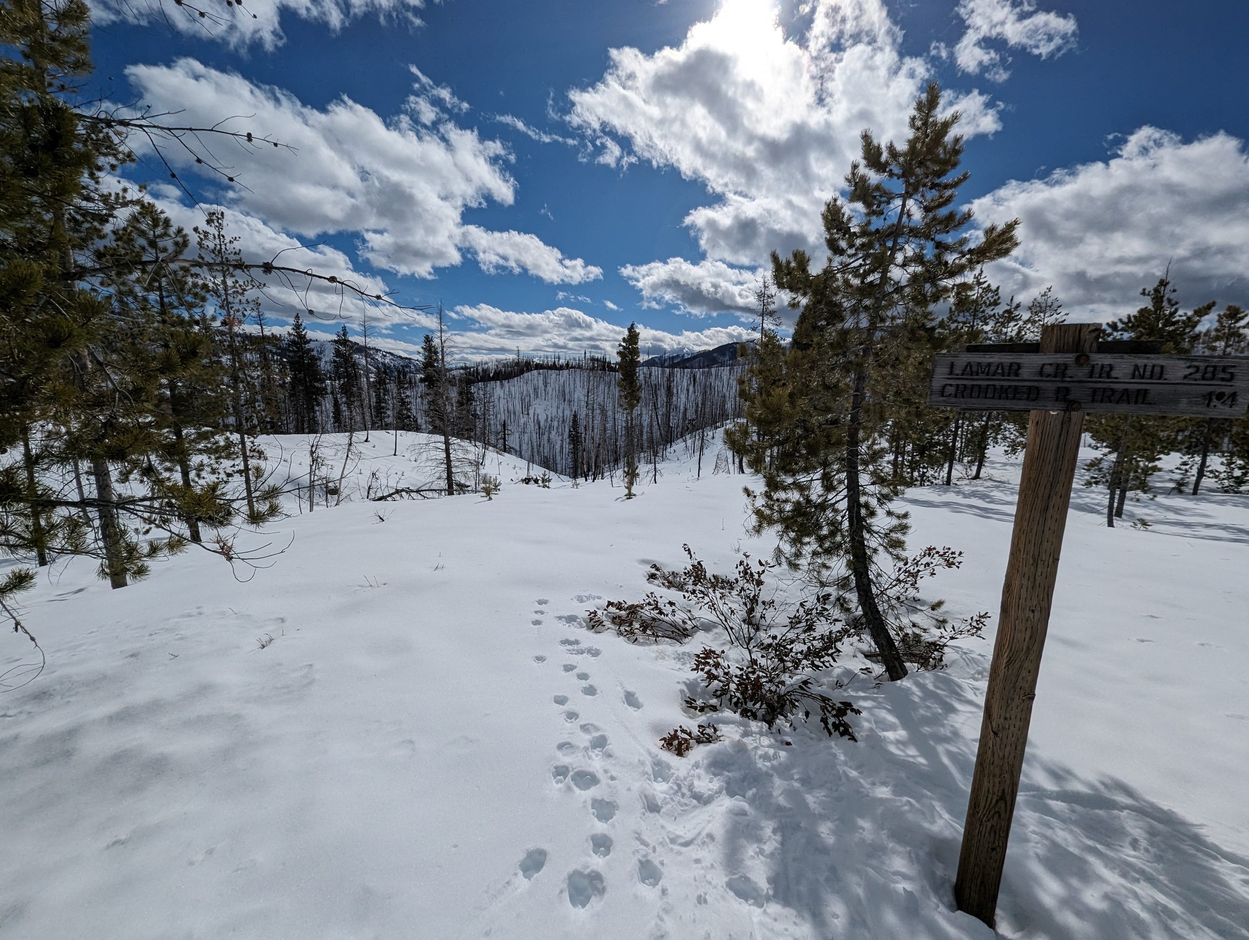
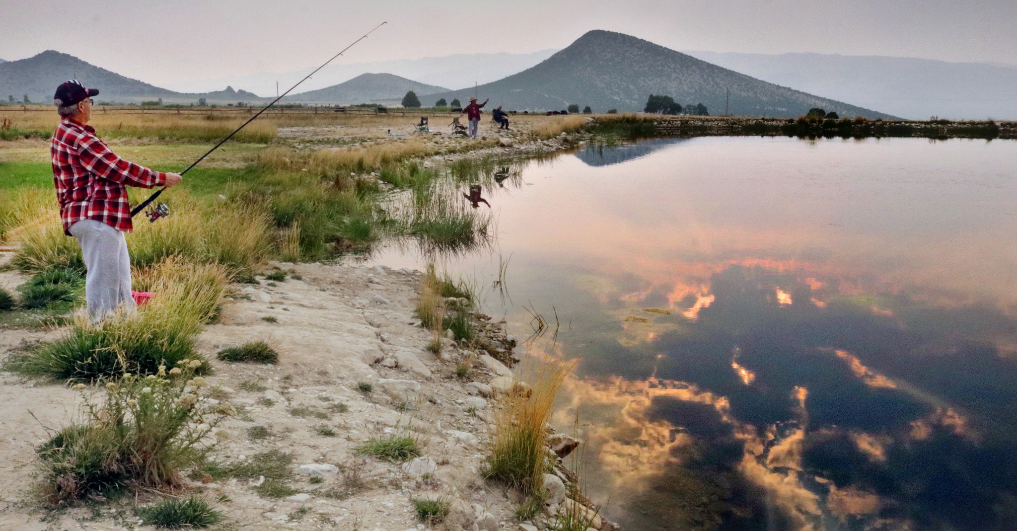
Rocky Ridge yurt is on the southern end of the Idaho City Trail system and is ideally located for fishing in the Crooked River. It is about ¾ of a mile from the Crooked River by way of the Lamar Creek trail.
Check out the summer yurt guide, winter yurt guide, summer trails map, winter trails map, and winter parking guidance.
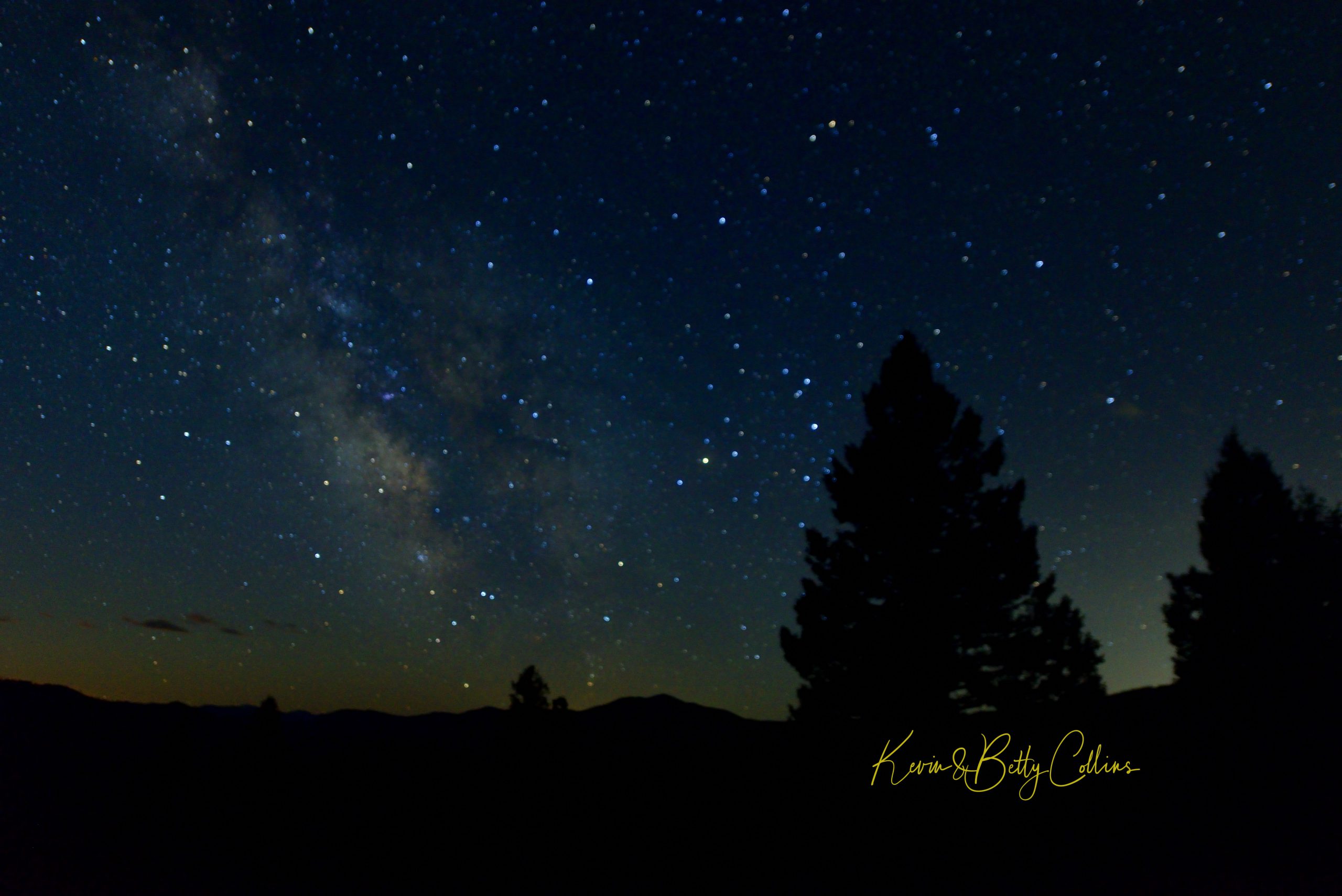
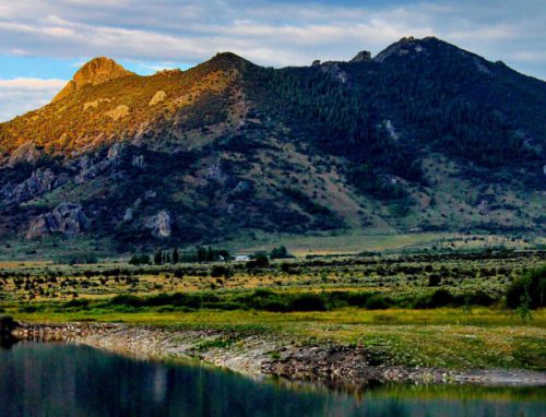
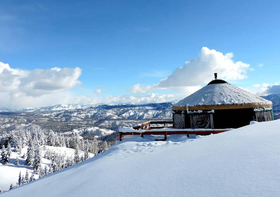
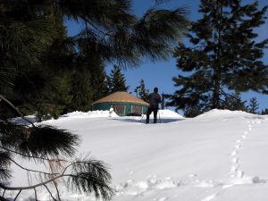
About Stargaze Yurt
You’ll understand how Stargaze got its name after you arrive. The spectacular 270-degree view from the yurt offers open vistas to Scott Mountain, Jackson Peak, Wolf Mountain, Steele Mountain, Pilots Peak and the Sawtooth Mountains. On clear evenings, you will experience unparalleled views of the night sky. When the yurt is snow-free, guests can drive with a high-clearance vehicle within a few hundred yards of of the front door. During the winter months, guests park in Beaver Creek Summer Park N’ Ski parking lot and ski or snowshoe about a mile and a half to access the yurt.
In addition to the spectacular views, the elevation of Stargaze (6,569 feet) guarantees an assortment of wildflowers during the summer months and a blaze of color in the fall. Once at the yurt, a short half-mile hike, ski, or snowshoe on a trail leads to the top of Stargaze Point. On this point you will have a 360-degree view of the Boise National Forest. During the winter months, many north and west facing slopes are perfect for backcountry skiing or snowboarding.
Check out the summer yurt guide, winter yurt guide, summer trails map, winter trails map, and winter parking guidance.
We recommend a high-clearance, all-wheel drive vehicle when traveling to the Idaho City Backcountry Yurts.


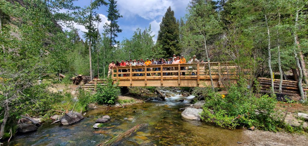
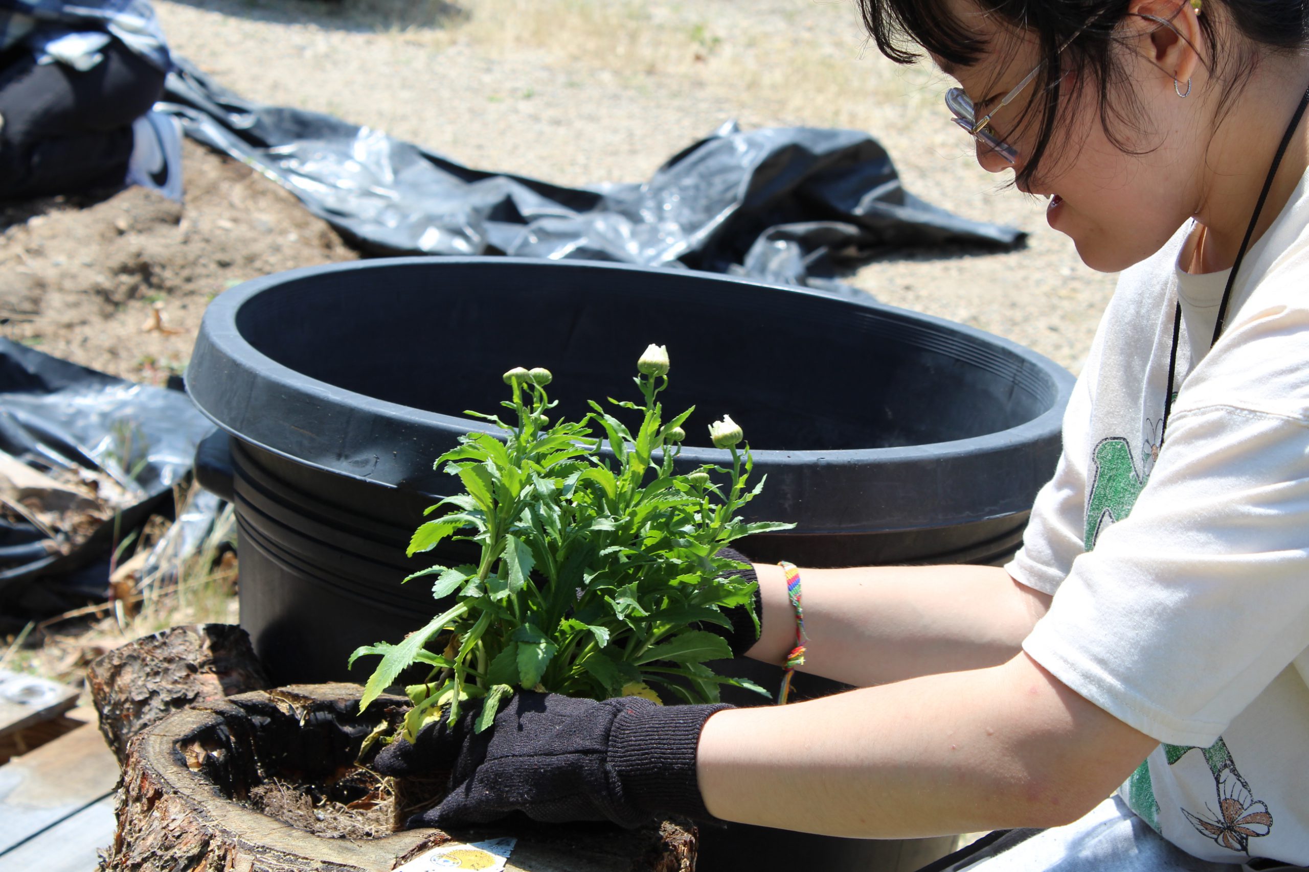
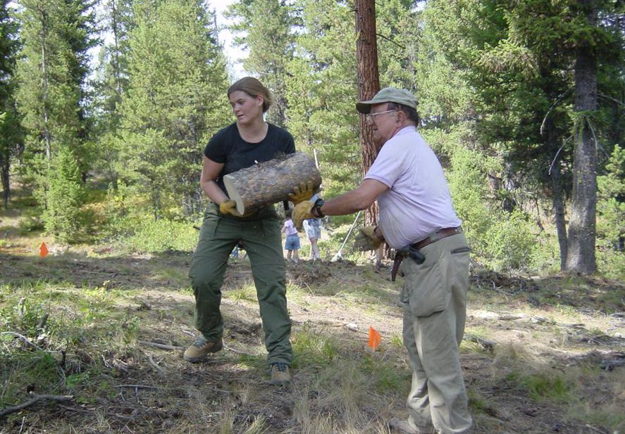
Volunteering

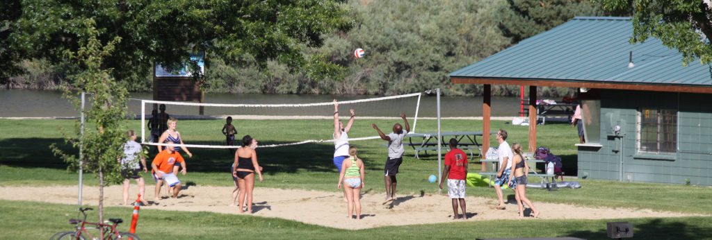
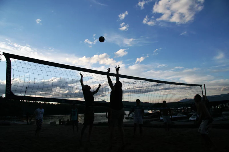
Volleyball Area
Virtual Exploration – Videos
Castle Rocks State Park Videos
Harriman State Park Videos
Bruneau Dunes State Park Videos
Dworshak State Park Videos
Idaho State Parks Reservation Policies
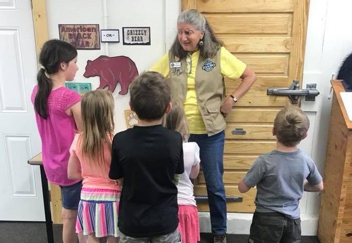
Teacher Resources
The Idaho Department of Parks and Recreation has many learning opportunities from campfire and Junior Ranger programs in our parks, to safety programs for motorized recreational activities.
Educational Park Programming
Many parks offer on-site environmental education opportunities, click here for more information or give your local Idaho state park a call!
![]()
If you have recently attended a park presentation with your class, please fill out this evaluation form. Your feedback allows us to improve our programs!
Lesson Plans
Lesson 1: 100 Years of Idaho Parks. Introduction to parks history and expanded content relating to the DVD.
Lesson 2: State Park Origins. About Idaho’s first state park and the young men who built it.
Lesson 3: Mapping Idaho. Using graph paper to plot Idaho’s state parks on a map.
Lesson 4: State Park Weather. Learning how weather affects your visit.
Lesson 5: Water Safety. Learning about water safety and more about state parks.
Lesson 6: State Parks by Design. Learning about the purpose of state parks and how they are managed.
Lesson 7: Travel Planning. Plan a trip to a state park learn about map legends.
Lesson 8: The Park Brochure. How would you design a brochure for a state park? What would you put in it?
Lesson 9: Historic Buildings. Learn that many historic buildings, including the oldest in Idaho, are in state parks. Art project: Your own Cataldo Mission.
Lesson 10: The State Parks Challenge. Match up questions and answers about the things you have studied.
Complete Resource Book (8 mb download)
Be Outside, Idaho
![]()
Be Outside, Idaho is a coalition of over 100 diverse organizations (Including Idaho Department of Parks and Recreation) that collaborate and share resources to help address ‘nature deficit disorder’ and connect Idaho’s youth to the outdoors. Our partners include representatives from: state and federal public lands managers, wildlife managers, healthcare providers, educators, city parks and recreation departments, nonprofit organizations, elected officials, individuals and others. Be Outside Idaho provides resources and opportunities to Idahoans that promote youth activity and outdoor time. Check out the many, many resources available: Link to teacher’s resources
Additionally, Thousand Springs State Park offers experiential learning that meets Idaho’s State Teaching Standards in Geology, U.S. History, and Idaho History. Download a brochure that discusses this program and others available in the area via a partnership with U.S. Fish and Wildlife Service and the National Park Service.
More Great Learning Resources
For students in Idaho, current online learning opportunities Idaho State Parks offer include:
Castle Rocks State Park/City of Rocks National Reserve are offering online learning experiences through short video presentations:
Below are park videos:
The videos can also be seen on Castle Rocks State Park & City of Rocks National Reserve Facebook pages.
Old Mission State Park offers a video that can be downloaded on the park history, as well as:
- Cataldo Mission Fact Sheet
- Coeur d’Alene’s Old Mission Persons and Places
- Coeur d’Alene’s Old Mission Vocabulary
- Mission Grounds
- Parish House Fact Sheet
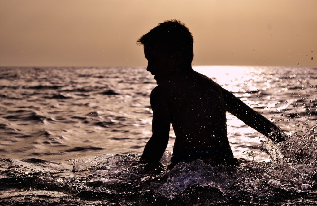
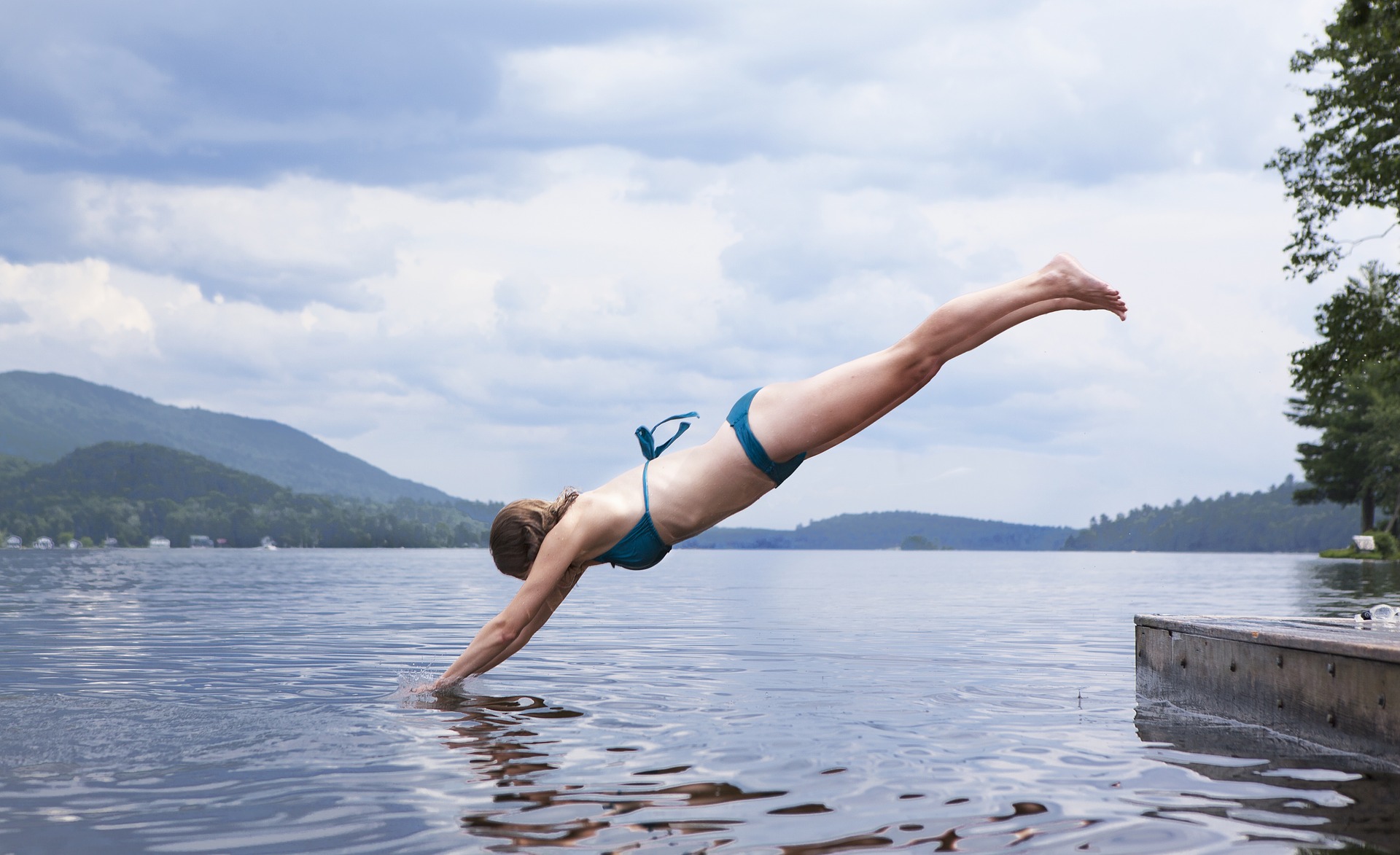
Swimming
Snowshoeing

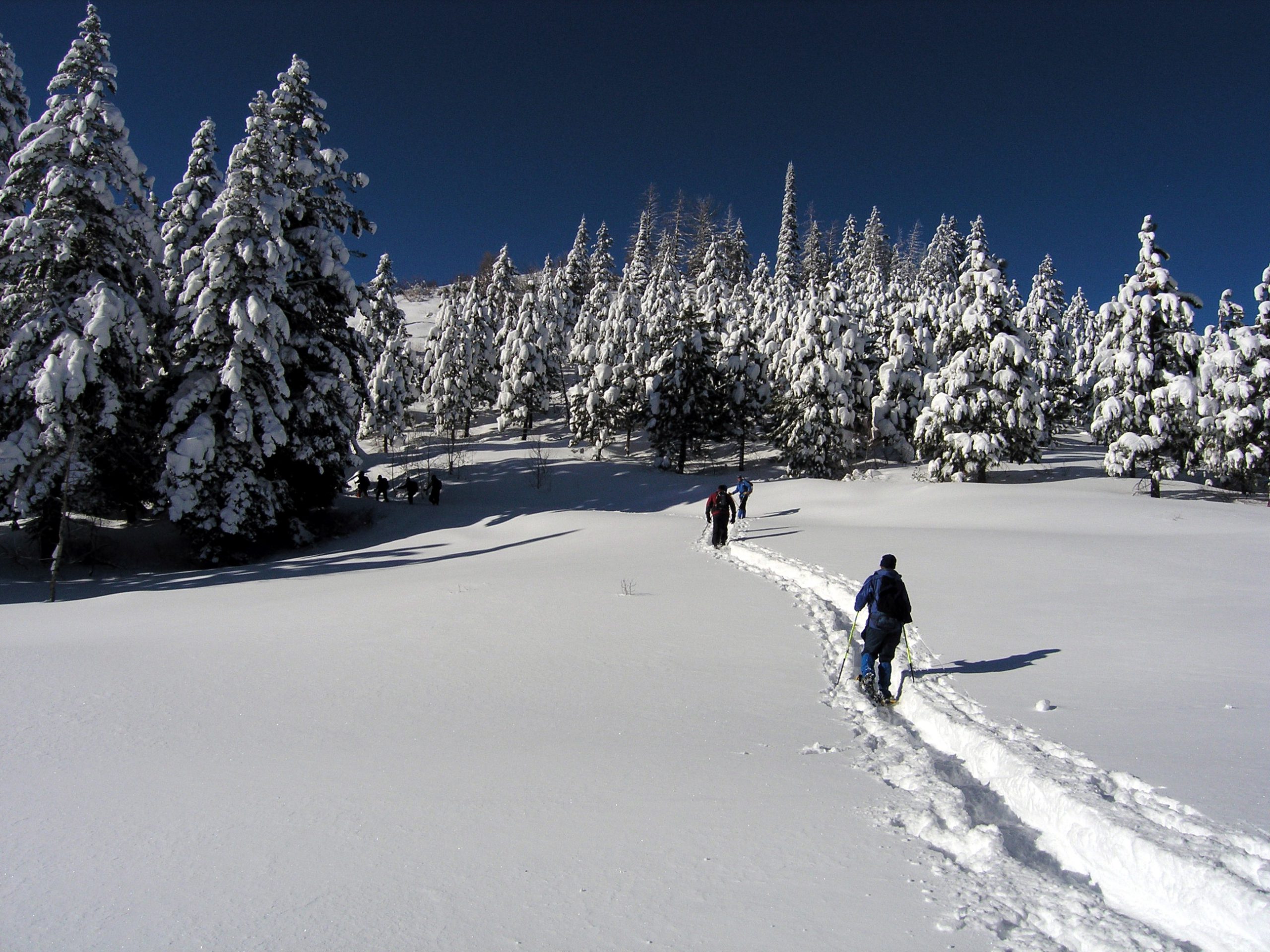
Idaho has a long snow season and high elevations, which translate into hundreds of miles of Nordic activities including: skate skiing, traditional skiing, and snowshoeing opportunities. In addition to 300 miles of groomed ski trails you will find a few hundred more miles of marked trails that provide solitude and untouched powder. The following parks offer overnight accommodations during the winter months:
- Castle Rocks State Park
- Farragut State Park
- Harriman State Park (premium)
- Lake Cascade State Park
- Ponderosa State Park (premium)
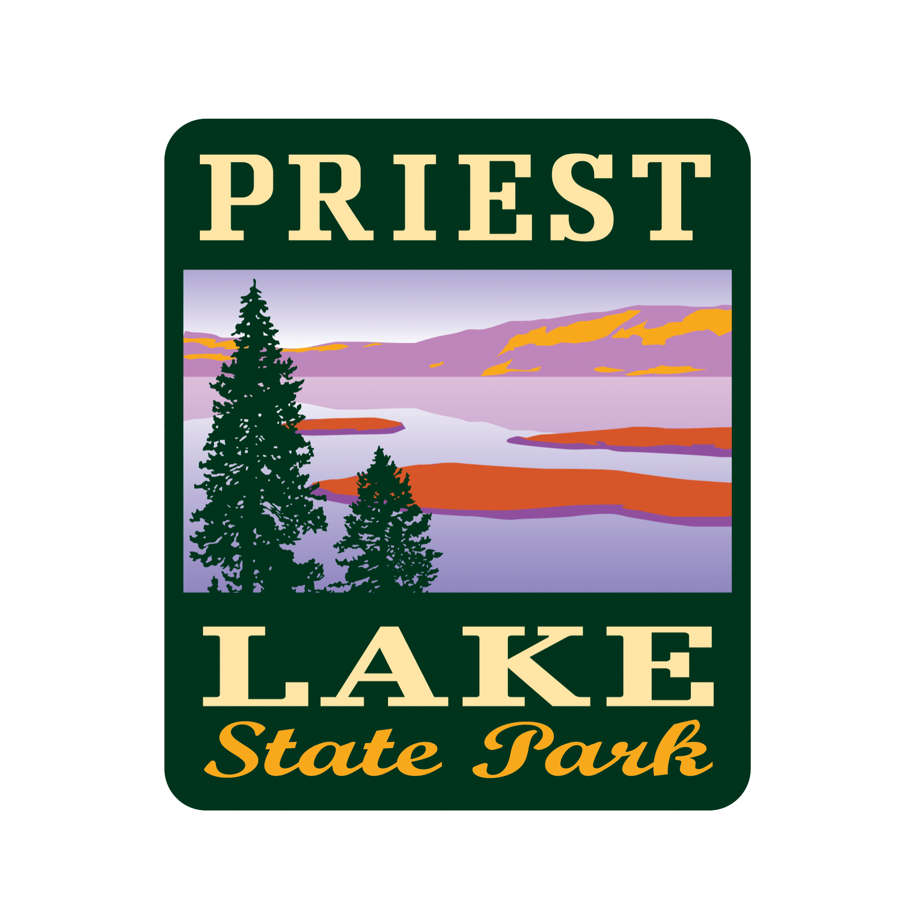
- Priest Lake State Park
- Winchester State Park
Winter Updates
Avalanche Warnings, Road Conditions, & Weather Reports
- Avalanche Warnings
- Snow Conditions
- Road Conditions
- 10 Day Forecast
- For more information, visit our Winter Safety & Education page
Winter Safety & Education
Strap on the skis or snowshoes and enjoy the snow at any of 14 Park N’ Ski areas across Idaho. Over 180 miles of groomed and ungroomed trails are marked in some of the most scenic areas in Idaho.
Revenues from the sale of permits go toward plowing parking lots and improving Nordic ski and snowshoe opportunities. Upon purchasing, skiers and snowshoers can designate which area they would like to have receive their fee. This designation process gives permit purchasers an opportunity to help make improvements to an area of their choice. In multiple-use parking lots, snowmobilers, when snowmobiling, are not required to purchase a Park N’ Ski pass.
The Park N’ Ski program is managed primarily by Idaho Department of Parks and Recreation, with cooperation and support from U.S. Forest Service, the Idaho Department of Lands, the Idaho Department of Transportation, and many local recreation user groups who provide volunteer trail-enhancement work to make it all possible.
Park N’ Ski Locations
There are 14 Park N’ Ski locations throughout Idaho. Park N’ Ski permits are required November 15 – April 30.
- Hanna Flats – 33 miles North of Priest River off State Highway 57
- Priest Lake Golf Course – 28 miles North of Priest River, west side Priest Lake off Highway 57
- Priest Lake State Park’s Park N Ski Unit: 11 miles North of Coolin, east side of Priest Lake
- Chipmunk Rapids: 22 miles North of Priest River, off Highway 57
- 4th of July Pass: From Coeur d’Alene, travel east on Highway I-90, approx. 23 miles take exit 28
- Fish Creek Meadows: From Grangeville, travel South of Forest Service Road 221, approx. 8 miles
- Palouse Divide: From Moscow, travel North on Highway 95, approx. 16 miles, then travel East on Highway 6, approx. 23 miles
- Brimstone/Buffalo River: From Ashton, travel North on Highway 20, approx. 26 miles
- Bear Gulch/Mesa Falls: From Ashton, travel East on Mesa Falls Forest Highway 47, approx. 12 miles
- Fall River Ridge: From Ashton, travel East on Mesa Falls Forest Highway 47 about 6 miles, then right onto Cave Falls Road about 6 miles
- Mink Creek: From Highway 15 at Pocatello, take Exit 63, travel South on Portneuf Road about 2 miles then South on Bannock Highway, approx. 10 miles
- Beaver Creek Summit: 25 miles North of Idaho city, off Highway 21
- Banner Ridge: 23 miles North of Idaho City, off Highway 21
- Gold Fork: 20 miles North of Idaho City, off Highway 21
- Whoop-Em-Up: 18 miles North of Idaho City, off Highway 21
Fees
How to Purchase a Permit
Purchase on-line
Purchase at local vendors
Park N’ Ski Locations
There are 17 Park N’ Ski locations throughout Idaho. Park N’ Ski permits are required November 15 – April 30. See other tabs for locations.
Fees
| Details | Hanna Flats Park N’ Ski |
|---|---|
| Location | 33 miles north of Priest River off State Highway 57 |
| Difficulty | Beginner – intermediate |
| Distance | 5 m/10 km of ski trails; 2.2 m/3.5 km snowshoe trails |
| Grooming | Yes – traditional kick and glide and snowshoe |
| Snowshoeing | Yes |
| Yurt | No |
| Backcountry ski potential | Yes |
| Restroom | Yes |
| Dogs | Yes |
| About | Nordic ski trails and snowshoe trails at Hanna Flats are relatively gentle in a meadow and forest setting on the west side of Priest Lake. The trail system is well-suited for snowshoers and track skiers. The adjoining airstrip is a great workout for skate skiing. Two short loops are available for skiers and several interlacing loops for snowshoers. The Hanna Grove Nature Trail, located a little more than a mile from the trailhead, is worth checking out to see some old growth cedar trees and read about an old wildfire. Backcountry skiers could climb adjacent mountains above the flats to crank out a few turns. |
| More Information | Priest Lake Nordic Club Facebook Page Priest Lake Ranger District- (208) 443-2512 |
| Maps | Hanna Flats Hanna Flats Location Map |
| Details | Priest Lake Golf Course Park N’ Ski |
|---|---|
| Location | 28 m N of Priest River on west side of Priest Lake off Hwy 57 |
| Difficulty | Beginner – intermediate |
| Distance | 9.1 m/14.6 km ski trails; 2.8 m/4.5 km snowshoe trails |
| Grooming | Yes – set track for traditional kick and glide |
| Snowshoeing | Yes |
| Yurt | No |
| Backcountry ski potential | Yes |
| Restroom | Yes |
| Dogs | Allowed |
| About | The Priest Lake Golf Course has the most extensive groomed Nordic trail system in the vicinity of Priest Lake. During the winter season, the area is blanketed with generous amounts of snow and the golf course is transformed into the Priest Lake Nordic Center. Hill’s Resort serves as the hub for the Golf Course Nordic system and also offers rental equipment. The trail system provides routes along the lakeside and also connects to the Hanna Flats trails to the north. The total of nearly 50 kilometers of groomed trails from beginning to intermediate level provide an ideal setting for family Nordic activities. Trails are groomed on a regular basis, conditions permitting, for traditional kick and glide skiers and skate skiers. The Nordic Park N’ Ski Trail area is open daily. |
| More Information | Hill’s Resort (208) 443-2551 Priest Lake Nordic Club Facebook Page |
| Maps | Priest Lake Golf Course Priest Lake Golf Course Location Map |
| Details | Priest Lake State Park |
|---|---|
| Location | 11 m N of Coolin, ID on east side of Priest Lake |
| Difficulty | Beginner – intermediate |
| Distance | 5.4 m/8.7 km ski trails; 1.5 m/2.4 km snowshoe trails |
| Grooming | Yes |
| Snowshoeing | Yes |
| Yurt | No but winter one- and two-room cabins are available for $45 per night |
| Backcountry ski potential | No |
| Restroom | Yes |
| Dogs | Yes on ungroomed trails only |
| About | Priest Lake State Park’s Indian Creek Unit provides a change of scenery immediately adjacent to the lake. A compact trail loop system circles the park’s visitor center area, and if that’s not enough of a workout, another loop system to the north provides more mileage and more challenging trails. There is a new viewpoint trail that affords nice views of the lake and surrounding mountains on a sunny day. The park’s visitor center and store are open on weekends for fresh coffee or hot chocolate. Snowshoes can also be rented at the vistor’s center. |
| More Information | Priest Lake State Park (208) 443-2200 |
| Maps | Priest Lake State Park Priest Lake State Park Location Map |
| Details | Chipmunk Rapids |
|---|---|
| Location | 22 miles north of Priest River, off State Hwy 57 |
| Difficulty | Beginner to more difficult |
| Distance | 10.4 miles |
| Grooming | Occasional, track set for traditional kick and glide skiers |
| Snowshoeing | Yes |
| Yurt | No |
| Backcountry ski potential | Yes |
| Restroom | Yes |
| Dogs | Yes |
| About | Chipmunk Rapids ski trails are a two-loop system of interconnecting roads. The trail head is near the Priest Lake Visitors Information Center at Dickensheet Junction. The groomed trails are called the Kaniksu Marsh Loop and the River View Loop. There are other ungroomed trails in the area which are sometimes skier track set. These trails are mainly flat and used by novice to advanced cross-country skiers. The trails offer spectacular views of Kaniksu Marsh, Priest River, and the Selkirk Mountains. This area is also frequently used by big game as a winter range area, so try to minimize your disturbance to the winterizing wildlife. |
| More Information | Priest Lake Nordic Club Facebook Page Priest Lake Ranger District- (208) 443-2512 |
| Maps | Chipmunk Rapids Area Map |
| Details | 4th of July Pass |
|---|---|
| Location | From Coeur d’Alene, travel East on Hwy I-90, approximately 23 miles, take exit 28 |
| Difficulty | Beginner – intermediate with a few expert pitches |
| Distance | 7.8 miles |
| Grooming | Yes, 10-foot skating lane with track set for traditional kick and glide |
| Snowshoeing | Yes |
| Yurt | No, but there is a warming hut |
| Backcountry ski potential | Yes |
| Restroom | Yes |
| Dogs | No |
| About | 4th of July Pass is a great place to ski or snowshoe because it starts from a high point afforded by the 4th of July Summit. Three loop trails wind through stately cedar, fir, and pine forests. The snowshoeing trails are almost as extensive as the groomed ski trails. Backcountry skiers can climb nearby mountains to carve turns. |
| More Information | Panhandle Nordic Club Facebook Page Couer d’Alene River Ranger District (208) 664-2318 |
| Maps | 4th of July Trail Map |
| Details | Fish Creek Meadows Park N’ Ski |
|---|---|
| Location | From Grangeville, ID travel S on Forest Service Rd. 221 approximately 8 miles |
| Difficulty | Beginner – intermediate |
| Distance | 12 m/19.3 km |
| Grooming | Yes |
| Snowshoeing | No on groomed trails | Yes off-trail |
| Yurt | No but there is a warming hut |
| Backcountry ski potential | Yes |
| Restroom | Restrooms available at Trailhead |
| Dogs | Yes on ungroomed trails only |
| About | The Fish Creek Park N’ Ski area is a premium place to go Nordic skiing or snowshoeing. The terrain is moderate and well-suited for beginners and intermediate skiers. On a clear day, you can see Seven Devils and Gospel Hump Wilderness areas from the Fish Creek Meadows. For the adventurous, some nearby backcountry Nordic touring is possible. |
| More Information | (208) 839-2211- Salmon River Ranger District |
| Maps | Fish Creek Meadows Trails Fish Creek Location |
| Details | Palouse Divide Park N’ Ski |
|---|---|
| Location | From Moscow travel N on Hwy 95 approximately 16 miles, then travel E on Hwy 6 approximately 23 miles |
| Difficulty | Beginner – intermediate |
| Distance | 18 m/29 km ski trails |
| Grooming | Yes – set track for traditional kick and glide |
| Snowshoeing | Yes |
| Yurt | No |
| Backcountry ski potential | Yes |
| Restroom | No |
| Dogs | Yes on ungroomed trails only |
| About | Palouse Divide has something for everyone — Nordic trails for skate skiers and traditional cross-country skiers; a snowshoeing area on the west side of Idaho Hwy 6; and several opportunities for backcountry skiers to carve turns on either side of the highway. About 12 of the 18 miles of trail are groomed periodically. The ski trails hug the mountainside and contour through a forested setting, making them suitable for most abilities. There are several steep pitches to navigate. Backcountry skiers can seek out turns on Bald Mountain Lookout or Dennis Mountain. |
| More Information | (208) 875-1131 – Palouse Ranger Disctrict |
| Maps | Palouse Divide Trails Palouse Divide Location |
| Details | Brimstone/Buffalo River Park N’ Ski |
|---|---|
| Location | From Ashton travel N on Hwy 20 approximately 26 miles |
| Difficulty | Beginner – Intermediate – Expert |
| Distance | 17.9 m/28.8 km |
| Grooming | Yes – set track for traditional kick and glide |
| Snowshoeing | No on groomed trails, yes off-trail |
| Yurt | No |
| Backcountry ski potential | No |
| Restroom | No |
| Dogs | Not allowed |
| About | The Brimstone/Buffalo River Park N’ Ski area has many great opportunities for Nordic skiing in a beautiful setting next to Island Park Reservoir, the Buffalo River, Henrys Fork and Box Canyon. A 2.1 mile interpretive trail with information about nature in winter is a great loop for kids and families. The 2.8-mile Moose Loop is a little longer and connects to three other loops; Thurmon Ridge, Boggy Springs and Antelope Park. The Brimstone Trail, a 10.8-mile one-way trail, connects from Ponds Lodge to Harriman State Park. |
| More Information | For grooming report call Ashton Ranger Station: (208)652-7442 |
| Maps | Brimstone/Buffalo River trails Harriman State Park trails guide Brimstone/Buffalo Location Map |
| Details | Bear Gulch/Mesa Falls Park N’ Ski |
|---|---|
| Location | From Ashton travel E. on Mesa Falls Forest Hwy 47 approximately 12 miles |
| Difficulty | Intermediate – Advanced |
| Distance | 9.1 m/14.7 km |
| Grooming | Yes – set track for traditional kick and glide |
| Snowshoeing | No on groomed trails, yes off-trail |
| Yurt | No |
| Backcountry ski potential | No |
| Restroom | Yes at trailhead and at Upper and Lower Mesa Falls |
| Dogs | No |
| About | The Bear Gulch/Mesa Falls trail system is one of the most scenic anywhere in Idaho, particularly because the ski trails cruise along the rim overlooking both Upper and Lower Mesa Falls. Views of the Teton Mountain Range are possible on a clear day. It’s a 9.1-mile round-trip trek to the Upper Falls (where the water falls 110 feet), but well worth the effort for the strong and hardy. Shorter loops of 3.9 miles or 5.9 are available closer to the trailhead. The trailhead and a short section of the ski trail are shared use areas with snowmobiles. |
| More Information | For grooming report call Ashton Ranger Station (208)652-7442 |
| Maps | Bear Gulch/Mesa Falls trails Bear Gulch/Mesa Falls Guide Bear Gulch/Mesa Falls Location Map |
| Details | Fall River Ridge Park N’ Ski |
|---|---|
| Location | From Ashton travel E on Mesa Falls Forest Hwy 47 about 6 miles then right onto Cave Falls Rd about 6 miles |
| Difficulty | Beginner – intermediate (with a few expert pitches) |
| Distance | 7.1 m/11.4 km |
| Grooming | Yes, 10-foot skating lane with track set for traditional kick and glide |
| Snowshoeing | No on groomed trails, yes off-trail |
| Yurt | No |
| Backcountry ski potential | No |
| Restroom | No |
| Dogs | Not allowed |
| About | Three loops await Nordic skiers here on a mountain bench that overlooks the Fall River canyon. There is a 2.2 mile easy loop immediately accessible from the trailhead, then a more difficult 3.4 mile second loop and a third loop that covers a total of 7.1 miles roundtrip from the trailhead. Skiers may see an occasional moose nearby. The trailhead is shared with snowmobiles. |
| More Information | For grooming report call Ashton Ranger Station (208)652-7442 |
| Maps | Fall River Ridge trails Fall River Location Map |
| Details | Mink Creek Park N’ Ski |
|---|---|
| Location | From Hwy 15 at Pocatello take Exit 63, travel S on Portneuf Rd about 2 miles then S on Bannock Hwy approximately 10 miles |
| Difficulty | Beginner – intermediate – Expert |
| Distance | 18 m/29 km ski trails |
| Grooming | Limited – with set track for traditional kick and glide |
| Snowshoeing | Yes |
| Yurt | No |
| Backcountry ski potential | Yes |
| Restroom | Yes |
| Dogs | Yes on ungroomed trails only |
| About | The Mink Creek Park N’ Ski area is loaded with great ski and snowshoe trails close to Pocatello. The area has seven plowed parking areas, providing great access to five different trails. The West Fork of Mink Creek and Valve House offer out-and-back experiences in a mountain draw, while the Porcelain Pot area provides more loops. The Porcelain Pot trails can be combined with a ripping downhill on the Corral Creek Trail. East Mink Creek Nordic Center The East Mink Creek Nordic Center is not a Park N’ Ski program but it is managed by the Pocatello City Parks and Recreation Department and is located at the end of the Scout Mountain Road. For an additional fee you can access their groomed ski trails and designated snowshoe trails. Contact them at (208) 232-3901. |
| More Information | Westside Ranger District (208) 236-7500 |
| Maps | Mink Creek trails |
| Details | Island Park Snow Depths |
|---|---|
| About | For updated snow depths in the Island Park area, select this link. The site is located near the community of Island Park at 6290 feet in elevation. |
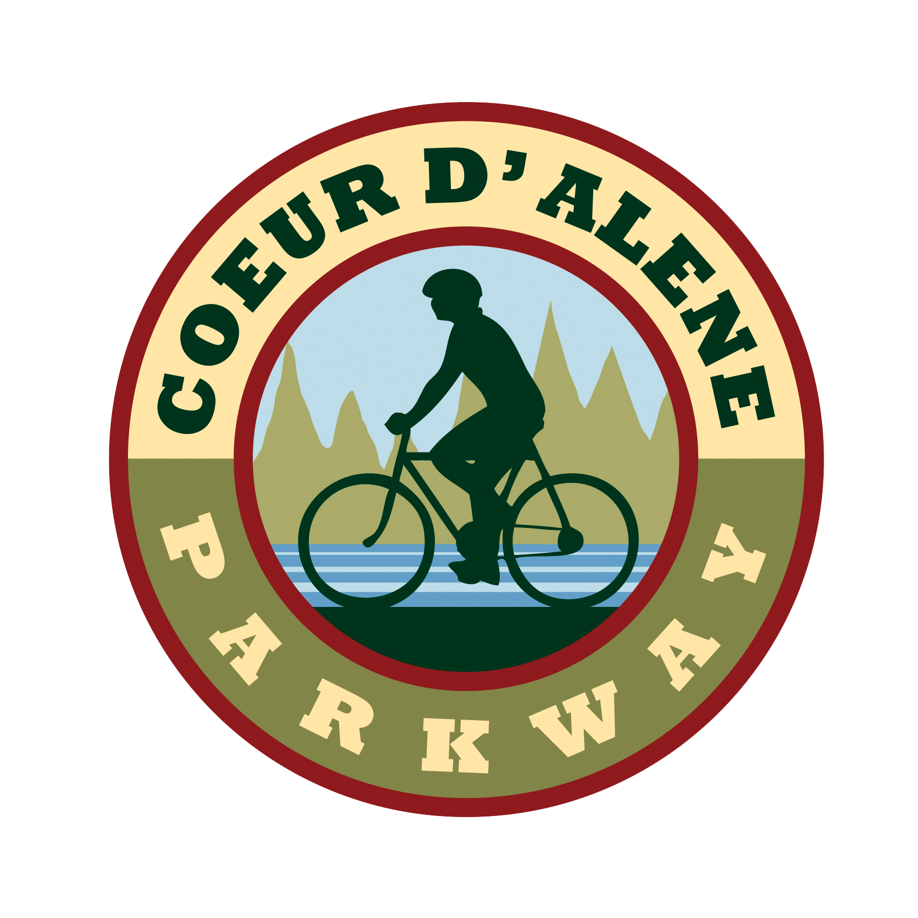
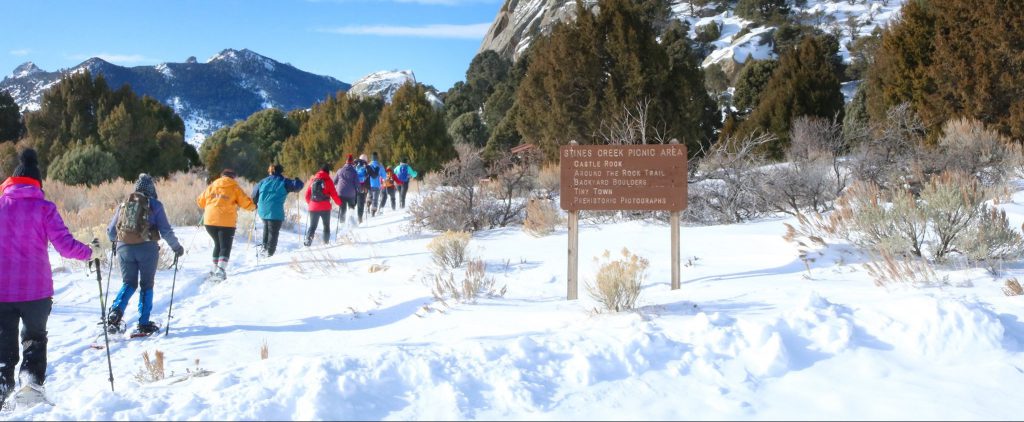
The South Idaho Park N’ Ski area is a great place to stay and play. The trails in this area are used to access the Idaho City Backcountry Yurt System.
For Mores Creek Summit conditions, visit https://www.nwrfc.noaa.gov/snow/snowplot.cgi?MRKI1.
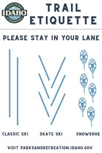
Remember, this is a multi-use trail system open to skiers, snowshoers, fat-tire bikers, and hikers. Please preserve the tracks for skiers by utilizing the trail lane intended for your user group.
| Details | Beaver Creek Summit Park N’ Ski |
|---|---|
| Location | 25 m N of Idaho City off Hwy 21 |
| Difficulty | Intermediate – Advanced |
| Distance | 3 m |
| Grooming | No |
| Snowshoeing | Yes |
| Yurt | Yes – Stargaze Yurt |
| Backcountry ski potential | Yes – fabulous! |
| Restroom | No |
| Dogs | Yes |
| About | This ungroomed out-and-back trail is designed especially for backcountry Nordic folks, whether on skis or snowshoes. You’ll understand how it got its name after you make your way to the top of Stargaze Point (1.5 miles one way) where you’ll find a 360 degree view of the Boise National Forest that includes Pilots Peak, Wilson Butte, Sunset Peak, Rock Creek and Scott Mountain. At over 6,500 feet, it’s the perfect Telemark skiing on many north and west facing slopes where there is deep powder most winter seasons. |
| More Information | Non-Motorized Trails Facebook |
| Parking | The Park N’ Ski parking lot is just before the snowplow turn around on the left side of Hwy 21, about 300 yards before the Beaver Creek Summit. Do not park in the snowplow turn around parking lot. From the parking lot ski/snowshoe along the shoulder of Hwy 21 for about 300 yards until you reach the highest point, Beaver Creek Summit. At the summit turn left on an old road bed marked with a sign post saying “Stargaze Trail.” |
| Maps | Beaver Creek Summit trail map Beaver Creek Summit location map Beaver Creek Summit Winter Parking Rules |
| Details | Banner Ridge Park N’ Ski |
|---|---|
| Location | 23 m N of Idaho City off Hwy 21 |
| Difficulty | Intermediate – Advanced |
| Distance | 22 m/35.4 km |
| Grooming | Yes – set track for traditional kick and glide |
| Snowshoeing | Yes |
| Yurt | Yes – Banner Ridge and Elkhorn Yurts |
| Backcountry ski potential | Yes |
| Restroom | Yes |
| Dogs | Yes on ungroomed trails only |
| About | If you like to crank out the miles on your skis, backcountry ski or cruise around on snowshoes either on-trail or off-trail, the Banner Ridge area is packed with opportunity and fun. It’s a pretty steep 1.3-mile climb from the trailhead to the ridge, but once you’re on top, there are many loops, big views and open bowls to enjoy from there. |
| More Information | Non-Motorized Trails Facebook |
| Maps | Banner Ridge trail map Banner Ridge location map Banner Ridge Winter Parking Rules |
| Details | Gold Fork Park N’ Ski |
|---|---|
| Location | Location 20 miles north of Idaho City off Highway 21 |
| Difficulty | Beginner – intermediate |
| Distance | Total 21.4 m/34.4 km; Gold Fork Loop – 5.1 m /8.2 km; Skyline Loop 4 m/6.4 km |
| Grooming | Yes – set for traditional kick and glide |
| Snowshoeing | Yes |
| Yurt | Yes – Whispering Pine and Skyline Yurts |
| Backcountry ski potential | Yes on the Gold Fork side |
| Restroom | Yes |
| Dogs | Yes on all trails |
| About | The Gold Fork Park N’ Ski area provides access to two complete trail systems on either side of Hwy 21. One trail tours the Gold Fork area, the other loops the Skyline area and connects to the greater Banner Ridge/Beaver Creek trail systems. A separate ungroomed snowshoe trail tours a ridge in the Gold Fork area. There’s also a short snowshoe trail from the Skyline yurt. This is a great place to take kids for an easy, low key outing. |
| More Information | Non-Motorized Trails Facebook |
| Maps | Gold Fork trail map Gold Fork location map Gold Fork Winter Parking Rules |
| Details | Whoop-Um-Up Park N’ Ski |
|---|---|
| Location | 18 m N of Idaho City on Hwy 21 |
| Difficulty | Beginner – intermediate |
| Distance | 6.6m/10.6km ski trails |
| Grooming | No |
| Snowshoeing | Yes |
| Yurt | Yes – Rocky Ridge Yurt |
| Backcountry ski potential | No |
| Restroom | Yes |
| Dogs | Yes |
| About | Snowshoers with dogs love Whoop-Um-Up because this is one of the areas where dogs are welcome. Dogs are also welcome in the Rocky Ridge yurt. Be aware that the parking area is shared with snowmobiles, so you will encounter snow machines as you gear up for your adventure. Trails can be a bit rugged in this area with a few steep and challenging downhill sections along the creek trail. |
| More Information | Non-Motorized Trails Facebook |
| Maps | Whoop-Um-Up trail map Whoop-Um-Up location map Whoop-Um-Up Parking Guide |
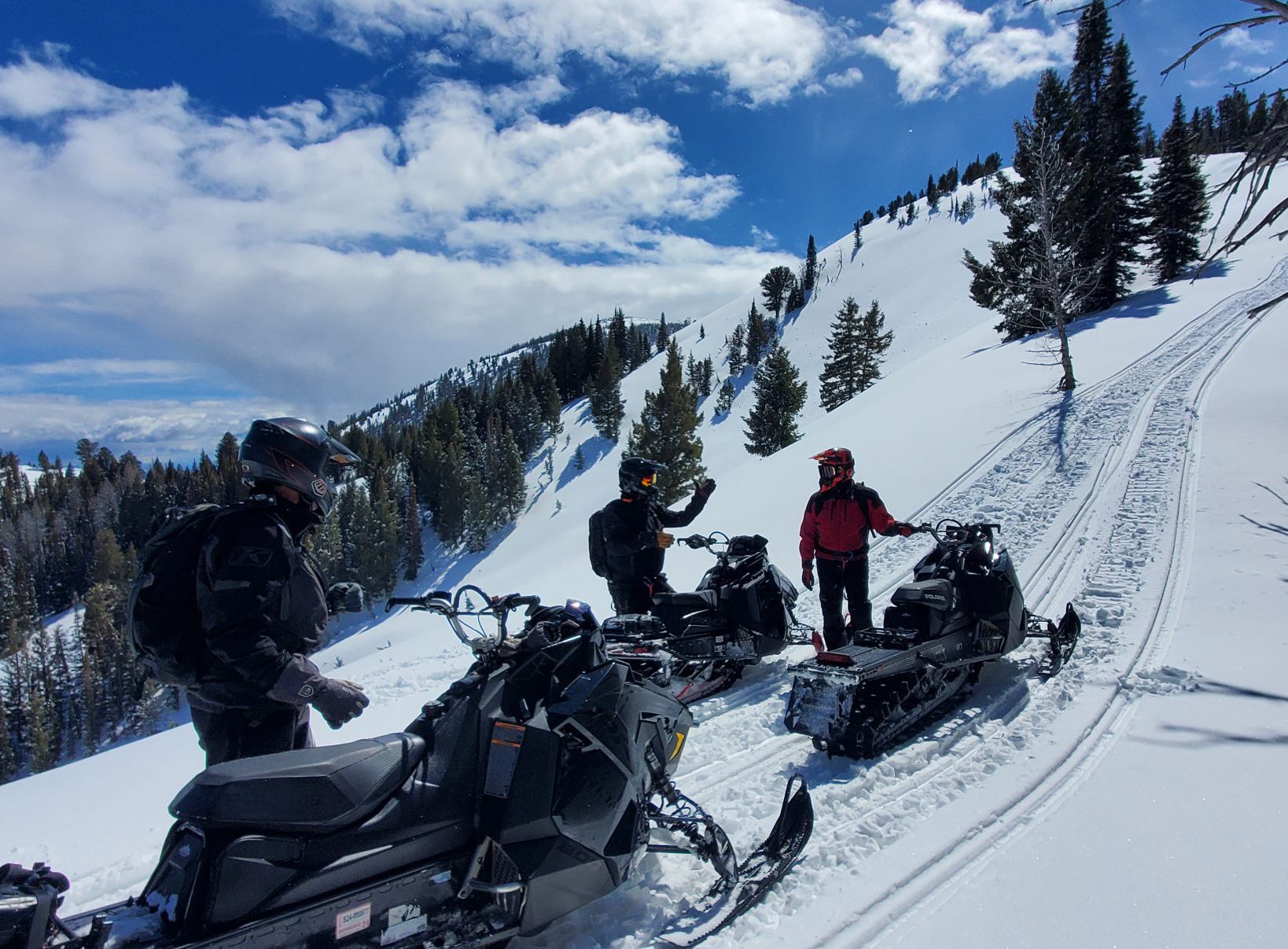
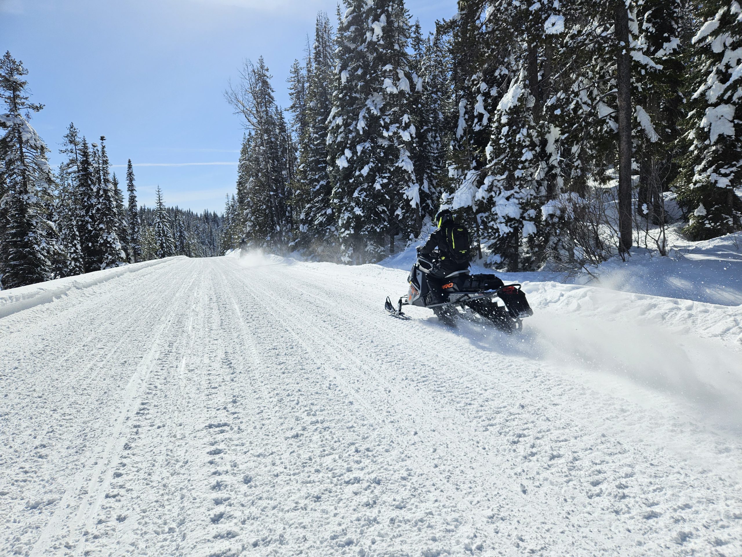
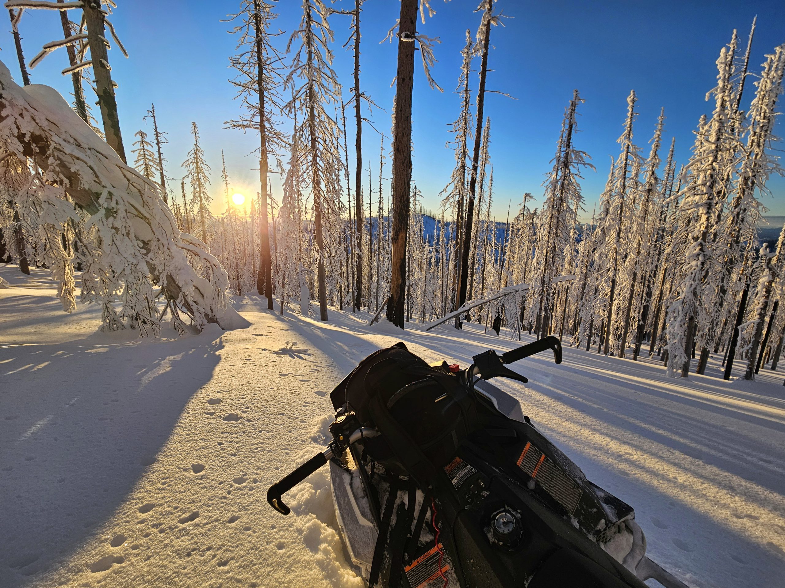
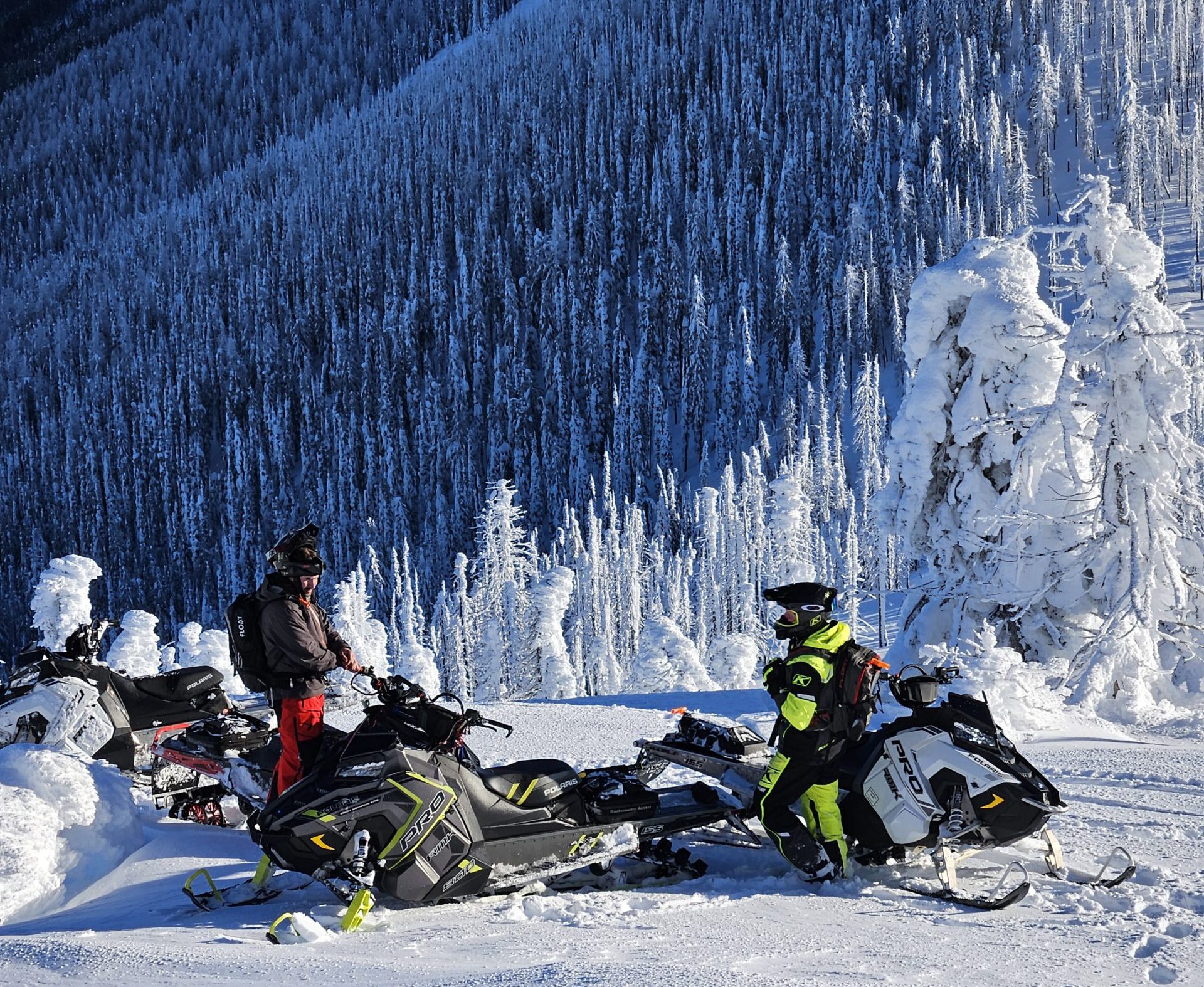
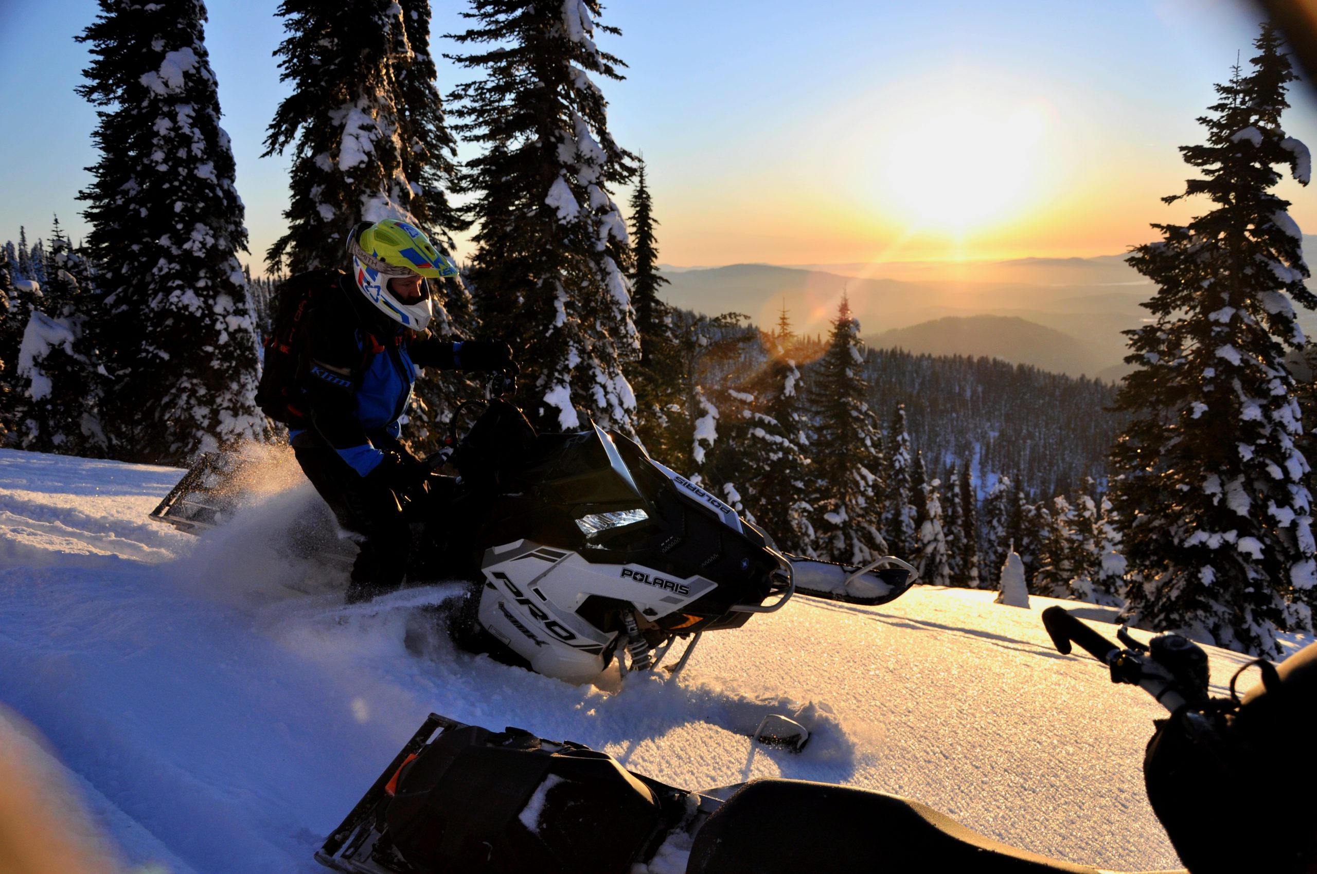
Snowmobiling
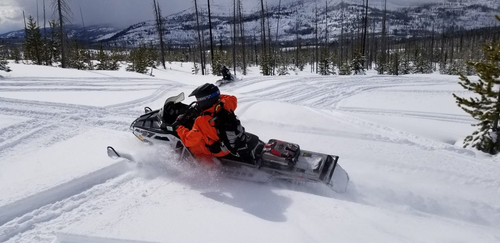
The Motorized Trails Program’s winter activities consist of the following:
- Working with counties and land managers to provide maintenance on groomed snowmobile trails
- Providing snowmobile education opportunities
- Partnering with snowmobile law enforcement programs
- Participating in statewide travel planning
- Working with snowmobile clubs and organizations
Economic Impact
Download the Economic Impact and Importance of Snowmobiling in Idaho.
Designations
To ensure the area you ride has enough funding to operate throughout the season, please designate your certificate of number fees to the county you ride.
The Idaho snowmobile program is funded through certificate-of-number fees purchased by snowmobilers. On November 1 of each year every snowmobile operated on private or public land must be numbered.
Fees
Resident: $45.50
Non-Resident: $59.50
Rentals: $75.50
You may also purchase a resident 2-year for $89.50 and non-resident 2-year for $117.50.
Note: non-residents are not exempt from purchasing an Idaho snowmobile certificate of number.
How is your certificate of number fee broken down?
- $1.50 vendor fee
- $1.00 to snowmobile related search and rescue efforts
- 85% goes to the county-operated snowmobile grooming programs
- Up to 15% goes to administration fees and the printing costs of registration stickers
What are the certificate of number fees used for?
- Grooming
- Parking lot plowing
- Signing
- Clearing groomed trails
- Avalanche classes
- New rider classes
Snowmobile Stickers
Purchase one or two-year resident and non-resident snowmobile/snowbike/tracked-OHV stickers at vendors or online. Stickers will be mailed to you, and your email receipt is your temporary permit.
Local Sticker Vendors
If you need to review your current, unexpired recreation permits and they do not appear when you access the online system, please call 1-888-922-6743 for assistance.
When does grooming occur?
Grooming happens as weather, snow, and safety permit. The bullets below briefly identify when programs groom trails.
- When the safety of the equipment and operators is not a concern.
- When there is a minimum of 18” of snow in the parking lot.
- When avalanche conditions do not pose a safety concern for grooming operations.
- When the grooming temperatures are between -20⁰F and 40⁰F.
Rider Community
Check out the Idaho State Snowmobile Association for additional information, regional club lists, and more! Click here or the logo below to be re-directed to their site.
Priest Lake
State Designated Area: #9A
Elevation: 2,500–6,500
Prime Season: Dec–March
Route: Idaho Highway 57
Lodging/Services Info: (888) 774-3785
priestlake.org
Map Info: (208) 443-2512
Priest Lake boasts more than 400 miles of groomed trails that wind through heavy timber, endless windswept ridges and snow-filled bowls. North of Nordman, the Granite Pass trail system consists of four groomed trails stretching nearly 100 miles. The highest peaks range from 6,000 to 7,000 feet. Priest Lake accommodations range from luxury resorts, condominiums, rustic cabins, roadside motor inns, and charming bed and breakfasts.
Sandpoint and Bonners Ferry
State Designated Area: #9B
Elevation: 2,500–7,200
Prime Season: Dec–March
Route: U.S. 95 and U.S. 2
Lodging/Services Info: (208) 267-5922 (Bonners Ferry) or (800) 800-2106 (Sandpoint)
sandpointchamber.org
Map Info: (208) 263-5111
Located 40 miles north of Coeur d’Alene and 25 miles south of the Canadian border, the Sandpoint/ Bonners Ferry area offers more than 100 miles of marked and groomed trails. This area of breathtaking mountain peaks is Canada’s gateway to Silver Country. Favorite riding areas include: Spruce Lake, Copper Ridge, Deer Creek, Canuck, Roman Nose Lakes, Apache Ridge and Dodge Peak to the southwest, and Cooks Pass to the west.
Coeur d'Alene
State Designated Area: #28
Elevation: 3,000–5,000
Prime Season: Jan–March
Miles From Town: 12
Route: U.S. 95
Lodging/Services/Map Info: (208) 664-3194
fyinorthidaho.com
A tradition of timber and mining has created an extensive network of trails in the Coeur d’Alene/ Kootenai County area. These trails provide snowmobilers with 350 miles of diverse riding conditions within easy access off Interstate 90. From straight high-speed “highways” to high-mountain switchbacks, there’s a trail for any rider. The Coeur d’Alene system connects with the Wallace trail system and on to Haugan and St. Regis, MT, a 1,000-mile trek of unparalleled scenery, accommodations and accessibility. Closer to Coeur d’Alene at the Fernan Saddle, elevations range from 2,500 feet to more than 6,000 feet. 12 miles east of Coeur d’Alene, the Fourth-of-July system offers 54 miles of trails for the snowmobile enthusiast. Numerous trail systems can also be found near the towns of Hayden and Hayden Lake, including the 43-mile Hayden Creek-Horse Heaven Loop. Ten miles southeast of Athol is the Bunco Trail System which takes in four groomed trails totaling 60 miles.
Wallace
State Designated Area: #40
Elevation: 2,700–5,000
Prime Season: Dec–March
Full Service Towns: Wallace, Kellogg, Avery
Route: Interstate 90
Lodging/Services/Map Info: (208) 753-7151
wallaceidaho chamber.com
Experienced snowmobilers and families love the challenge of this rustic area. Historic Wallace is Idaho’s Snowmobile City, USA, and features some of the finest high-mountain snowmobiling in the world. Historic Wallace is snowmobile-friendly and features an ‘open streets’ ordinance welcoming riders to access area trails from anywhere in town. Located high in the Bitterroot Mountains near the Idaho/ Montana border, this beautiful 1880’s Old West mining town is listed on the National Historic Register and is easily accessible via Interstate 90 from Seattle, Spokane and Missoula.
Avery
State Designated Area: #40B
Elevation: 2,700–5,000
Prime Season: Dec–March
Full Service Towns: Avery, Wallace
Lodging/Services Info: (208) 245-4410.
Map Info: (208) 245-4410.
scheffys.com
This once-thriving railroad town is now a great place to stage your snowmobile ride. With connection to the Wallace (area 40) program to the north and the beautiful St. Joe River County to the south. 4 trailheads leave from the town of Avery for easy access to approximately 180 miles of groomed trails, as well as large play areas and hill climbs for all skills of riders to enjoy. 2 warming huts are located on the hill for your comfort and safety. Gas, food and lodging are available in Avery. In the winter, Avery can be accessed by driving 47 miles up NFD Road #50 from St. Maries.
St. Maries
State Designated Area: #5
Elevation: 6,300–10,157
Prime Season: Dec–March
Full Service Towns: St. Maries
Miles From Town: 30 miles from St. Maries
Route: From St. Maries travel South on Hwy 5 to Santa, then South on Hwy 3 to Fernwood/Clarkia.
Lodging/Services Info: St. Maries Chamber of Commerce (208) 245-3563
U.S. Forest Service (800) 245-2531
stmaries chamber.org
North Idaho has the snow and terrain to create a snowmobiler’s paradise. Snowmobiling is one of the area’s fastest-growing sports. Because St. Maries is located in the Bitterroot Mountains, ski areas and snowmobiling opportunities are plentiful. In winter months, snowmobiling enthusiasts delight in miles of groomed trails and good snow. There are over 600 acres available just outside St. Maries for snowmobiling. In surrounding Benewah and Shoshone counties, the miles and miles of trails are endless for snowmobiling. A history of timber and mining has left an extensive network of trails through the Idaho Panhandle National Forest.
idahowinter.org.
Snowmobiling regulations and trail maps are available from U.S. Forest Service offices throughout the region. With the eminent success of snowmobiling projects throughout North Idaho, here’s a recommendation: Make plans for your visit before the rest of the world gets here!
Moscow
State Designated Area: #29
Elevation: 2,300–6,000
Prime Season: Dec–March
Route: U.S. 95
Lodging/Services Info: Elk River City Call (208) 826-3209
moscowchamber.com
Map Info: (208) 875-1131
Latah County offers 300 miles of groomed snowmobile trails spread over three areas. The largest is a 250-mile network of trails between the small towns of Bovill and Elk River. Northeast of Moscow on Moscow Mountain, a smaller system of trails extends along the ridge, down into a loop trail and back up to a spectacular view at the mountain’s summit (4,721 feet). East of the town of Harvard is a network of groomed trails with trailheads near Laird Park on Strychnine Creek and a few miles beyond at North Fork Creek.
Orofino
State Designated Area: #18
Elevation: 3,000–6,000
Prime Season: Dec–Apr
Full Service Towns: Orofino, Pierce, Weippe
Miles from Town: 20
Route: U.S. 12, Idaho Highway 11
Lodging/Services Info: (208) 476-4335
orofino.com
Map Info: (208) 476-4541
In Clearwater County, a panoramic view of the region is found at Bald Mountain Lookout, the site of a winter survival cabin for snowmobilers. This area features more than 200 miles of groomed and several miles of ungroomed trails. Trail rides and hill climbs can be enjoyed at elevations ranging from 3,000 to 6,000 feet.
Lewiston
State Designated Area: #35
Elevation: 3,000–5,000
Prime Season: Jan–March
Full Service Towns: Lewiston, Winchester
Miles from Town: 20
Route: U.S. 95
Lodging/Services Info: (800) 473-3543
ohwy.com/id/l/lewistcc.htm
Map Info: (208) 743-3531
Nez Perce County grooms 250 miles in the Waha Area in Nez Perce and Lewis counties. The trail system winds around Craig Mountain near Winchester and offers open and forested areas. Parking is available near Waha and Winchester.
Grangeville
State Designated Area: #25A
Elevation: 5,000–8,000
Prime Season: Nov–April
Miles From Town: 7
Route: U.S. 95, south on U.S. Forest Road 221
Lodging/Services Info:(208) 983-0460
Map Info: (208) 983-1950
The Grangeville area has a 150-mile groomed snowmobile trail system that begins seven miles south of Grangeville at Fish Creek Recreation Area. From there, groomed trails run south along the Old Milner Trail to the old town site of Florence and the breaks of the Salmon River. Side trips can be taken to the edge of the Gospel Hump Wilderness. The trail system to the west of Fish Creek has two groomed loops. The Goose Creek Loop provides access to High Camp, overlooking Grangeville and the Camas Prairie. The longer Service Flats Loop offers open ridges and views of the Seven Devils Mountains and the Salmon River Canyon.
Elk City/Dixie
State Designated Area: #25B
Elevation: 4,000–7,000
Prime Season: Dec–March
Route: U.S. 95,
Idaho Highways 13 and 14
Lodging/Services Info: (208) 842-2383
Map Info: (208) 842-2245
Central Idaho County (Elk City, Red River, and Dixie) offers approximately 200 miles of groomed trails. A wide variety of snowmobiling is available ranging from trails in heavy timber to open snowfields. Major trailheads are available at Elk City, Newsome Creek, Trapper Creek and Dixie.
McCall
State Designated Area: #43A
Elevation: 5,000–8,000
Prime Season: Dec–April
Route: Idaho Highway 55
Lodging/Services Info: (208) 634-7631
mccallchamber.org
Map Info: (208) 634-0427
This popular recreation area features some of the best snowmobiling in the state with well-groomed trails and backcountry play areas. Snowmobile trails take off from Cascade, Donnelly, and McCall. The trail accesses the Lady Bug Play Area, where acres of powder await. The Railroad Pass Trail takes you into Warm Lake, Deadwood, and Yellow Pine where fuel, food, and lodging are available. Area byways offer access to backcountry areas such as Goose Lake, Brundage Reservoir, Granite Lake, Little Payette Lake, Warren, Secesh, Red Ridge, and Blue Bunch. Warren and Secesh have food and lodging available. Parking areas west and north of McCall provide off-highway parking and easy access to trails.
Smiths Ferry/Cascade/Warm Lake
State Designated Areas:
#43B, #43C, #43D
Elevation: 5,000–8,000
Prime Season: Dec–April
Route: Idaho Highway 55
Lodging/Services Info: (208) 382-3833
Map Info: (208) 634-0427
Sixty miles north of Boise on Highway 55, snowmobile trails take off from Smith’s Ferry and 18 miles further north in Cascade. The Wellington Snow Park (near Smith’s Ferry) offers 400 miles of trails, 250 of which are groomed, with access to McCall, Cascade, Ola, Stanley, Warm Lake and Garden Valley. The Winter Wonderland Trail leaves the mountain meadows of Smith’s Ferry, weaves past the towns of Cascade and Donnelly and crosses the mountains, offering spectacular scenic vistas at over 7,900 feet-before reaching McCall.
Garden Valley
State Designated Area: #8B
Elevation: 3,000–8,000
Prime Season: Dec–March
Miles from Town: 5
Route: Idaho Highway 55, turn east at Banks
Lodging/Services Info:(208) 462-5003
Fax: (208) 462-3703
gvchamber.org
Map Info: (208) 634-0427
The Garden Valley snowmobile trail system begins at the Terrace Lake Resort. A total of 137 miles are groomed, leading to Packer John and connecting with the trail system maintained by the Smith’s Ferry grooming program. Garden Mountain can also be reached from the trail system, though the route is ungroomed.
Idaho City
State Designated Area: #8A
Elevation: 3,500–8,200
Prime Season: Dec–March
Route: Idaho Highway 21
Lodging/Services Info: (208) 392-4148
Map Info: (208) 392-6681
Located in the heart of Idaho’s Gold Rush country, historic Idaho City is a starting point for more than 220 miles of groomed trails. Gentle, tree-covered mountain slopes offer a variety of riding conditions for the entire family. Idaho City’s snowmobile trail system connects with the Pine/Featherville system. Food and lodging are located in Idaho City.
Pine and Featherville
State Designated Area: #20
Elevation: 4,500–9,500
Prime Season: Nov–April
Route: U.S. 20
Lodging/Services Info: (800) 587-4464
Map Info: (208) 587-7961
A network of groomed trails is located north of Highway 20 near Anderson Ranch Reservoir in southwest Idaho. More than 380 miles of well-marked, groomed trails offer snowmobilers nearly every kind of terrain imaginable for winter fun. The base elevation is near 4,200 feet and climbs close to 10,000 feet in the fabulous Trinity Mountains and the high-mountain prairies and rolling hills of Cat Creek. Popular paths include Trinity Lakes, Pfifer Creek, James Creek, Wagon Town Loop, and Burnt Creek. Several locations in the Anderson Ranch Recreation Area offer lodging, food, gas, and RV facilities. The Malcomson Parking Area, 14 miles west of Fairfield on Highway 20, provides a warming hut and access to more than 300 square miles of public and private land.
Twin Falls
State Designated Area: #42
Elevation: 7,000–8,000
Prime Season: Dec–March
Miles From Town: 36
Route: Twin Falls County Route G3
Lodging/Services Info: (800) 255-8946
twinfallschamber.com
Map Info: (208) 737-3200
South of Twin Falls, located in the foothills and mountains of the south rim of the Snake River Valley, lies the Diamondfield Jack Snowplay area. Easily accessible from Interstate 84 on County Route G3, the Diamondfield Jack area offers more than 200 miles of groomed and marked trails in 200 square miles of Sawtooth National Forest and BLM land. A plowed, 85-car parking lot provides access and the U.S. Forest Service maintains two warming huts and heated restrooms.
Burley
State Designated Area: #16
Elevation: 6,000–10,000
Prime Season: Dec–March
Miles from Town: 25
Route: U.S. 30
Lodging/Services Info: (800) 333-3408
minicassiachamber.com
Map Info: (208) 678-0430
Cassia County is much the same as the South Hills of Twin Falls. The area is known for its long snowmobiling season and fantastic views of the Snake River Plain. At Howell Canyon is a warming hut, heated restrooms, and an 85-car parking lot. The area boasts some of the highest snowfall totals in south-central Idaho. Cassia County has an extensive 120-mile groomed trail system in the Sublett Range east of Burley. The main access for the trail system is in North Heglar Canyon.
Bear Lake County
State Designated Areas: #4, #15, #21
Elevation: 6,000–8,700
Prime Season: Nov–April
Full-Service Towns: Montpelier, Preston, Soda Springs
Miles From Town: 10
Route: U.S. 89 and U.S. 30
Lodging/Services Info: (800) 448-BEAR
Map Info: (208) 847-0375
Straddling the Utah border in southeast Idaho, beautiful Bear Lake is accessible from Montpelier on Highway 89. In addition to a network of 350 miles of groomed trails, this area has extensive additional mileage in marked, ungroomed trails. Changes in elevation offer terrain varying from mountainous to open meadow. The St. Charles/ Fish Haven Loop is one of the most popular routes. Other trails include: Paris, Mink Creek, Bloomington, Georgetown/ Montpelier Loop, Crow Creek, Stump Creek, Eight-Mile Meadow Creek and Ant Canyon. A 40-mile groomed trail starts and ends at the Trail Canyon Warming Hut. Several parking areas make trails easily accessible. Snowmobile rentals, accommodations and tour packages are available throughout the Bear Lake area, with full services available in Montpelier. Services are also available in Preston, Soda Springs and several smaller communities along Highway 89.
Bannock County
State Designated Area: #3
Elevation: 5,000–8,000
Prime Season: Dec–March
Full-Service Towns: Lava Hot Springs, Pocatello
Route: U.S. 30
Lodging/Services Info: (888) 201-1063
pocatelloidaho.com
Map Info: (208) 236-7500
The Bannock County grooming program maintains 250 miles of snowmobile trails in Bannock, Power and Caribou counties. The two main areas with trail systems are the Scout Mountain-Mink Creek area and the Inman-Pebble-Toponce area. One warming shelter is available in each area. Parking lots are provided in both areas. Visitors can find local accommodations and a variety of snowmobile activities throughout the valley.
Bonneville and Bingham Counties
State Designated Areas: #10, #6
Elevation: 5,000–9,000
Prime Season: Jan–March
Full-Service Town:
Idaho Falls
Miles From Town: 15
Route: Bone Road
Lodging/Services Info: (800) 634-3246
yellowstoneteton.org
Map Info: (800) 634-3246
A network of 400 miles of groomed trails leads you to some of the world’s finest snowmobiling playgrounds. This trail system also connects with the Bear Lake, Franklin, and Caribou snowmobile trail systems. Majestic mountains, beautiful timbered areas, and open flats make this snowmobiling region one of the finest. Popular trails are Bone to Alpine, Brockman and Skyline, Wolverine and King Canyon. These wide groomed trails lead you to the great playgrounds of eastern Idaho. Three warming huts located along the trail system add to your comfort and safety.
Madison, Jefferson, and Teton Counties
State Designated Areas:
#33, #26, #41
Elevation: 4,000–9,000
Prime Season: Dec–April
Full-Service Towns: Rexburg, Driggs
Miles From Town: 10
Route: Idaho Highway 33
Lodging/Services Info: (208) 356-5700
rexcc.com
Map Info: (208) 356-3102
Madison, Jefferson, and Teton counties offer 280 miles of groomed trails and tens of thousands of acres of off-trail riding. Riders can sled between the communities of Rexburg, Tetonia, and Driggs. Popular trails start in the west on Lyons Creek, Burn Siding and lead to Red Butte via 218, with a snowmobile slide that drops into 1,000 Springs Valley. Journey on to Packsaddle Basin for powder riding or hill climbing and then on to the Teton’s Viewpoint and Driggs or back to Rexburg over the Roller Coasters.
Ashton & Island Park
State Designated Area: #22
Elevation: 6,600–9,000
Prime Season: Dec–April
Full-Service Towns: numerous communities are located along Island Park’s 32-mile “Main Street.”
Route: U.S. 20
Lodging/Services Info: (800) 634-3246
Map Info: (208) 624-7266
Ashton
With a view of the majestic Teton Mountains, groomed trails from Ashton provide routes to the popular Mesa Falls area, Yellowstone’s Cave Falls, and Grand Teton National Park. The area contains wide open powder riding across rolling hills. Snowmobilers can access 400 miles of groomed trails on private and public land through the Targhee National Forest. Trails from Mesa Falls lead north to Island Park and Yellowstone National Park. A 45-mph speed limit on groomed trails is enforced. Snowmobile rentals are available.
Island Park
Bordering Yellowstone National Park and connecting to the West Yellowstone and Continental Divide Trail systems, Island Park is Idaho’s crown jewel of snowmobiling. Here, more than 500 miles of groomed trails connect with 800 more miles in West Yellowstone and Wyoming. Island Park also has thousands of miles of backcountry riding. The Island Park system is unique because it provides you with access to Yellowstone National Park through its northwest corner. Tour the park, exit the south gate and return to your motel via the Ashton area. Riders will take in breathtaking sights such as Big Springs, Mesa Falls, Mount Two-Top, South Plateau and the Centennial Range of the Rocky Mountains. Mount Jefferson, the WaHoo Chute, The Keg, Willow Creek, Lions Head, and many more exciting places are options for the more experienced rider. Renowned Two-Top Mountain provides a spectacular view of Henry’s Lake and Henry’s Lake Flat. A 45-mph speed limit on groomed trails is enforced. Snowmobile rentals and guided tours are available.
Fairfield
State Designated Areas: #13, #24, #32
Elevation: 5,000–9,000
Prime Season: Dec–March
Miles from Town: 10
Route: U.S. 20
Lodging/Services Info: (208) 764-2222
or (208) 764-2506
Map Info: (208) 764-3202
The Fairfield snowmobile program grooms 220 miles of trail in Camas County and provides a snowmobile shelter north of Wells Summit. The area provides quality groomed trails and outstanding open play areas.
Blaine County
State Designated Area: #7
Elevation: 5,000–10,000
Prime Season: Dec–March
Full Service Towns: Hailey, Ketchum, Sun Valley
Miles from town: 10
Route: Idaho Highway 75
Lodging/Services Info: (800) 634-3347
visitsunvalley.com
Map Info: (800) 634-3347
Blaine County is world-famous for skiing at Sun Valley, but the area offers fantastic snowmobiling as well. The Blaine County snowmobile program grooms 120 miles of trail in the Baker Creek area north of Ketchum and the Wood River Recreation Area, three miles west of Hailey. The area also has lots of off-trail riding and spectacular scenery.
Stanley
State Designated Area: #19
Elevation: 2,700–9,500
Prime Season: Nov–April
Full-Service Towns: Stanley, Lowman
Route: Idaho Highways 21 and 75
Lodging/Services Info: (800) 878-7950
Map Info: (208) 774-3000
Stanley and the surrounding area offers spectacular scenery and even more spectacular snowmobiling. The City of Stanley grooms nearly 200 miles of trails including the Stanley to Lowman, and Stanley to Deadwood Lodge trails. Here, riders find off-trail fun, some of the best scenic vistas in the West and heights up to 7,000 feet as they cruise alongside the Sawtooth Mountain range. Mountain trails, lakes and wide-open meadows offer great riding for beginners to experts. The Stanley trail system contains the northeast portion of the Highway to Heaven Trail that begins in Boise. Snowmobilers can also connect with the Boise and Valley county grooming programs. Trails are groomed weekly and sometimes more depending on the weather. Riders can play in the Sawtooth Valley up to Smiley Creek and the headwaters of the Salmon River. A warming hut can be found in Bear Valley. Towards the west, the meadows of Valley Creek provide more off-trail fun.
Salmon
State Designated Area: #30
Elevation: 5,000–10,000
Prime Season: Dec–April
Full Service Town: Salmon
Route: U.S. 93
Lodging/Services Info: (208) 756-2100
Map Info: (208) 756-5200
Located in the shadow of the Rocky Mountains and the Continental Divide, Lemhi County’s snow-laden mountains offer terrain suited to all types of rides and experiences. Two of seven groomed trails (225 miles total), provide immediate access to numerous points of interest. From Salmon, snowmobilers enjoy riding the Old Stage Coach Road to the ghost town of Leesburg, or select any of several other locations accessible from this route. Twenty miles south on Highway 28, the Warm Spring Loop offers all sorts of exhilarating conquests. A few of the most accepted excursions include miles of leisurely riding along the Continental Divide, big game sightings and dropping off into beautiful mountain meadows, lakes and some of the most pristine country anyone could hope to witness. The area has unlimited, uncongested recreational opportunities, with many areas remaining undisturbed all season long. Snow conditions range from good to excellent throughout the season.
Snowmobiling is a fun and exciting sport that enables people of all ages to enjoy the outdoors in the winter.
Each year in Idaho the sport of snowmobiling continues to grow. While snowmobiling is one of the best ways to enjoy Idaho’s backcountry, it can be hazardous if you aren’t prepared. IDPR offers free avalanche awareness and companion rescue clinics as well as snowmobile operators classes.
The avalanche awareness and companion rescue clinics are divided into classroom and field exercises and are held regularly during the winter months. For information about dates of clinics, please visit RecEd by clicking the link below or by reaching out to your regional educator:
Sign up for a Snowmobile Safety Class
These classes are divided into classroom and field exercises and are held regularly during the winter months. For information about dates of classes in your region, contact your region coordinator:
East Idaho
Blake Service
Office: (208) 769-1511
Cell: (208) 416-3119
Rich Gummersall
Snowmobile Safety
2025 IDPR Avalanche Awareness & Companion Rescue Clinic Schedules:
Eight Steps to Reducing Your Risk
1. Get smart! The smart first step is to learn from the avalanche experts. This will take a commitment of time and effort on your part. Divide the task into three parts. First, take an avalanche course. Second, check out the videos on avalanche safety. Third, do some reading.
2. Utilize your resources. avalanche.org
• Sawtooth National Avalanche Center (208) 622-8027
• Idaho Panhandle National Avalanche Center (208) 765-7323
• Payette National Forest Avalanche Center (208) 634-0409
Gallatin National Forest Avalanche Center (406) 587-6981
Utah National Forest Avalanche Center (888) 999-4019
Bridger-Teton National Forest Avalanche Center (307) 733-2664
3. Identify avalanche terrain. Avalanches run repeatedly year after year in the same areas — slopes called avalanche paths. Avalanches most often start on slopes of 30–45 degrees.
4. Read nature’s signs. Sometimes the snow shows clear and present danger signs of an avalanche. Some signs are a fresh avalanche, snow collapsing beneath you or creating noticeable cracks. Some weather signs that signal increasing inevitability are heavy snowfall or strong winds blowing snow and snow plumes off the ridges.
5. Test the snow. Look for test slopes where you can dig snowpits and perform stress tests. You can learn all about snowpits while attending Idaho Parks and Recreation’s Avalanche Awareness & Companion Rescue Clinic.
6. Travel smart. There are several rules of backcountry travel that will help to minimize your avalanche risk. One at a time! Only one person at a time should go onto the slope.
Avoid the center. The greatest danger on any steep slope comes when you are in the middle of it. Stay on shallow slopes. You can always travel on avalanche-free slopes up to 25 degrees.
Never ride alone.
7. Take your pulse. In other words, check your attitude. It can get you in trouble. Are you so goal-oriented — to climb this peak or highmark that slope — that you are willing to take unwarranted risk? Do not overlook clear and present danger signs! Do not fall into peer pressure! Are you letting haste or fatigue get you in trouble? To prevent accidents from happening, you must control the human factor in your decision-making. Know your limitations.
8. Be ready for rescue. There are three parts to the rescue equation that will reduce your risk: what equipment to carry, what to do if you are caught, and what to do if a friend is caught.
Why should I number my snowmobile?
The fees collected from snowmobile sticker sales go towards supporting the sport of snowmobiling such as grooming, parking lot plowing, signing, clearing groomed trails, avalanche classes, and new rider classes. Along with supporting your sport comes the legal responsibility to purchase your sticker before November 1st of each year.
How do I number a new or used snowmobile?
How do I renew my snowmobile certificate of number?
How much are certificate of number fees?
Certificate of number fees are $45.50 for residents and $59.50 non-residents and $75.50 for rental machines. Resident 2-year for $89.50 and non-resident 2-year for $117.50.
How long is my sticker valid?
For one year. All certificates of number are valid from November 1 to October 31 of the following year. Idaho Code 67-7103
Do I have to number my snowmobile if I am a not a resident of Idaho?
Idaho requires all out-of-state snowmobilers to purchase a nonresident snowmobile user certificate. The certificate costs $59.50 and is available at authorized snowmobile registration vendors. It is good for a period of one year. Short term certificates are not available. Nonresidents may designate their certificate fees to the county snowmobile program of their primary use.
Where do I put the certificate of number stickers on my snowmobile?
The validation sticker shall be located on the snowmobile and shall be completely visible and shall be maintained in legible condition whenever the snowmobile is in operation.
Where do my certificate of number dollars go?
Snowmobile Certificate of Number Designation Map
Your sticker purchase goes back into your sport! Certificate of number dollars collected go back into programs that benefit snowmobilers. You can designate which Idaho county you want your dollars to go. Each county with a snowmobile program is entitled to 85% of the numbering fees designated for that county. The money may only be used for county snowmobile programs such as maintenance and operation of snowmobile trail groomers, signing of snowmobile trails, plowing parking lots, and maintaining warming shelters. Up to 15% of the state snowmobile account generated each year may be used by the department for administrative costs, such as the cost of the sticker and mailing renewal notices.
Please view or download Snowmobiling in Idaho here.
Purchase stickers online or at a local vendor.
If you need to review your current, unexpired recreation permits and they do not appear when you access the online system, please call 1-888-922-6743 for assistance.
Snowmobiling is a fun and exciting sport that enables people of all ages to enjoy the outdoors in the winter.
Each year in Idaho the sport of snowmobiling continues to grow. While snowmobiling is one of the best ways to enjoy Idaho’s backcountry, it can be hazardous if you aren’t prepared.
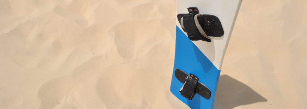
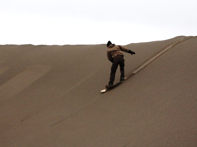
Sandboarding