

Ashton to Tetonia Trail
 Home / State Park
PARK UPDATE
Spring 2026
 Ashton-Tetonia Trail Paving Project Update
  Current Closures
 All closed parking areas are impassable. Please do not drive around barricades or enter construction zones.
 Parking & Trail Access
 The Grainville Parking Area and France Parking Area are currently the only parking lots open to the public. For everyone’s safety, please avoid all active construction areas and give our crews the room they need to work safely and efficiently. The sooner they can complete the work safely, the sooner we can reopen the trail and parking areas for everyone to enjoy.
The Ashton Visitor Center is open 7 days per week, staffing dependent.
Please be mindful of your speed while recreating on the Ashton-Tetonia Trail to ensure a safe and enjoyable visit for all. Class 3 e-bikes, motorized ATVs, OHVs, & vehicles are not permitted on the trail.
Park Reservations
Find a Spot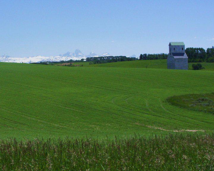
Additional Links
Contact the Park
Street Address: 801 N Hwy 20 Ashton, ID 83420 Phone: 208-652-7520Hours of Operation:
Email the ParkUpcoming Events
About the Park
Park Information Amenities Activities Accommodations Seasonal Maps About the Park Park Information Location: [Ashton Trailhead Info] 72 miles NW of Jackson Hole, WY | 105 miles NE of Pocatello, ID | 54 miles NE of Idaho Falls Boating: No information available. Winter Groomed Nordic Track(s): No information available. Trail Types:- Hike
- Bike
- Horse
- Indoor Restrooms at visitor center
- Vault Toilets at Marysville and Judkins parking areas.
 Biking
 Bird Watching
 Cross-Country (XC) Skiing
 Hiking
 History
 Horseback Riding
 Snowshoeing
 Volunteering
General Information
PARK UPDATE
The Ashton Visitor Center is now open 7 days per week. If center is locked, staff is working on the grounds nearby. Please be mindful of your speed while recreating on the Ashton-Tetonia Trail to ensure a safe and enjoyable visit for all. Class 3 e-bikes, motorized ATVs, OHVs, & vehicles are not permitted on the trail.
The old Pillsbury Mills Elevator in France, Idaho, just one of the historic grain elevators you will experience along the Ashton-Tetonia Trail
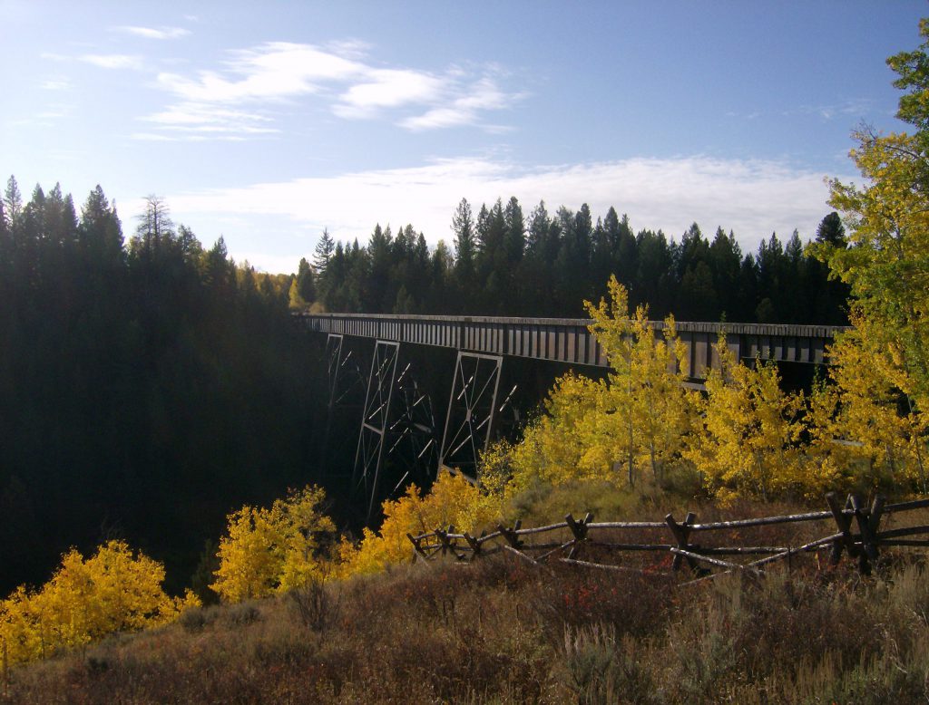
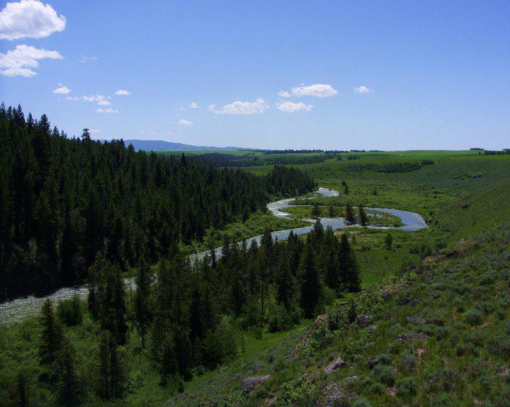
Bitch Creek, as seen from atop the historic train trestle
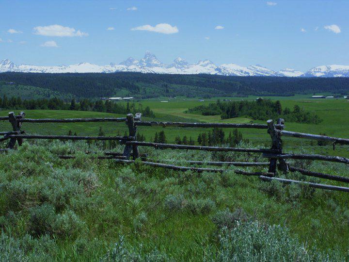
Sweeping views of the Teton range are experienced the length of the Ashton-Tetonia Trail
About the Park
- Hike
- Bike
- Horse
- Indoor Restrooms
- Swimming – Lake/River
- Vault Toilets
BikingBird WatchingCross-Country (XC) SkiingHikingHistoryHorseback RidingSnowshoeingVolunteering
Accomodations
General Accomodations
No accomodations listed.General Information
Shuttle Service
Are you ready to explore the scenic Ashton-Tetonia Trail hassle free? InstaGear outdoors is a St. Anthony based business that offers bike rentals, shuttle services, and guided rides on the Ashton-Tetonia Trail. Gear up and discover the convenience of using a bike shuttle service for your next adventure! InstaGear Outdoors Contact:- Phone: 208-206-9011
- Website: Learn more!
Get Directions
Special Projects
Ashton-Tetonia Trail Paving Project The Idaho Department of Parks and Recreation plans to pave the Ashton-Tetonia Trail, Some work will begin this fall, with the majority scheduled for next year. Seeking to attract more users and to decrease the annual maintenance of the trail, the department secured federal funding to pay for the $3 million project. Based on the experience with the Coeur d’Alene Parkway and the Trail of the Coeur d’Alenes in North Idaho, the department expects the paving will be beneficial to the area’s economy. Project Details- Construction:
-3.56 miles from Ashton to Falls River Trestle
-0.92 miles from Judkins Parking Lot toward Bitch Creek Trestle
-0.94 miles from Tetonia Parking Lot to Highway 33
-Paving 5 parking areas for improved access
-Installing 14 upgraded gates
-Adding new trail signage for easier navigation
- Length: Paving 5.5 miles of trail
- Width: 8-10 feet
- Thickness: 3 inches of asphalt over a 9 inch base layer of compacted material.
Ashton-Tetonia Trail Comments
Visitor Center Improvement Projects The project started in April 2024 and is expected to be completed by September 2024. The goal of this project is to make the building more accessible, complete much needed repairs/ replacements to fundamental parts of the building, and to improve the facility so it can be open year-round.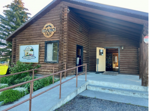
- Furnace
- Pellet stove
- Office space
- ADA Accessibility for bathrooms and the entrance
- Restroom remodel
- Roof replacement
- Exterior staining/ trim replacement
Get Directions
Special Projects
Ashton-Tetonia Trail Paving Project The Idaho Department of Parks and Recreation plans to pave the Ashton-Tetonia Trail, Some work will begin this fall, with the majority scheduled for next year. Seeking to attract more users and to decrease the annual maintenance of the trail, the department secured federal funding to pay for the $3 million project. Based on the experience with the Coeur d’Alene Parkway and the Trail of the Coeur d’Alenes in North Idaho, the department expects the paving will be beneficial to the area’s economy. Project Details- Construction:
-3.56 miles from Ashton to Falls River Trestle
-0.92 miles from Judkins Parking Lot toward Bitch Creek Trestle
-0.94 miles from Tetonia Parking Lot to Highway 33
-Paving 5 parking areas for improved access
-Installing 14 upgraded gates
-Adding new trail signage for easier navigation
- Length: Paving 5.5 miles of trail
- Width: 8-10 feet
- Thickness: 3 inches of asphalt over a 9 inch base layer of compacted material.
Ashton-Tetonia Trail Comments
Visitor Center Improvement Projects The project started in April 2024 and is expected to be completed by September 2024. The goal of this project is to make the building more accessible, complete much needed repairs/ replacements to fundamental parts of the building, and to improve the facility so it can be open year-round.- Furnace
- Pellet stove
- Office space
- ADA Accessibility for bathrooms and the entrance
- Restroom remodel
- Roof replacement
- Exterior staining/ trim replacement